TopoQuest Logo
Do you find TopoQuest useful?
Help keep TopoQuest running and adding new maps/features by donating!
Bitcoin:  19c7KJd3qBynnjoSw5npx9KScwjBe4ifkT
Litecoin:  LXs6TkuXGGXo1vDsWCkWVdjQX94eUKd6ui
Home View Maps Find Maps Find Places Resources & Links


Lockney, New Mexico Topographic Map

USGS Map Title: Lockney, NM
USGS Map MRC: 35103E3
DRG (GeoTIFF) Download: o35103e3.tif


Neighboring USGS Topographic Map Quads:


  McCloy Ranch, NM  
35103F4
 

  Cherokee Valley, NM  
35103F3
 

  Kerlin Hill, NM  
35103F2
 

  McCarty Ranch, NM  
35103E4
 

  Lockney, NM  
35103E3
 

  Obar, NM  
35103E2
 

  Logan North, NM  
35103D4
 

  Logan NE, NM  
35103D3
 

  Cammak Camp, NM  
35103D2


Map MRC Location:

N36°
W104°
N36°
W103°
H8 H7 H6 H5 H4 H3 H2 H1
G8 G7 G6 G5 G4 G3 G2 G1
F8 F7 F6 F5 F4 F3 F2 F1
E8 E7 E6 E5 E4 E3 E2 E1
D8 D7 D6 D5 D4 D3 D2 D1
C8 C7 C6 C5 C4 C3 C2 C1
B8 B7 B6 B5 B4 B3 B2 B1
A8 A7 A6 A5 A4 A3 A2 A1
N35°
W104°
N35°
W103°

Lockney, NM USGS 1:24K Topographic Map Preview:
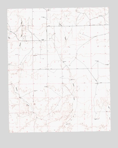
Lockney, NM USGS Topographic Map
Click on map above to begin viewing in our Map Viewer.

This topographic map contains these locations and features:
Feature Name Type Latitude Longitude GNIS ID View Map
05260 Water WellWellN35.5592°W103.3166°934673View Map
05261 Water WellWellN35.5625°W103.3363°935114View Map
05268 Water WellWellN35.5228°W103.3144°934665View Map
05289 Water WellWellN35.5953°W103.3538°934682View Map
05291 Water WellWellN35.5912°W103.3311°935113View Map
05292 Water WellWellN35.5912°W103.3350°934680View Map
05293 Water WellWellN35.5875°W103.3644°935108View Map
05294 Water WellWellN35.5770°W103.3419°935119View Map
05295 Water WellWellN35.5637°W103.3330°935115View Map
05445 Water WellWellN35.6225°W103.3016°935090View Map
05446 Water WellWellN35.6106°W103.3080°935099View Map
05447 Water WellWellN35.6153°W103.3277°934694View Map
05448 Water WellWellN35.6073°W103.3477°935096View Map
05449 Water WellWellN35.6048°W103.3244°935107View Map
05450 Water WellWellN35.5939°W103.3211°934681View Map
05451 Water WellWellN35.5848°W103.2841°934678View Map
05452 Water WellWellN35.5689°W103.3738°935117View Map
05474 Water WellWellN35.5453°W103.3244°934669View Map
05477 Water WellWellN35.5306°W103.2508°934668View Map
Bell TankReservoirN35.5956°W103.3748°886191View Map
Brice WellWellN35.5481°W103.2652°886726View Map
Bryant WellWellN35.5420°W103.3436°886815View Map
Butler DrawValleyN35.5053°W103.3063°886981View Map
Butler WellWellN35.5703°W103.3075°886986View Map
Camco Ranch AirportAirportN35.5778°W103.2780°936988View Map
Carrol WellWellN35.5673°W103.2522°887227View Map
Etheridge WellWellN35.5773°W103.3441°888931View Map
Frampton WellWellN35.5523°W103.2988°889210View Map
Haney WellWellN35.6162°W103.2591°889747View Map
Kelly WellWellN35.5459°W103.3277°890659View Map
Keyes WellWellN35.6075°W103.3575°890682View Map
KidderLocaleN35.5720°W103.2925°924282View Map
KiethLocaleN35.5150°W103.3275°924353View Map
LockneyLocaleN35.5925°W103.3338°915855View Map
Lockney Post Office (historical)Post OfficeN35.5925°W103.3338°937683View Map
New Saggert WellWellN35.5123°W103.2702°892455View Map
Old Ranch WellWellN35.5078°W103.3055°892887View Map
Payne WellWellN35.6228°W103.3252°893129View Map
Smith WellWellN35.5703°W103.2647°894952View Map
Twin WellsWellN35.5198°W103.3452°895967View Map
Willis WellWellN35.6156°W103.3300°896649View Map

Note: Coordinates in the location and feature list above are referenced to NAD83 datum.


Copyright (C) 2008-2025 Ryan Niemi / Sunset Dynamics ... All Rights Reserved