TopoQuest Logo
Do you find TopoQuest useful?
Help keep TopoQuest running and adding new maps/features by donating!
Bitcoin:  19c7KJd3qBynnjoSw5npx9KScwjBe4ifkT
Litecoin:  LXs6TkuXGGXo1vDsWCkWVdjQX94eUKd6ui
Home View Maps Find Maps Find Places Resources & Links


Kinsman, Ohio Topographic Map

USGS Map Title: Kinsman, OH
USGS Map MRC: 41080D5
DRG (GeoTIFF) Download: o41080d5.tif


Neighboring USGS Topographic Map Quads:


  Cherry Valley, OH  
41080E6
 

  Andover, OH  
41080E5
 

  Hartstown, PA  
41080E4
 

  Gustavus, OH  
41080D6
 

  Kinsman, OH  
41080D5
 

  Greenville West, PA  
41080D4
 

  Cortland, OH  
41080C6
 

  Orangeville, OH  
41080C5
 

  Sharpsville, PA  
41080C4


Map MRC Location:

N42°
W81°
N42°
W80°
H8 H7 H6 H5 H4 H3 H2 H1
G8 G7 G6 G5 G4 G3 G2 G1
F8 F7 F6 F5 F4 F3 F2 F1
E8 E7 E6 E5 E4 E3 E2 E1
D8 D7 D6 D5 D4 D3 D2 D1
C8 C7 C6 C5 C4 C3 C2 C1
B8 B7 B6 B5 B4 B3 B2 B1
A8 A7 A6 A5 A4 A3 A2 A1
N41°
W81°
N41°
W80°

Kinsman, OH USGS 1:24K Topographic Map Preview:
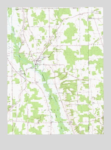
Kinsman, OH USGS Topographic Map
Click on map above to begin viewing in our Map Viewer.

This topographic map contains these locations and features:
Feature Name Type Latitude Longitude GNIS ID View Map
Allen CornersLocaleN41.4153°W80.5590°1037370View Map
Badger High SchoolSchoolN41.4476°W80.5873°1037572View Map
Biggin CornersLocaleN41.3862°W80.5437°1038044View Map
Brockway CemeteryCemeteryN41.3828°W80.5690°1961522View Map
Burghill Vernon Fire Department Station 19BuildingN41.3871°W80.5696°2549835View Map
Camp SugarbushLocaleN41.3901°W80.5848°1038754View Map
Carr FarmsLocaleN41.4044°W80.5750°2707322View Map
Clear CreekStreamN41.4595°W80.6159°1066653View Map
CorinthPopulated PlaceN41.3987°W80.6229°1062712View Map
Corinth Post Office (historical)Post OfficeN41.3987°W80.6234°2059954View Map
Cornelian Post Office (historical)Post OfficeN41.4931°W80.5303°2056308View Map
CornelionPopulated PlaceN41.4931°W80.5309°1062713View Map
Dewey (historical)Populated PlaceN41.4684°W80.5873°1061994View Map
Dewey Post Office (historical)Post OfficeN41.4681°W80.5873°2059971View Map
FarmdalePopulated PlaceN41.4370°W80.6081°1061067View Map
Farmdale Post OfficePost OfficeN41.4376°W80.6081°2059984View Map
Giddings CemeteryCemeteryN41.3850°W80.5428°1040857View Map
KinsmanPopulated PlaceN41.4439°W80.5887°1064944View Map
Kinsman Center Census Designated PlaceCensusN41.4544°W80.5854°2584365View Map
Kinsman LakeReservoirN41.4507°W80.5795°1042294View Map
Kinsman Post OfficePost OfficeN41.4445°W80.5887°2056259View Map
Kinsman Presbyterian ChurchChurchN41.4487°W80.5892°1062009View Map
Kinsman United Methodist ChurchChurchN41.4481°W80.5848°1062010View Map
Kinsman Volunteer Fire DepartmentBuildingN41.4515°W80.5858°2549569View Map
Maple CreekStreamN41.4481°W80.5798°1042934View Map
Mayburn CornersLocaleN41.4256°W80.5879°1043069View Map
Mill CreekStreamN41.3878°W80.5576°1066837View Map
Naturally Yours FarmLocaleN41.4147°W80.5264°2570571View Map
New Kinsman CemeteryCemeteryN41.4495°W80.5881°1961540View Map
Rocky Ridge CemeteryCemeteryN41.4103°W80.5140°1199407View Map
Saint Patricks Catholic ChurchChurchN41.4551°W80.5815°1062011View Map
Sheets Field Airport (historical)AirportN41.4162°W80.5253°1082772View Map
StanhopePopulated PlaceN41.4984°W80.6040°1063033View Map
Stanhope Post Office (historical)Post OfficeN41.4987°W80.6040°1959113View Map
State Line ChurchChurchN41.4951°W80.5140°1199606View Map
Stratton CreekStreamN41.4348°W80.5809°1066986View Map
Stulls CornersLocaleN41.4048°W80.5140°1199632View Map
Sugar CreekStreamN41.4459°W80.6004°1037294View Map
Superior (historical)Populated PlaceN41.4042°W80.5531°1061998View Map
Superior Post Office (historical)Post OfficeN41.4042°W80.5526°2060395View Map
Township of KinsmanCivilN41.4620°W80.5687°1087036View Map
Township of VernonCivilN41.3875°W80.5687°1087044View Map
Valley View FarmsLocaleN41.4914°W80.6039°2707323View Map
VernonPopulated PlaceN41.3864°W80.5687°1058099View Map
Vernon United Methodist ChurchChurchN41.3862°W80.5690°1062008View Map
West View CemeteryCemeteryN41.3775°W80.5698°1047811View Map

Note: Coordinates in the location and feature list above are referenced to NAD83 datum.


Copyright (C) 2008-2024 Ryan Niemi / Sunset Dynamics ... All Rights Reserved