TopoQuest Logo
Do you find TopoQuest useful?
Help keep TopoQuest running and adding new maps/features by donating!
Bitcoin:  19c7KJd3qBynnjoSw5npx9KScwjBe4ifkT
Litecoin:  LXs6TkuXGGXo1vDsWCkWVdjQX94eUKd6ui
Home View Maps Find Maps Find Places Resources & Links


Chesterfield Reservoir, Idaho Topographic Map

USGS Map Title: Chesterfield Reservoir, ID
USGS Map MRC: 42111H8
DRG (GeoTIFF) Download: o42111h8.tif


Neighboring USGS Topographic Map Quads:


  Lincoln Peak, ID  
43112A1
 

  Dunn Basin, ID  
43111A8
 

  Paradise Valley, ID  
43111A7
 

  Jeff Cabin Creek, ID  
42112H1
 

  Chesterfield Reservoir, ID  
42111H8
 

  Grizzly Creek, ID  
42111H7
 

  Bear Camp Gulch, ID  
42112G1
 

  Chesterfield, ID  
42111G8
 

  Hatch, ID  
42111G7


Map MRC Location:

N43°
W112°
N43°
W111°
H8 H7 H6 H5 H4 H3 H2 H1
G8 G7 G6 G5 G4 G3 G2 G1
F8 F7 F6 F5 F4 F3 F2 F1
E8 E7 E6 E5 E4 E3 E2 E1
D8 D7 D6 D5 D4 D3 D2 D1
C8 C7 C6 C5 C4 C3 C2 C1
B8 B7 B6 B5 B4 B3 B2 B1
A8 A7 A6 A5 A4 A3 A2 A1
N42°
W112°
N42°
W111°

Chesterfield Reservoir, ID USGS 1:24K Topographic Map Preview:
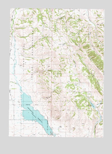
Chesterfield Reservoir, ID USGS Topographic Map
Click on map above to begin viewing in our Map Viewer.

This topographic map contains these locations and features:
Feature Name Type Latitude Longitude GNIS ID View Map
Big Jimmy CreekStreamN42.9991°W111.9922°371175View Map
Bilious CreekStreamN42.9971°W111.8983°395217View Map
Chesterfield ReservoirReservoirN42.8976°W111.9673°376091View Map
Cold SpringSpringN42.9259°W111.9134°395236View Map
Corduroy SpringSpringN42.9082°W111.8769°395253View Map
Coyote CreekStreamN42.9849°W111.8888°395266View Map
East Fork Twentyfour Mile CreekStreamN42.9027°W111.8863°372566View Map
Fourth of July CreekStreamN42.9119°W111.9847°372768View Map
Hibner SpringSpringN42.8858°W111.9337°395464View Map
Horse CampLocaleN42.9649°W111.9302°395483View Map
Jeff Cabin CreekStreamN42.9263°W111.9894°373299View Map
Jim Corneilson CanyonValleyN42.9099°W111.9602°395530View Map
Pole CanyonValleyN42.8899°W111.8811°394929View Map
Portneuf DamDamN42.8783°W111.9438°398781View Map
Rass CreekStreamN42.9469°W111.9936°397084View Map
Rock CreekStreamN42.9277°W111.9847°374714View Map
Rocky CanyonValleyN42.9271°W111.9855°376092View Map
Spring CreekStreamN42.9546°W111.9933°395979View Map
Twentyfour Mile DamDamN42.9033°W111.8869°398621View Map
Twentyfour Mile ReservoirReservoirN42.9062°W111.8895°398441View Map
West CreekStreamN42.9877°W111.8930°399630View Map
Wood CreekStreamN42.9863°W111.8908°399669View Map

Note: Coordinates in the location and feature list above are referenced to NAD83 datum.


Copyright (C) 2008-2025 Ryan Niemi / Sunset Dynamics ... All Rights Reserved