TopoQuest Logo
Do you find TopoQuest useful?
Help keep TopoQuest running and adding new maps/features by donating!
Bitcoin:  19c7KJd3qBynnjoSw5npx9KScwjBe4ifkT
Litecoin:  LXs6TkuXGGXo1vDsWCkWVdjQX94eUKd6ui
Home View Maps Find Maps Find Places Resources & Links


Chilao Flat, California Topographic Map

USGS Map Title: Chilao Flat, CA
USGS Map MRC: 34118C1
DRG (GeoTIFF) Download: o34118c1.tif


Neighboring USGS Topographic Map Quads:


  Acton, CA  
34118D2
 

  Pacifico Mountain, CA  
34118D1
 

  Juniper Hills, CA  
34117D8
 

  Condor Peak, CA  
34118C2
 

  Chilao Flat, CA  
34118C1
 

  Waterman Mountain, CA  
34117C8
 

  Pasadena, CA  
34118B2
 

  Mount Wilson, CA  
34118B1
 

  Azusa, CA  
34117B8


Map MRC Location:

N35°
W119°
N35°
W118°
H8 H7 H6 H5 H4 H3 H2 H1
G8 G7 G6 G5 G4 G3 G2 G1
F8 F7 F6 F5 F4 F3 F2 F1
E8 E7 E6 E5 E4 E3 E2 E1
D8 D7 D6 D5 D4 D3 D2 D1
C8 C7 C6 C5 C4 C3 C2 C1
B8 B7 B6 B5 B4 B3 B2 B1
A8 A7 A6 A5 A4 A3 A2 A1
N34°
W119°
N34°
W118°

Chilao Flat, CA USGS 1:24K Topographic Map Preview:
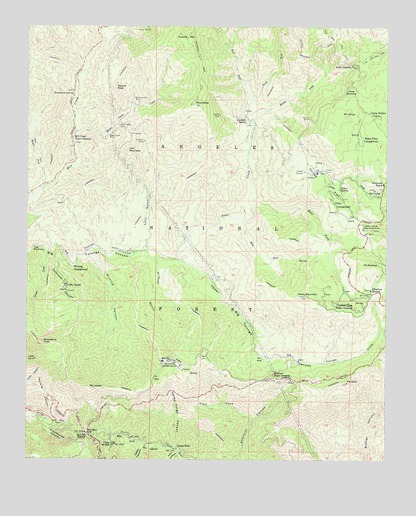
Chilao Flat, CA USGS Topographic Map
Click on map above to begin viewing in our Map Viewer.

This topographic map contains these locations and features:
Feature Name Type Latitude Longitude GNIS ID View Map
Alder CreekStreamN34.3075°W118.0745°269467View Map
Alder SaddleGapN34.3639°W118.0134°269477View Map
Bandido CampgroundLocaleN34.3458°W118.0037°276624View Map
Barley FlatsFlatN34.2786°W118.0753°269681View Map
Baughman SpringSpringN34.3556°W118.1102°269710View Map
Black Cargo MineMineN34.3464°W118.0951°269881View Map
Black Crow MineMineN34.3433°W118.0987°269882View Map
Camp Hi-HillLocaleN34.2550°W118.0953°270193View Map
Camp Hidden ValleyLocaleN34.3494°W118.0031°270194View Map
Camp KoleLocaleN34.2542°W118.0731°270199View Map
Camp RosenitaLocaleN34.3556°W118.0123°270216View Map
Cedar CanyonValleyN34.2542°W118.0848°270362View Map
Charlton FlatFlatN34.2944°W118.0134°252120View Map
Charlton Flats Picnic GroundsLocaleN34.2950°W118.0145°270396View Map
Charlton StationLocaleN34.2989°W118.0065°270397View Map
Chilao CampgroundLocaleN34.3239°W118.0192°270418View Map
Chilao CreekStreamN34.3225°W118.0276°270419View Map
Chilao FlatFlatN34.3300°W118.0237°270420View Map
Chilao StationLocaleN34.3281°W118.0176°270421View Map
Chilao Visitors CenterLocaleN34.3278°W118.0045°276625View Map
Cloudburst CanyonValleyN34.2617°W118.1184°270505View Map
Colby Bridge Day Use AreaLocaleN34.3094°W118.1120°1802862View Map
Colby RanchLocaleN34.3000°W118.1126°270531View Map
Coldwater CanyonValleyN34.3094°W118.1167°270551View Map
Doe SpringSpringN34.2999°W118.0004°241527View Map
East Fork Alder CreekStreamN34.3233°W118.0487°270982View Map
Falcon MineMineN34.3739°W118.0848°271093View Map
Falls CanyonValleyN34.2528°W118.0728°271098View Map
Gabrielino National Scenic TrailTrailN34.2636°W118.0431°1802883View Map
Gold Bar MineMineN34.3419°W118.0862°271323View Map
Granite MountainSummitN34.3715°W118.0707°1656532View Map
Grotto CreekStreamN34.3100°W118.1190°271447View Map
Horse FlatsFlatN34.3461°W118.0103°1665719View Map
Horse Flats CampgroundLocaleN34.3425°W118.0101°271645View Map
Iron MountainSummitN34.3391°W118.0911°1656544View Map
Ladybug CanyonValleyN34.2614°W118.1176°271949View Map
Loomis MineMineN34.3494°W118.0601°245104View Map
Loomis RanchLocaleN34.3489°W118.0506°245105View Map
Lynx GulchValleyN34.3089°W118.0909°245322View Map
Lynx Target Shooting AreaLocaleN34.3233°W118.0792°276627View Map
Middle Fork Alder CreekStreamN34.3400°W118.0490°245860View Map
Middle Fork Mill CreekStreamN34.3281°W118.1215°272443View Map
Middle Shooting AreaLocaleN34.3308°W118.1203°1802863View Map
Mill Creek Picnic GroundsLocaleN34.3422°W118.1103°1655170View Map
Monte Cristo CreekStreamN34.3442°W118.1101°246109View Map
Monte Cristo MineMineN34.3533°W118.0881°246110View Map
Monte Cristo StationLocaleN34.3292°W118.1231°276628View Map
Mount HillyerSummitN34.3494°W118.0159°271580View Map
Mount LawlorSummitN34.2708°W118.1040°244672View Map
Mount MooneySummitN34.3059°W118.0073°1656575View Map
Mount SallySummitN34.2722°W118.0142°248748View Map
Mule ForkStreamN34.3189°W118.0512°246350View Map
Newcomb RanchLocaleN34.3297°W118.0020°246507View Map
Nike Site LA-09L (historical)MilitaryN34.2783°W118.0756°2129538View Map
North Fork Alder CreekStreamN34.3517°W118.0509°272672View Map
Old CampLocaleN34.3267°W118.0053°246834View Map
Rabbit PeakSummitN34.3569°W118.0956°247906View Map
Red Box GapGapN34.2586°W118.1051°248030View Map
Red Box StationLocaleN34.2578°W118.1053°248031View Map
RoundtopSummitN34.3525°W118.0680°248430View Map
Shortcut Picnic GroundsLocaleN34.2742°W118.0398°249418View Map
Shortcut StationLocaleN34.2753°W118.0334°276626View Map
Silver Moccasin TrailTrailN34.3064°W118.0103°1802864View Map
Strawberry PeakSummitN34.2836°W118.1203°249987View Map
Trail ForkStreamN34.2619°W118.0470°250591View Map
Upper Big Tujunga CanyonValleyN34.3069°W118.0731°255811View Map
Valley ForgeLocaleN34.2533°W118.0728°1802873View Map
Valley Forge CanyonValleyN34.2531°W118.0734°250912View Map
Valley Forge Lodge (historical)LocaleN34.2531°W118.0728°1670019View Map
Vetter MountainSummitN34.2972°W118.0287°251014View Map
West Fork Alder CreekStreamN34.3517°W118.0509°274425View Map
Wickiup CampgroundLocaleN34.3064°W118.1098°251519View Map
Wickiup CanyonValleyN34.3100°W118.1051°251520View Map
Wildcat GulchValleyN34.3081°W118.0815°251552View Map

Note: Coordinates in the location and feature list above are referenced to NAD83 datum.


Copyright (C) 2008-2024 Ryan Niemi / Sunset Dynamics ... All Rights Reserved