TopoQuest Logo
Do you find TopoQuest useful?
Help keep TopoQuest running and adding new maps/features by donating!
Bitcoin:  19c7KJd3qBynnjoSw5npx9KScwjBe4ifkT
Litecoin:  LXs6TkuXGGXo1vDsWCkWVdjQX94eUKd6ui
Home View Maps Find Maps Find Places Resources & Links


Chino Valley South, Arizona Topographic Map

USGS Map Title: Chino Valley South, AZ
USGS Map MRC: 34112F4
DRG (GeoTIFF) Download: o34112f4.tif


Neighboring USGS Topographic Map Quads:


  Sullivan Buttes, AZ  
34112G5
 

  Chino Valley North, AZ  
34112G4
 

  King Canyon, AZ  
34112G3
 

  Jerome Canyon, AZ  
34112F5
 

  Chino Valley South, AZ  
34112F4
 

  Prescott Valley North, AZ  
34112F3
 

  Iron Springs, AZ  
34112E5
 

  Prescott, AZ  
34112E4
 

  Prescott Valley South, AZ  
34112E3


Map MRC Location:

N35°
W113°
N35°
W112°
H8 H7 H6 H5 H4 H3 H2 H1
G8 G7 G6 G5 G4 G3 G2 G1
F8 F7 F6 F5 F4 F3 F2 F1
E8 E7 E6 E5 E4 E3 E2 E1
D8 D7 D6 D5 D4 D3 D2 D1
C8 C7 C6 C5 C4 C3 C2 C1
B8 B7 B6 B5 B4 B3 B2 B1
A8 A7 A6 A5 A4 A3 A2 A1
N34°
W113°
N34°
W112°

Chino Valley South, AZ USGS 1:24K Topographic Map Preview:
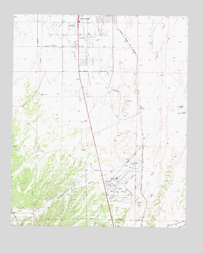
Chino Valley South, AZ USGS Topographic Map
Click on map above to begin viewing in our Map Viewer.

This topographic map contains these locations and features:
Feature Name Type Latitude Longitude GNIS ID View Map
Antelope Hills Golf CourseLocaleN34.6428°W112.4207°43408View Map
Apostolic Christian ChurchChurchN34.6256°W112.4417°2670616View Map
Black HillSummitN34.6959°W112.3813°26387View Map
Bottleneck WashStreamN34.6620°W112.4160°26638View Map
Bottleneck Wash DamDamN34.6634°W112.4163°26639View Map
Chino Valley CemeteryCemeteryN34.7314°W112.4701°27602View Map
Chino Valley Fire District Station 62BuildingN34.7316°W112.4525°2672627View Map
Chino Valley High SchoolSchoolN34.7466°W112.4515°38333View Map
Chino Valley Irrigation DitchCanalN34.6936°W112.4266°27603View Map
Chino Valley United Methodist ChurchChurchN34.7388°W112.4506°2670728View Map
Cooper Farm Landing Strip (historical)AirportN34.7425°W112.4577°38364View Map
Ernest A Love FieldAirportN34.6509°W112.4204°45478View Map
Federal Aviation Administration TowerBuildingN34.6517°W112.4210°41119View Map
Grace Baptist ChurchChurchN34.7162°W112.4543°2671084View Map
Granite SidingPopulated PlaceN34.6956°W112.4093°29469View Map
Little Black Hill TankReservoirN34.6931°W112.3764°31032View Map
Prescott Fire Department Station 73BuildingN34.6458°W112.4252°2672564View Map
Prescott Regional Airpark and Commerce CenterLocaleN34.6496°W112.4196°2671983View Map
Robin AirportAirportN34.7371°W112.4496°45333View Map
Rolling Hills CemeteryCemeteryN34.6502°W112.4302°33783View Map
Saint Lukes Episcopal ChurchChurchN34.6504°W112.4330°2671313View Map
Tri - city College Preparatory High SchoolSchoolN34.6358°W112.4057°2543681View Map
TuttPopulated PlaceN34.6606°W112.4149°35599View Map
Westside Christian ChurchChurchN34.6259°W112.4958°2671465View Map

Note: Coordinates in the location and feature list above are referenced to NAD83 datum.


Copyright (C) 2008-2025 Ryan Niemi / Sunset Dynamics ... All Rights Reserved