TopoQuest Logo
Do you find TopoQuest useful?
Help keep TopoQuest running and adding new maps/features by donating!
Bitcoin:  19c7KJd3qBynnjoSw5npx9KScwjBe4ifkT
Litecoin:  LXs6TkuXGGXo1vDsWCkWVdjQX94eUKd6ui
Home View Maps Find Maps Find Places Resources & Links


Chireno North, Texas Topographic Map

USGS Map Title: Chireno North, TX
USGS Map MRC: 31094E3
DRG (GeoTIFF) Download: o31094e3.tif


Neighboring USGS Topographic Map Quads:


  Martinsville, TX  
31094F4
 

  Mount Herman, TX  
31094F3
 

  Neuville, TX  
31094F2
 

  Melrose, TX  
31094E4
 

  Chireno North, TX  
31094E3
 

  San Augustine West, TX  
31094E2
 

  Etoile North, TX  
31094D4
 

  Chireno South, TX  
31094D3
 

  Norwood, TX  
31094D2


Map MRC Location:

N32°
W95°
N32°
W94°
H8 H7 H6 H5 H4 H3 H2 H1
G8 G7 G6 G5 G4 G3 G2 G1
F8 F7 F6 F5 F4 F3 F2 F1
E8 E7 E6 E5 E4 E3 E2 E1
D8 D7 D6 D5 D4 D3 D2 D1
C8 C7 C6 C5 C4 C3 C2 C1
B8 B7 B6 B5 B4 B3 B2 B1
A8 A7 A6 A5 A4 A3 A2 A1
N31°
W95°
N31°
W94°

Chireno North, TX USGS 1:24K Topographic Map Preview:
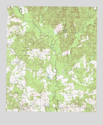
Chireno North, TX USGS Topographic Map
Click on map above to begin viewing in our Map Viewer.

This topographic map contains these locations and features:
Feature Name Type Latitude Longitude GNIS ID View Map
Apostolic ChurchChurchN31.5471°W94.2602°1351222View Map
AttoyacPopulated PlaceN31.5588°W94.3580°1379373View Map
Big Iron Ore CreekStreamN31.5446°W94.3055°1381335View Map
Black BranchStreamN31.5574°W94.2613°1372595View Map
Black BranchStreamN31.5257°W94.3077°1352291View Map
Blue CreekStreamN31.5332°W94.3024°1352449View Map
Bog CreekStreamN31.5921°W94.3227°1352559View Map
Camp Worth (historical)Populated PlaceN31.6121°W94.2924°2034854View Map
Gethsemane CemeteryCemeteryN31.5791°W94.2596°1357981View Map
Holmes CemeteryCemeteryN31.6246°W94.3444°1359458View Map
Horsepen BranchStreamN31.5918°W94.3280°1359622View Map
Hulse CreekStreamN31.6043°W94.2619°1359811View Map
Little Iron Ore CreekStreamN31.6002°W94.2666°1361388View Map
New HopePopulated PlaceN31.5496°W94.2621°2034903View Map
Niciper CreekStreamN31.5124°W94.3024°1363880View Map
Pat Scoggins DamDamN31.5402°W94.3152°1861852View Map
Price CreekStreamN31.5343°W94.3021°1375565View Map
Ratcliff ChurchChurchN31.5057°W94.2771°1366021View Map
Rocky Mound ChurchChurchN31.5716°W94.2660°1366797View Map
Scoggins LakeReservoirN31.5421°W94.3163°1889769View Map
Spring LakeReservoirN31.5959°W94.2950°1889770View Map
Spring Lake DamDamN31.5935°W94.2969°1862066View Map
Spring Ridge CemeteryCemeteryN31.5821°W94.2933°1369032View Map
Tandakee CreekStreamN31.6007°W94.3360°1369578View Map
Tupelo Gum SloughStreamN31.5713°W94.3052°1370212View Map

Note: Coordinates in the location and feature list above are referenced to NAD83 datum.


Copyright (C) 2008-2025 Ryan Niemi / Sunset Dynamics ... All Rights Reserved