TopoQuest Logo
Do you find TopoQuest useful?
Help keep TopoQuest running and adding new maps/features by donating!
Bitcoin:  19c7KJd3qBynnjoSw5npx9KScwjBe4ifkT
Litecoin:  LXs6TkuXGGXo1vDsWCkWVdjQX94eUKd6ui
Home View Maps Find Maps Find Places Resources & Links


San Augustine West, Texas Topographic Map

USGS Map Title: San Augustine West, TX
USGS Map MRC: 31094E2
DRG (GeoTIFF) Download: o31094e2.tif


Neighboring USGS Topographic Map Quads:


  Mount Herman, TX  
31094F3
 

  Neuville, TX  
31094F2
 

  Hurstown, TX  
31094F1
 

  Chireno North, TX  
31094E3
 

  San Augustine West, TX  
31094E2
 

  San Augustine East, TX  
31094E1
 

  Chireno South, TX  
31094D3
 

  Norwood, TX  
31094D2
 

  Chinquapin, TX  
31094D1


Map MRC Location:

N32°
W95°
N32°
W94°
H8 H7 H6 H5 H4 H3 H2 H1
G8 G7 G6 G5 G4 G3 G2 G1
F8 F7 F6 F5 F4 F3 F2 F1
E8 E7 E6 E5 E4 E3 E2 E1
D8 D7 D6 D5 D4 D3 D2 D1
C8 C7 C6 C5 C4 C3 C2 C1
B8 B7 B6 B5 B4 B3 B2 B1
A8 A7 A6 A5 A4 A3 A2 A1
N31°
W95°
N31°
W94°

San Augustine West, TX USGS 1:24K Topographic Map Preview:
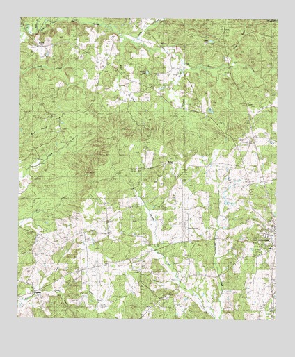
San Augustine West, TX USGS Topographic Map
Click on map above to begin viewing in our Map Viewer.

This topographic map contains these locations and features:
Feature Name Type Latitude Longitude GNIS ID View Map
Blount ParkParkN31.5330°W94.1641°1352434View Map
Captain Thomas William Blount HouseBuildingN31.5324°W94.1677°2031397View Map
Cattail PondLakeN31.6158°W94.1578°1353988View Map
China Chapel ChurchChurchN31.5360°W94.2141°1354422View Map
Clay CemeteryCemeteryN31.5707°W94.1891°1354585View Map
Couller CreekStreamN31.6046°W94.1666°1355153View Map
DenningPopulated PlaceN31.5146°W94.2452°1379653View Map
Denning New Hope Volunteer Fire DepartmentBuildingN31.5121°W94.2388°2655572View Map
Garrett CemeteryCemeteryN31.5360°W94.1388°1357903View Map
Greer CemeteryCemeteryN31.6002°W94.1974°1358420View Map
HarmonyPopulated PlaceN31.6166°W94.1846°1379894View Map
Heavenly Jerusalem First Born ChurchChurchN31.5868°W94.2180°1354485View Map
Highland PondLakeN31.6026°W94.1885°1890024View Map
Holt CemeteryCemeteryN31.6191°W94.1871°1359464View Map
IronosaPopulated PlaceN31.6132°W94.2419°1889699View Map
Lanetown ChurchChurchN31.5838°W94.1577°1360930View Map
Lewis CemeteryCemeteryN31.5488°W94.1383°1361120View Map
McKeever CreekStreamN31.6230°W94.2099°1362481View Map
McRae ChurchChurchN31.5321°W94.1860°1362540View Map
Moses CemeteryCemeteryN31.5399°W94.1319°1363188View Map
Odell CreekStreamN31.6199°W94.2427°1364342View Map
Perkins CemeteryCemeteryN31.5321°W94.1474°1365062View Map
Pleasant Hill ChurchChurchN31.5924°W94.2233°1365431View Map
Price CemeteryCemeteryN31.5005°W94.1599°1382572View Map
RedlandPopulated PlaceN31.5652°W94.1763°1889700View Map
Rivers CreekStreamN31.6057°W94.1502°1366531View Map
Rocky BranchStreamN31.5099°W94.2419°1366745View Map
Saint Luke ChurchChurchN31.5080°W94.1805°1367229View Map
Saint Matthew ChurchChurchN31.6063°W94.2077°1367276View Map
San Augustine County AirportAirportN31.5442°W94.1690°1387484View Map
San Augustine DivisionCivilN31.5155°W94.1695°1939165View Map
San Augustine Police DepartmentBuildingN31.5386°W94.1258°2751112View Map
Sanders CemeteryCemeteryN31.5157°W94.2321°1367670View Map
Sandy CreekStreamN31.6163°W94.1966°1367713View Map
Shiloh ChurchChurchN31.5352°W94.2391°1368168View Map
Texas Forest Service San Augustine OfficeBuildingN31.5066°W94.1296°2655659View Map
Thomas CemeteryCemeteryN31.5193°W94.2069°1369836View Map
UnionPopulated PlaceN31.5199°W94.1908°1889963View Map
William Garrett Plantation HouseBuildingN31.5355°W94.1399°2032429View Map

Note: Coordinates in the location and feature list above are referenced to NAD83 datum.


Copyright (C) 2008-2024 Ryan Niemi / Sunset Dynamics ... All Rights Reserved