TopoQuest Logo
Do you find TopoQuest useful?
Help keep TopoQuest running and adding new maps/features by donating!
Bitcoin:  19c7KJd3qBynnjoSw5npx9KScwjBe4ifkT
Litecoin:  LXs6TkuXGGXo1vDsWCkWVdjQX94eUKd6ui
Home View Maps Find Maps Find Places Resources & Links


Mount Herman, Texas Topographic Map

USGS Map Title: Mount Herman, TX
USGS Map MRC: 31094F3
DRG (GeoTIFF) Download: o31094f3.tif


Neighboring USGS Topographic Map Quads:


  Garrison East, TX  
31094G4
 

  Arcadia, TX  
31094G3
 

  Center, TX  
31094G2
 

  Martinsville, TX  
31094F4
 

  Mount Herman, TX  
31094F3
 

  Neuville, TX  
31094F2
 

  Melrose, TX  
31094E4
 

  Chireno North, TX  
31094E3
 

  San Augustine West, TX  
31094E2


Map MRC Location:

N32°
W95°
N32°
W94°
H8 H7 H6 H5 H4 H3 H2 H1
G8 G7 G6 G5 G4 G3 G2 G1
F8 F7 F6 F5 F4 F3 F2 F1
E8 E7 E6 E5 E4 E3 E2 E1
D8 D7 D6 D5 D4 D3 D2 D1
C8 C7 C6 C5 C4 C3 C2 C1
B8 B7 B6 B5 B4 B3 B2 B1
A8 A7 A6 A5 A4 A3 A2 A1
N31°
W95°
N31°
W94°

Mount Herman, TX USGS 1:24K Topographic Map Preview:
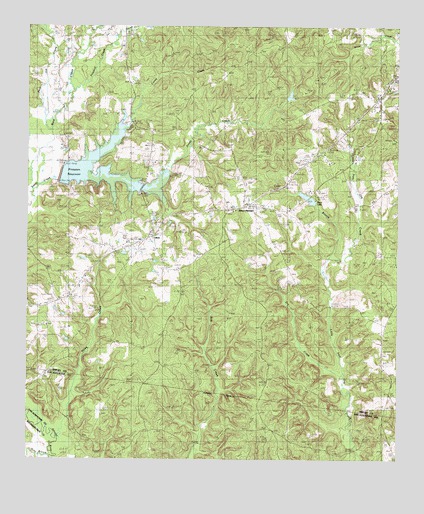
Mount Herman, TX USGS Topographic Map
Click on map above to begin viewing in our Map Viewer.

This topographic map contains these locations and features:
Feature Name Type Latitude Longitude GNIS ID View Map
AikenPopulated PlaceN31.6899°W94.3321°1350911View Map
Caney CreekStreamN31.7424°W94.3027°1889766View Map
Dean CreekStreamN31.6316°W94.3641°1355787View Map
Dry CreekStreamN31.7043°W94.3038°1889767View Map
Excelsior SchoolSchoolN31.6882°W94.3366°1357137View Map
Lucas CemeteryCemeteryN31.6788°W94.2638°1361950View Map
Mount HermanPopulated PlaceN31.6982°W94.3016°1380217View Map
Naconiche CreekStreamN31.6388°W94.3749°1375093View Map
Old Salem ChurchChurchN31.6418°W94.2508°1364484View Map
Pearl LakeReservoirN31.6997°W94.2793°1364938View Map
Pinkston DamDamN31.7052°W94.3635°1862821View Map
Pinkston ReservoirReservoirN31.7074°W94.3504°1862822View Map
Polly BranchStreamN31.6257°W94.3671°1365548View Map
Poor Joe CreekStreamN31.7196°W94.3660°1365583View Map
Pounds CreekStreamN31.7485°W94.3430°1365693View Map
Powdrill CreekStreamN31.7324°W94.3585°1375554View Map
Sardis CemeteryCemeteryN31.6282°W94.3324°1367775View Map
White Rock ChurchChurchN31.6780°W94.3549°1371410View Map

Note: Coordinates in the location and feature list above are referenced to NAD83 datum.


Copyright (C) 2008-2024 Ryan Niemi / Sunset Dynamics ... All Rights Reserved