TopoQuest Logo
Do you find TopoQuest useful?
Help keep TopoQuest running and adding new maps/features by donating!
Bitcoin:  19c7KJd3qBynnjoSw5npx9KScwjBe4ifkT
Litecoin:  LXs6TkuXGGXo1vDsWCkWVdjQX94eUKd6ui
Home View Maps Find Maps Find Places Resources & Links


South Otselic, New York Topographic Map

USGS Map Title: South Otselic, NY
USGS Map MRC: 42075F7
DRG (GeoTIFF) Download: o42075f7.tif


Neighboring USGS Topographic Map Quads:


  DeRuyter, NY  
42075G8
 

  Erieville, NY  
42075G7
 

  West Eaton, NY  
42075G6
 

  Cuyler, NY  
42075F8
 

  South Otselic, NY  
42075F7
 

  Otselic, NY  
42075F6
 

  Cincinnatus, NY  
42075E8
 

  Pitcher, NY  
42075E7
 

  East Pharsalia, NY  
42075E6


Map MRC Location:

N43°
W76°
N43°
W75°
H8 H7 H6 H5 H4 H3 H2 H1
G8 G7 G6 G5 G4 G3 G2 G1
F8 F7 F6 F5 F4 F3 F2 F1
E8 E7 E6 E5 E4 E3 E2 E1
D8 D7 D6 D5 D4 D3 D2 D1
C8 C7 C6 C5 C4 C3 C2 C1
B8 B7 B6 B5 B4 B3 B2 B1
A8 A7 A6 A5 A4 A3 A2 A1
N42°
W76°
N42°
W75°

South Otselic, NY USGS 1:24K Topographic Map Preview:
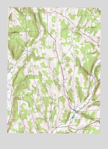
South Otselic, NY USGS Topographic Map
Click on map above to begin viewing in our Map Viewer.

This topographic map contains these locations and features:
Feature Name Type Latitude Longitude GNIS ID View Map
Ashbell BrookStreamN42.6462°W75.7849°942624View Map
Bucks BrookStreamN42.6831°W75.7577°945084View Map
Camp Georgetown (historical)BuildingN42.7311°W75.7814°2727072View Map
Cary HillSummitN42.6917°W75.7846°945936View Map
Crumb HillSummitN42.7362°W75.8102°947871View Map
Crumb Hill CemeteryCemeteryN42.7426°W75.8216°947873View Map
First Baptist ChurchChurchN42.6479°W75.7838°2456119View Map
Glading BrookStreamN42.6345°W75.7966°951152View Map
Knapp PondLakeN42.6886°W75.8712°954763View Map
Lane HillSummitN42.6623°W75.8499°955027View Map
Lane School (historical)SchoolN42.6645°W75.8696°955028View Map
Lincklaen CenterPopulated PlaceN42.7070°W75.8485°955359View Map
Lincklaen Center CemeteryCemeteryN42.7103°W75.8498°2123385View Map
MariposaPopulated PlaceN42.7076°W75.8102°972764View Map
Marstan FarmsLocaleN42.7228°W75.7628°2556821View Map
North West Corners CemeteryCemeteryN42.6299°W75.7728°2559145View Map
Northwest CornersPopulated PlaceN42.6295°W75.7735°958994View Map
Otselic Valley Junior - Senior High SchoolSchoolN42.6497°W75.7850°2669073View Map
Parce MountainSummitN42.6406°W75.7713°959852View Map
Pond School (historical)SchoolN42.6853°W75.8733°960903View Map
Rhode IslandPopulated PlaceN42.6790°W75.7996°962440View Map
Rhode Island CemeteryCemeteryN42.6731°W75.8006°962441View Map
Seventh Day HollowPopulated PlaceN42.6842°W75.7619°964867View Map
Seventh Day Hollow CemeteryCemeteryN42.6847°W75.7617°2559144View Map
Silas Hill MountainSummitN42.6562°W75.8019°965226View Map
South HillSummitN42.6901°W75.8496°965778View Map
South HillSummitN42.7365°W75.8685°965780View Map
South OtselicPopulated PlaceN42.6467°W75.7813°965833View Map
South Otselic Volunteer Fire DepartmentBuildingN42.6458°W75.7833°2734747View Map
Thompson BrookStreamN42.6601°W75.7677°967404View Map
Town of LincklaenCivilN42.6827°W75.8430°979151View Map
Truman HillSummitN42.6873°W75.7516°967911View Map
Ufford CemeteryCemeteryN42.6302°W75.8088°2123386View Map
Ufford CornersLocaleN42.6312°W75.8085°968110View Map
Valley View CemeteryCemeteryN42.6452°W75.7818°2123387View Map
Waldron CornersLocaleN42.6323°W75.7927°968668View Map
Woodlawn CemeteryCemeteryN42.6723°W75.8707°971671View Map

Note: Coordinates in the location and feature list above are referenced to NAD83 datum.


Copyright (C) 2008-2024 Ryan Niemi / Sunset Dynamics ... All Rights Reserved