TopoQuest Logo
Do you find TopoQuest useful?
Help keep TopoQuest running and adding new maps/features by donating!
Bitcoin:  19c7KJd3qBynnjoSw5npx9KScwjBe4ifkT
Litecoin:  LXs6TkuXGGXo1vDsWCkWVdjQX94eUKd6ui
Home View Maps Find Maps Find Places Resources & Links


Renville, Minnesota Topographic Map

USGS Map Title: Renville, MN
USGS Map MRC: 44095G2
DRG (GeoTIFF) Download: o44095g2.tif


Neighboring USGS Topographic Map Quads:


  Clara City, MN  
44095H3
 

  Prinsburg, MN  
44095H2
 

  Blomkest, MN  
44095H1
 

  Sacred Heart, MN  
44095G3
 

  Renville, MN  
44095G2
 

  Danube, MN  
44095G1
 

  Iverson Lake, MN  
44095F3
 

  Vicksburg, MN  
44095F2
 

  Bechyn, MN  
44095F1


Map MRC Location:

N45°
W96°
N45°
W95°
H8 H7 H6 H5 H4 H3 H2 H1
G8 G7 G6 G5 G4 G3 G2 G1
F8 F7 F6 F5 F4 F3 F2 F1
E8 E7 E6 E5 E4 E3 E2 E1
D8 D7 D6 D5 D4 D3 D2 D1
C8 C7 C6 C5 C4 C3 C2 C1
B8 B7 B6 B5 B4 B3 B2 B1
A8 A7 A6 A5 A4 A3 A2 A1
N44°
W96°
N44°
W95°

Renville, MN USGS 1:24K Topographic Map Preview:
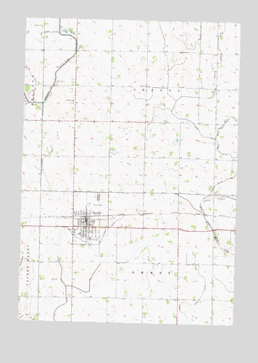
Renville, MN USGS Topographic Map
Click on map above to begin viewing in our Map Viewer.

This topographic map contains these locations and features:
Feature Name Type Latitude Longitude GNIS ID View Map
City of RenvilleCivilN44.7908°W95.2047°2396350View Map
County Ditch Number FortyfiveCanalN44.7697°W95.2256°642110View Map
County Ditch Number One Hundred SevenCanalN44.7516°W95.2436°639159View Map
County Ditch Number One Hundred TwoCanalN44.8186°W95.2342°641586View Map
County Ditch Number Seventeen ACanalN44.8436°W95.1422°641738View Map
County Ditch Number Thirtyfive ACanalN44.7577°W95.1489°642000View Map
County Ditch Number ThirtynineCanalN44.8691°W95.2358°642038View Map
County Ditch Number ThirtysevenCanalN44.7880°W95.1375°642019View Map
Ebenezer ChurchChurchN44.8413°W95.2211°643141View Map
Ebenezer Presbyterian CemeteryCemeteryN44.8405°W95.2225°2065442View Map
Emden CemeteryCemeteryN44.8718°W95.2405°643329View Map
Emden Christian Reformed ChurchChurchN44.7950°W95.2189°2065434View Map
Fairview CemeteryCemeteryN44.8030°W95.2053°643508View Map
First Lutheran ChurchChurchN44.7864°W95.2153°2065433View Map
Holy Redeemer ChurchChurchN44.7889°W95.2086°2065435View Map
Prairie Family Practice CenterHospitalN44.7931°W95.2122°2065439View Map
Ren Villa Nursing HomeHospitalN44.7847°W95.2097°2065438View Map
RenvillePopulated PlaceN44.7891°W95.2117°649934View Map
RenvilleLocaleN44.7933°W95.2122°2065432View Map
Renville Ambulance ServiceBuildingN44.7890°W95.2110°2721356View Map
Renville City HallBuildingN44.7911°W95.2114°2065429View Map
Renville City LibraryBuildingN44.7911°W95.2114°2065430View Map
Renville Fire DepartmentBuildingN44.7904°W95.2117°2065431View Map
Renville Police DepartmentBuildingN44.7922°W95.2117°2065428View Map
Renville Post OfficePost OfficeN44.7922°W95.2119°2065427View Map
Renville Public SchoolSchoolN44.7917°W95.2072°2065440View Map
Saint John's Lutheran ChurchChurchN44.7903°W95.2097°2065437View Map
Township of CrooksCivilN44.8475°W95.1787°663892View Map
Township of EmmetCivilN44.7588°W95.1772°664097View Map
United Methodist ChurchChurchN44.7903°W95.2114°2065436View Map

Note: Coordinates in the location and feature list above are referenced to NAD83 datum.


Copyright (C) 2008-2025 Ryan Niemi / Sunset Dynamics ... All Rights Reserved