TopoQuest Logo
Do you find TopoQuest useful?
Help keep TopoQuest running and adding new maps/features by donating!
Bitcoin:  19c7KJd3qBynnjoSw5npx9KScwjBe4ifkT
Litecoin:  LXs6TkuXGGXo1vDsWCkWVdjQX94eUKd6ui
Home View Maps Find Maps Find Places Resources & Links


Claud, Alabama Topographic Map

USGS Map Title: Claud, AL
USGS Map MRC: 32086E1
DRG (GeoTIFF) Download: o32086e1.tif


Neighboring USGS Topographic Map Quads:


  Dexter, AL  
32086F2
 

  Eclectic, AL  
32086F1
 

  Red Hill, AL  
32085F8
 

  Wetumpka, AL  
32086E2
 

  Claud, AL  
32086E1
 

  Tallassee, AL  
32085E8
 

  Willow Springs, AL  
32086D2
 

  Brassell, AL  
32086D1
 

  Shorter, AL  
32085D8


Map MRC Location:

N33°
W87°
N33°
W86°
H8 H7 H6 H5 H4 H3 H2 H1
G8 G7 G6 G5 G4 G3 G2 G1
F8 F7 F6 F5 F4 F3 F2 F1
E8 E7 E6 E5 E4 E3 E2 E1
D8 D7 D6 D5 D4 D3 D2 D1
C8 C7 C6 C5 C4 C3 C2 C1
B8 B7 B6 B5 B4 B3 B2 B1
A8 A7 A6 A5 A4 A3 A2 A1
N32°
W87°
N32°
W86°

Claud, AL USGS 1:24K Topographic Map Preview:
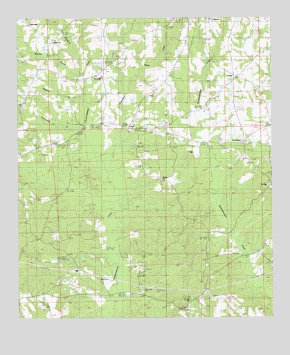
Claud, AL USGS Topographic Map
Click on map above to begin viewing in our Map Viewer.

This topographic map contains these locations and features:
Feature Name Type Latitude Longitude GNIS ID View Map
Abercomby BranchStreamN32.5757°W86.0902°112890View Map
AYS Youth CampLocaleN32.5204°W86.0652°137139View Map
Butler Memorial ChurchChurchN32.5093°W86.0300°137151View Map
Castleberry Memorial Congregational ChurchChurchN32.6246°W86.0294°1699957View Map
Central ChurchChurchN32.5162°W86.0983°137159View Map
China Grove CemeteryCemeteryN32.5115°W86.0644°116056View Map
ClaudPopulated PlaceN32.5790°W86.0705°116193View Map
Claud Church of ChristChurchN32.5793°W86.0689°137163View Map
Claud Independent Methodist ChurchChurchN32.5782°W86.0694°137164View Map
Crabapple ValleyValleyN32.5243°W86.1008°137175View Map
FloydPopulated PlaceN32.6001°W86.0172°118456View Map
Glendale AcresPopulated PlaceN32.6037°W86.0469°1699966View Map
Good HopePopulated PlaceN32.5735°W86.0133°119107View Map
Good Hope Baptist ChurchChurchN32.5729°W86.0144°158141View Map
Good Hope CemeteryCemeteryN32.5737°W86.0147°1730361View Map
Green CemeteryCemeteryN32.5746°W86.1033°154694View Map
Haney CreekStreamN32.6004°W86.0655°119679View Map
Heck RidgeRidgeN32.5307°W86.0583°137222View Map
Hidden ForestPopulated PlaceN32.5207°W86.0652°137223View Map
Knight LakeReservoirN32.5768°W86.1233°130714View Map
Knight Lake DamDamN32.5768°W86.1233°130713View Map
Marshall CemeteryCemeteryN32.5149°W86.0819°122307View Map
Meinzine BranchStreamN32.6007°W86.0947°122637View Map
Mount Olive ChurchChurchN32.5068°W86.0405°123303View Map
Mount Zion CemeteryCemeteryN32.5660°W86.0380°123424View Map
Mount Zion ChurchChurchN32.5579°W86.0539°152526View Map
Oak Valley ChurchChurchN32.5551°W86.0011°124137View Map
Pierce ChapelChurchN32.6226°W86.1183°155195View Map
Pleasant Hill ChurchChurchN32.6001°W86.0825°124995View Map
Prospect ChurchChurchN32.5201°W86.0961°153070View Map
R H Lamb LakeReservoirN32.5893°W86.0310°130737View Map
R H Lamb Lake DamDamN32.5885°W86.0300°130738View Map
Redland Volunteer Fire Department Station 2BuildingN32.5101°W86.1142°2691356View Map
Salem ChurchChurchN32.6001°W86.0833°137313View Map
Salem School (historical)SchoolN32.6001°W86.0833°137314View Map
Sand CreekStreamN32.6007°W86.0947°126307View Map
Sheppard CemeteryCemeteryN32.6151°W86.1082°126693View Map
Sheppard CreekStreamN32.6010°W86.0944°137319View Map
Taylor ChapelChurchN32.5293°W86.0033°127734View Map
Townsend CreekStreamN32.5607°W86.0791°128044View Map
Union Academy (historical)SchoolN32.5896°W86.1227°137344View Map
Union Number 2 Baptist ChurchChurchN32.5929°W86.0583°128294View Map
Wall CemeteryCemeteryN32.5979°W86.0519°1699969View Map
Warren CemeteryCemeteryN32.5035°W86.0075°137349View Map
Wingard LakeReservoirN32.6084°W86.0327°130779View Map
Wingard Lake DamDamN32.6068°W86.0316°130780View Map
Youngs AcademySchoolN32.6065°W86.1108°129316View Map

Note: Coordinates in the location and feature list above are referenced to NAD83 datum.


Copyright (C) 2008-2025 Ryan Niemi / Sunset Dynamics ... All Rights Reserved