TopoQuest Logo
Do you find TopoQuest useful?
Help keep TopoQuest running and adding new maps/features by donating!
Bitcoin:  19c7KJd3qBynnjoSw5npx9KScwjBe4ifkT
Litecoin:  LXs6TkuXGGXo1vDsWCkWVdjQX94eUKd6ui
Home View Maps Find Maps Find Places Resources & Links


Clayton, Wisconsin Topographic Map

USGS Map Title: Clayton, WI
USGS Map MRC: 45092C2
DRG (GeoTIFF) Download: o45092c2.tif


Neighboring USGS Topographic Map Quads:


  Range, WI  
45092D3
 

  Turtle Lake, WI  
45092D2
 

  Almena, WI  
45092D1
 

  Amery, WI  
45092C3
 

  Clayton, WI  
45092C2
 

  Arland, WI  
45092C1
 

  Forest, WI  
45092B3
 

  Graytown, WI  
45092B2
 

  Connorsville, WI  
45092B1


Map MRC Location:

N46°
W93°
N46°
W92°
H8 H7 H6 H5 H4 H3 H2 H1
G8 G7 G6 G5 G4 G3 G2 G1
F8 F7 F6 F5 F4 F3 F2 F1
E8 E7 E6 E5 E4 E3 E2 E1
D8 D7 D6 D5 D4 D3 D2 D1
C8 C7 C6 C5 C4 C3 C2 C1
B8 B7 B6 B5 B4 B3 B2 B1
A8 A7 A6 A5 A4 A3 A2 A1
N45°
W93°
N45°
W92°

Clayton, WI USGS 1:24K Topographic Map Preview:
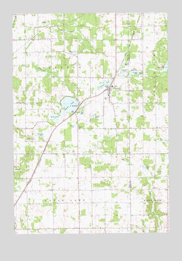
Clayton, WI USGS Topographic Map
Click on map above to begin viewing in our Map Viewer.

This topographic map contains these locations and features:
Feature Name Type Latitude Longitude GNIS ID View Map
Barbo LakeLakeN45.3160°W92.2166°1561160View Map
Bass LakeLakeN45.3023°W92.1279°1561238View Map
Bethany ChurchChurchN45.3102°W92.1966°1561620View Map
Camelia LakeLakeN45.3344°W92.1765°1562563View Map
ClaytonPopulated PlaceN45.3313°W92.1713°1563136View Map
Clayton CemeteryCemeteryN45.3307°W92.1574°1563137View Map
Clayton Elementary SchoolSchoolN45.3285°W92.1743°2713236View Map
Clayton Middle / High SchoolSchoolN45.3285°W92.1729°1988732View Map
Clayton Middle SchoolSchoolN45.3284°W92.1733°2713269View Map
Clayton Police DepartmentBuildingN45.3314°W92.1711°2759927View Map
Clayton Volunteer Fire DepartmentBuildingN45.3314°W92.1710°2696696View Map
Edgewood School (historical)SchoolN45.2750°W92.1869°1831819View Map
Emmanuel ChurchChurchN45.3038°W92.2352°1564633View Map
Faith Lutheran ChurchChurchN45.3294°W92.1719°1988733View Map
Gilbert LakeLakeN45.3529°W92.2003°1565516View Map
Greeley LakeLakeN45.3162°W92.1861°1565794View Map
Holy Trinity Orthodox ChurchChurchN45.2844°W92.1349°1566632View Map
Holy Trinity Russian Orthodox CemeteryCemeteryN45.2851°W92.1357°1988535View Map
Immanuel Evangelical Lutheran ChurchChurchN45.3302°W92.1732°1988734View Map
JoelPopulated PlaceN45.3605°W92.2346°1577665View Map
Little Moon LakeLakeN45.3410°W92.1526°1568323View Map
Long LakeLakeN45.2866°W92.1451°1568551View Map
Magnor LakeLakeN45.3227°W92.2051°1568897View Map
Marsh LakeLakeN45.3108°W92.1998°1569077View Map
Meadowbrook School (historical)SchoolN45.2739°W92.1271°1837969View Map
Moe Lutheran ChurchChurchN45.2750°W92.2196°1569627View Map
Mud LakeLakeN45.3181°W92.1949°1569948View Map
Nepadoggen CreekStreamN45.3536°W92.2410°1570177View Map
Paulson LakeLakeN45.3063°W92.2286°1571095View Map
RichardsonPopulated PlaceN45.3191°W92.1999°1572280View Map
South Clayton School (historical)SchoolN45.3169°W92.2407°1831848View Map
Sunny Brook School (historical)SchoolN45.3677°W92.1380°1838021View Map
Sunny Slope School (historical)SchoolN45.3094°W92.1263°1838022View Map
Town of ClaytonCivilN45.3394°W92.2257°1582968View Map
Town of Clear LakeCivilN45.2526°W92.2168°1582973View Map
Village of ClaytonCivilN45.3260°W92.1710°1582967View Map
West Clayton CemeteryCemeteryN45.3247°W92.2413°1576489View Map

Note: Coordinates in the location and feature list above are referenced to NAD83 datum.


Copyright (C) 2008-2024 Ryan Niemi / Sunset Dynamics ... All Rights Reserved