TopoQuest Logo
Do you find TopoQuest useful?
Help keep TopoQuest running and adding new maps/features by donating!
Bitcoin:  19c7KJd3qBynnjoSw5npx9KScwjBe4ifkT
Litecoin:  LXs6TkuXGGXo1vDsWCkWVdjQX94eUKd6ui
Home View Maps Find Maps Find Places Resources & Links


Clear Creek, Oregon Topographic Map

USGS Map Title: Clear Creek, OR
USGS Map MRC: 45123G3
DRG (GeoTIFF) Download: o45123g3.tif


Neighboring USGS Topographic Map Quads:


  Sager Creek, OR  
45123H4
 

  Birkenfeld, OR  
45123H3
 

  Pittsburg, OR  
45123H2
 

  Sunset Spring, OR  
45123G4
 

  Clear Creek, OR  
45123G3
 

  Vernonia, OR  
45123G2
 

  Cochran, OR  
45123F4
 

  Timber, OR  
45123F3
 

  Buxton, OR  
45123F2


Map MRC Location:

N46°
W124°
N46°
W123°
H8 H7 H6 H5 H4 H3 H2 H1
G8 G7 G6 G5 G4 G3 G2 G1
F8 F7 F6 F5 F4 F3 F2 F1
E8 E7 E6 E5 E4 E3 E2 E1
D8 D7 D6 D5 D4 D3 D2 D1
C8 C7 C6 C5 C4 C3 C2 C1
B8 B7 B6 B5 B4 B3 B2 B1
A8 A7 A6 A5 A4 A3 A2 A1
N45°
W124°
N45°
W123°

Clear Creek, OR USGS 1:24K Topographic Map Preview:
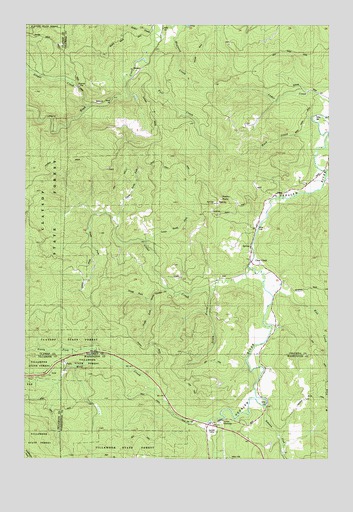
Clear Creek, OR USGS Topographic Map
Click on map above to begin viewing in our Map Viewer.

This topographic map contains these locations and features:
Feature Name Type Latitude Longitude GNIS ID View Map
Arcadia BridgeBridgeN45.8330°W123.2532°1638905View Map
Bero FieldAirportN45.8014°W123.2790°2645958View Map
Cedar CreekStreamN45.8526°W123.2504°1118748View Map
Clear CreekPopulated PlaceN45.8059°W123.2796°1118991View Map
Clear CreekStreamN45.8051°W123.2840°1118995View Map
Clear Creek Post Office (historical)Post OfficeN45.8059°W123.2796°1165058View Map
Coal CreekStreamN45.7818°W123.3610°1130242View Map
County Line (historical)LocaleN45.8448°W123.3593°1637721View Map
Eastman (historical)LocaleN45.8490°W123.3529°1637720View Map
Fall CreekStreamN45.8634°W123.3248°1120601View Map
Ginger CreekStreamN45.8512°W123.3504°1121143View Map
Green Timber CreekStreamN45.7984°W123.3168°1121404View Map
KeaseyPopulated PlaceN45.8615°W123.3296°1136433View Map
Keasey Post Office (historical)Post OfficeN45.8615°W123.3296°1165469View Map
Kist CreekStreamN45.7979°W123.2757°1122783View Map
Kist Post Office (historical)Post OfficeN45.7887°W123.2734°1165491View Map
Lausman (historical)LocaleN45.8737°W123.3129°1637718View Map
Logspur (historical)LocaleN45.8721°W123.3162°1637719View Map
Lousignont CreekStreamN45.7521°W123.2982°1123530View Map
Lower North ForkStreamN45.8121°W123.3260°1123576View Map
Maynard CreekStreamN45.8748°W123.3096°1123875View Map
North CemeteryCemeteryN45.8027°W123.2953°1130243View Map
North Fork Green Timber CreekStreamN45.7954°W123.3246°1124777View Map
North Fork Wolf CreekStreamN45.7804°W123.3465°1124818View Map
Robinson CreekStreamN45.7651°W123.2771°1158028View Map
Rocky PointCapeN45.8248°W123.2954°1126245View Map
South Fork Clear CreekStreamN45.8204°W123.3482°1127269View Map
South Fork Green Timber CreekStreamN45.7954°W123.3246°1127287View Map
South Prong Clear CreekStreamN45.7987°W123.2985°1127339View Map
Sunset CampLocaleN45.7571°W123.2990°1127745View Map
Timber SubstationLocaleN45.7604°W123.2957°1128108View Map
Upper North ForkStreamN45.8196°W123.3382°1128467View Map
Weed CreekStreamN45.8434°W123.2548°1128768View Map
Wolf CreekStreamN45.7612°W123.2968°1129279View Map

Note: Coordinates in the location and feature list above are referenced to NAD83 datum.


Copyright (C) 2008-2024 Ryan Niemi / Sunset Dynamics ... All Rights Reserved