TopoQuest Logo
Do you find TopoQuest useful?
Help keep TopoQuest running and adding new maps/features by donating!
Bitcoin:  19c7KJd3qBynnjoSw5npx9KScwjBe4ifkT
Litecoin:  LXs6TkuXGGXo1vDsWCkWVdjQX94eUKd6ui
Home View Maps Find Maps Find Places Resources & Links


Pittsburg, Oregon Topographic Map

USGS Map Title: Pittsburg, OR
USGS Map MRC: 45123H2
DRG (GeoTIFF) Download: o45123h2.tif


Neighboring USGS Topographic Map Quads:


  Marshland, OR  
46123A3
 

  Clatskanie, OR  
46123A2
 

  Delena, OR  
46123A1
 

  Birkenfeld, OR  
45123H3
 

  Pittsburg, OR  
45123H2
 

  Baker Point, OR  
45123H1
 

  Clear Creek, OR  
45123G3
 

  Vernonia, OR  
45123G2
 

  Bacona, OR  
45123G1


Map MRC Location:

N46°
W124°
N46°
W123°
H8 H7 H6 H5 H4 H3 H2 H1
G8 G7 G6 G5 G4 G3 G2 G1
F8 F7 F6 F5 F4 F3 F2 F1
E8 E7 E6 E5 E4 E3 E2 E1
D8 D7 D6 D5 D4 D3 D2 D1
C8 C7 C6 C5 C4 C3 C2 C1
B8 B7 B6 B5 B4 B3 B2 B1
A8 A7 A6 A5 A4 A3 A2 A1
N45°
W124°
N45°
W123°

Pittsburg, OR USGS 1:24K Topographic Map Preview:
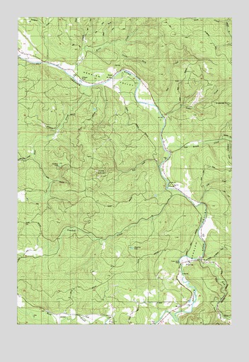
Pittsburg, OR USGS Topographic Map
Click on map above to begin viewing in our Map Viewer.

This topographic map contains these locations and features:
Feature Name Type Latitude Longitude GNIS ID View Map
Archibald CreekStreamN45.9504°W123.1279°1117034View Map
Battle CreekStreamN45.9771°W123.2223°1117318View Map
Big Eddy County ParkLocaleN45.9316°W123.1634°2668164View Map
Big Eddy ParkParkN45.9318°W123.1618°1117616View Map
Cedar CreekStreamN45.9601°W123.1671°1118749View Map
Clatsop State ForestForestN45.9371°W123.2026°1118986View Map
Cook CreekStreamN45.9240°W123.1446°1119218View Map
Crooked CreekStreamN45.9301°W123.1609°1119562View Map
Deer CreekStreamN45.9718°W123.2104°1119819View Map
East Fork Nehalem RiverStreamN45.9015°W123.1454°1120317View Map
Enterprise PointSummitN45.9648°W123.1271°1120511View Map
Fall CreekStreamN45.9390°W123.1684°1120602View Map
Gus CreekStreamN45.9643°W123.1718°1121494View Map
Hawkins LakeLakeN45.9058°W123.1843°1121669View Map
Johnson CreekStreamN45.9873°W123.2126°1122480View Map
Lindsay LakeLakeN45.9395°W123.2270°1123106View Map
Little Deer CreekStreamN45.9446°W123.2426°1123181View Map
Mist - Birkenfeld Rural Fire Protection District Burris StationBuildingN45.9673°W123.1904°2577095View Map
Mist - Birkenfeld Rural Fire Protection District Peterson StationBuildingN45.9471°W123.1656°2576761View Map
Mud ForkStreamN45.9879°W123.2010°1124456View Map
NatalLocaleN45.9759°W123.1954°1124600View Map
Natal Post Office (historical)Post OfficeN45.9759°W123.1954°1165688View Map
O'Black PondLakeN45.9737°W123.2145°1124878View Map
Oak Ranch CreekStreamN45.9465°W123.1654°1124913View Map
Pioneer ParkParkN45.8984°W123.1554°1130245View Map
PittsburgPopulated PlaceN45.9007°W123.1523°1125453View Map
Pittsburg Guard StationLocaleN45.8998°W123.1582°1162091View Map
Pittsburg Post Office (historical)Post OfficeN45.9007°W123.1523°1165794View Map
Poynter (historical)LocaleN45.8779°W123.2218°1637713View Map
South Fork Battle CreekStreamN45.9890°W123.1962°1127253View Map
Vernonia DivisionCivilN45.8804°W123.2070°1938144View Map

Note: Coordinates in the location and feature list above are referenced to NAD83 datum.


Copyright (C) 2008-2025 Ryan Niemi / Sunset Dynamics ... All Rights Reserved