TopoQuest Logo
Do you find TopoQuest useful?
Help keep TopoQuest running and adding new maps/features by donating!
Bitcoin:  19c7KJd3qBynnjoSw5npx9KScwjBe4ifkT
Litecoin:  LXs6TkuXGGXo1vDsWCkWVdjQX94eUKd6ui
Home View Maps Find Maps Find Places Resources & Links


Birkenfeld, Oregon Topographic Map

USGS Map Title: Birkenfeld, OR
USGS Map MRC: 45123H3
DRG (GeoTIFF) Download: o45123h3.tif


Neighboring USGS Topographic Map Quads:


  Nicolai Mountain, OR  
46123A4
 

  Marshland, OR  
46123A3
 

  Clatskanie, OR  
46123A2
 

  Sager Creek, OR  
45123H4
 

  Birkenfeld, OR  
45123H3
 

  Pittsburg, OR  
45123H2
 

  Sunset Spring, OR  
45123G4
 

  Clear Creek, OR  
45123G3
 

  Vernonia, OR  
45123G2


Map MRC Location:

N46°
W124°
N46°
W123°
H8 H7 H6 H5 H4 H3 H2 H1
G8 G7 G6 G5 G4 G3 G2 G1
F8 F7 F6 F5 F4 F3 F2 F1
E8 E7 E6 E5 E4 E3 E2 E1
D8 D7 D6 D5 D4 D3 D2 D1
C8 C7 C6 C5 C4 C3 C2 C1
B8 B7 B6 B5 B4 B3 B2 B1
A8 A7 A6 A5 A4 A3 A2 A1
N45°
W124°
N45°
W123°

Birkenfeld, OR USGS 1:24K Topographic Map Preview:
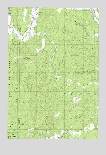
Birkenfeld, OR USGS Topographic Map
Click on map above to begin viewing in our Map Viewer.

This topographic map contains these locations and features:
Feature Name Type Latitude Longitude GNIS ID View Map
BirkenfeldPopulated PlaceN45.9907°W123.3376°1117733View Map
Birkenfeld BridgeBridgeN45.9891°W123.3389°1638902View Map
Birkenfeld Post OfficePost OfficeN45.9907°W123.3376°1164920View Map
Cougar CreekStreamN45.9748°W123.3312°1162757View Map
David CreekStreamN45.9207°W123.3637°1129891View Map
Deep CreekStreamN45.9759°W123.3468°1119785View Map
Early (historical)LocaleN45.8790°W123.3001°1637716View Map
Fishhawk CreekStreamN45.9984°W123.3379°1120783View Map
Grub CreekStreamN45.9784°W123.3690°1162756View Map
Homewood (historical)LocaleN45.8848°W123.2710°1637714View Map
Ivy CreekStreamN45.8807°W123.3012°1122305View Map
Kauppi LakeLakeN45.9174°W123.2943°1162760View Map
Lane CreekStreamN45.9487°W123.3146°1122938View Map
Lundgren Creek (historical)StreamN45.9957°W123.2590°1123619View Map
MistPopulated PlaceN45.9962°W123.2565°1136547View Map
Mist Post Office (historical)Post OfficeN45.9962°W123.2565°1165647View Map
Nelson CreekStreamN45.9973°W123.3748°1162755View Map
Neverstil Post Office (historical)Post OfficeN45.9929°W123.3415°1164548View Map
NeverstillPopulated PlaceN45.9759°W123.3446°1162759View Map
Pivot Post Office (historical)Post OfficeN45.8884°W123.3568°1164602View Map
Selder CreekStreamN45.8762°W123.3196°1126730View Map
Tara (historical)LocaleN45.8757°W123.3018°1637717View Map
VesperLocaleN45.9804°W123.3685°1162758View Map
Vesper SchoolLocaleN45.9804°W123.3748°1128529View Map
Zan (historical)LocaleN45.8807°W123.2848°1637715View Map

Note: Coordinates in the location and feature list above are referenced to NAD83 datum.


Copyright (C) 2008-2025 Ryan Niemi / Sunset Dynamics ... All Rights Reserved