TopoQuest Logo
Do you find TopoQuest useful?
Help keep TopoQuest running and adding new maps/features by donating!
Bitcoin:  19c7KJd3qBynnjoSw5npx9KScwjBe4ifkT
Litecoin:  LXs6TkuXGGXo1vDsWCkWVdjQX94eUKd6ui
Home View Maps Find Maps Find Places Resources & Links


Clearwater, Minnesota Topographic Map

USGS Map Title: Clearwater, MN
USGS Map MRC: 45094D1
DRG (GeoTIFF) Download: o45094d1.tif


Neighboring USGS Topographic Map Quads:


  Saint Cloud, MN  
45094E2
 

  Cable, MN  
45094E1
 

  Duelm, MN  
45093E8
 

  Saint Augusta, MN  
45094D2
 

  Clearwater, MN  
45094D1
 

  Clear Lake, MN  
45093D8
 

  South Haven, MN  
45094C2
 

  Annandale, MN  
45094C1
 

  Silver Creek, MN  
45093C8


Map MRC Location:

N46°
W95°
N46°
W94°
H8 H7 H6 H5 H4 H3 H2 H1
G8 G7 G6 G5 G4 G3 G2 G1
F8 F7 F6 F5 F4 F3 F2 F1
E8 E7 E6 E5 E4 E3 E2 E1
D8 D7 D6 D5 D4 D3 D2 D1
C8 C7 C6 C5 C4 C3 C2 C1
B8 B7 B6 B5 B4 B3 B2 B1
A8 A7 A6 A5 A4 A3 A2 A1
N45°
W95°
N45°
W94°

Clearwater, MN USGS 1:24K Topographic Map Preview:
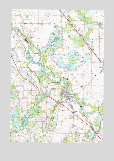
Clearwater, MN USGS Topographic Map
Click on map above to begin viewing in our Map Viewer.

This topographic map contains these locations and features:
Feature Name Type Latitude Longitude GNIS ID View Map
A J Acres CampgroundLocaleN45.4033°W94.0894°2068408View Map
Acacia CemeteryCemeteryN45.4248°W94.0670°639189View Map
Carter LakeLakeN45.4714°W94.0240°649051View Map
City of ClearwaterCivilN45.4102°W94.0445°2393554View Map
Clear LakeLakeN45.4465°W94.0451°641286View Map
Clear Lake Fire DepartmentBuildingN45.4444°W94.0023°2666678View Map
Clear Lake Post OfficePost OfficeN45.4436°W94.0003°2069466View Map
Clearview Elementary SchoolSchoolN45.4192°W94.0375°2069470View Map
Clearview SchoolSchoolN45.4389°W94.0114°641323View Map
ClearwaterPopulated PlaceN45.4194°W94.0489°641312View Map
Clearwater (historical)LocaleN45.4169°W94.0456°2067375View Map
Clearwater Assembly of God ChurchChurchN45.4200°W94.0511°2067385View Map
Clearwater City HallBuildingN45.4167°W94.0519°2067382View Map
Clearwater EstatesPopulated PlaceN45.4125°W94.0403°2067378View Map
Clearwater Fire and Rescue DepartmentBuildingN45.4165°W94.0524°2067383View Map
Clearwater KOA KampgroundsLocaleN45.4239°W94.0778°2068407View Map
Clearwater Medical ClinicHospitalN45.4194°W94.0486°2067381View Map
Clearwater Post OfficePost OfficeN45.4152°W94.0539°2067380View Map
Clearwater RiverStreamN45.4227°W94.0491°641322View Map
Clearwater United Methodist ChurchChurchN45.4206°W94.0483°2067386View Map
County Ditch Number TenCanalN45.3850°W94.0994°641570View Map
Crooked LakeLakeN45.3905°W94.1117°642459View Map
Dallas LakeLakeN45.4026°W94.0960°642611View Map
Eagle Trace Golf CourseLocaleN45.4083°W94.0347°2067379View Map
Exploring the Mississippi Headwaters Historical MarkerParkN45.4181°W94.0700°2068384View Map
Feldges LakeLakeN45.4048°W94.0934°643591View Map
Fish CreekStreamN45.3914°W94.0041°643669View Map
Fish LakeLakeN45.3831°W94.0160°643680View Map
Fuller LakeLakeN45.4214°W94.0748°643988View Map
Fuller Rest AreaLocaleN45.4181°W94.0700°2068383View Map
Haven Airport (historical)AirportN45.4897°W94.1214°660392View Map
Interchange 178CrossingN45.4125°W94.0583°2067521View Map
Long LakeLakeN45.3888°W94.1075°647053View Map
Long LakeLakeN45.4696°W94.0728°647056View Map
Maria LakeLakeN45.4000°W94.1191°647524View Map
Mount Hope CemeteryCemeteryN45.4050°W94.0566°648174View Map
Pickerel LakeLakeN45.4697°W94.0627°649364View Map
Plum CreekStreamN45.4380°W94.0819°649593View Map
Rejoice Lutheran ChurchChurchN45.4167°W94.0519°2067384View Map
Saint Luke CemeteryCemeteryN45.4097°W94.0589°650801View Map
Saint Luke's Catholic ChurchChurchN45.4042°W94.0556°2067377View Map
Saint Marcus CemeteryCemeteryN45.4408°W94.0008°650810View Map
Saint Marcus ChurchChurchN45.4439°W94.0003°2069463View Map
Seven Hills AirportAirportN45.4125°W94.0767°2676826View Map
Stickney LakeLakeN45.4577°W94.0444°652638View Map
Township of LyndenCivilN45.3974°W94.1069°664847View Map
Tri-County Alliance ChurchChurchN45.3847°W94.0556°2067376View Map
Warner LakeLakeN45.4188°W94.0828°653782View Map
Warner Lake County ParkParkN45.4181°W94.0847°2068409View Map

Note: Coordinates in the location and feature list above are referenced to NAD83 datum.


Copyright (C) 2008-2025 Ryan Niemi / Sunset Dynamics ... All Rights Reserved