TopoQuest Logo
Do you find TopoQuest useful?
Help keep TopoQuest running and adding new maps/features by donating!
Bitcoin:  19c7KJd3qBynnjoSw5npx9KScwjBe4ifkT
Litecoin:  LXs6TkuXGGXo1vDsWCkWVdjQX94eUKd6ui
Home View Maps Find Maps Find Places Resources & Links


Annandale, Minnesota Topographic Map

USGS Map Title: Annandale, MN
USGS Map MRC: 45094C1
DRG (GeoTIFF) Download: o45094c1.tif


Neighboring USGS Topographic Map Quads:


  Saint Augusta, MN  
45094D2
 

  Clearwater, MN  
45094D1
 

  Clear Lake, MN  
45093D8
 

  South Haven, MN  
45094C2
 

  Annandale, MN  
45094C1
 

  Silver Creek, MN  
45093C8
 

  French Lake, MN  
45094B2
 

  Albion Center, MN  
45094B1
 

  Buffalo West, MN  
45093B8


Map MRC Location:

N46°
W95°
N46°
W94°
H8 H7 H6 H5 H4 H3 H2 H1
G8 G7 G6 G5 G4 G3 G2 G1
F8 F7 F6 F5 F4 F3 F2 F1
E8 E7 E6 E5 E4 E3 E2 E1
D8 D7 D6 D5 D4 D3 D2 D1
C8 C7 C6 C5 C4 C3 C2 C1
B8 B7 B6 B5 B4 B3 B2 B1
A8 A7 A6 A5 A4 A3 A2 A1
N45°
W95°
N45°
W94°

Annandale, MN USGS 1:24K Topographic Map Preview:
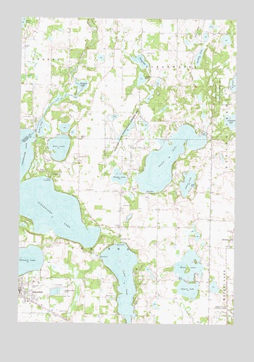
Annandale, MN USGS Topographic Map
Click on map above to begin viewing in our Map Viewer.

This topographic map contains these locations and features:
Feature Name Type Latitude Longitude GNIS ID View Map
Albion Ridges Golf CourseLocaleN45.2606°W94.0444°2067490View Map
Allina Medical Center at AnnandaleHospitalN45.2597°W94.1175°2067484View Map
AnnandaleLocaleN45.2611°W94.1242°2067493View Map
AnnandalePopulated PlaceN45.2627°W94.1244°639390View Map
Annandale Care CenterHospitalN45.2667°W94.1161°2067485View Map
Annandale Evangelical Free ChurchChurchN45.2628°W94.1242°2067494View Map
Annandale High SchoolSchoolN45.2665°W94.1087°2067488View Map
Annandale Middle SchoolSchoolN45.2638°W94.1219°2067487View Map
Annandale Police DepartmentBuildingN45.2638°W94.1234°2067477View Map
Annandale Post OfficePost OfficeN45.2639°W94.1244°2067529View Map
Annandale Public LibraryBuildingN45.2639°W94.1233°2067476View Map
Annandale United Methodist ChurchChurchN45.2656°W94.1244°2067495View Map
Annandale Volunteer Fire DepartmentBuildingN45.2663°W94.1175°2067479View Map
Bass LakeLakeN45.3220°W94.1022°639674View Map
Bendix Elementary SchoolSchoolN45.2662°W94.1136°2067486View Map
Camp CourageLocaleN45.2661°W94.0569°640795View Map
Camp FriendshipLocaleN45.3091°W94.1061°640799View Map
Cedar LakeReservoirN45.2693°W94.0646°1776718View Map
Cedar Lake DamDamN45.2766°W94.0769°1776717View Map
City of AnnandaleCivilN45.2600°W94.1204°2393962View Map
Clearwater LakeLakeN45.3044°W94.1192°641320View Map
Community Behavioral Health Hospital AnnandaleHospitalN45.2542°W94.1000°2697222View Map
Corinna CemeteryCemeteryN45.2897°W94.0653°641499View Map
Cornell LakeLakeN45.3502°W94.0552°641508View Map
County Ditch Number ThirtyoneCanalN45.3541°W94.1169°641956View Map
County Ditch Number TwentyCanalN45.2536°W94.0247°641794View Map
Eastview Mobile Home ParkPopulated PlaceN45.2653°W94.1050°2067489View Map
Elm Grove Mobile Home ParkPopulated PlaceN45.2628°W94.1242°2067492View Map
Grass LakeLakeN45.3301°W94.1129°644370View Map
Hoglund State Wildlife Management AreaParkN45.3455°W94.0078°645062View Map
Indian LakeLakeN45.3080°W94.0275°645410View Map
Kindome Hall of Jehovahs WitnessesChurchN45.2667°W94.1189°2067480View Map
Lakeview CemeteryCemeteryN45.2883°W94.0002°646437View Map
Mavencamp Airport (historical)AirportN45.2566°W94.0391°660277View Map
Mink LakeLakeN45.2739°W94.0255°647913View Map
Nixon LakeLakeN45.3575°W94.0558°648564View Map
Pleasant LakeLakeN45.2749°W94.1247°649560View Map
Quinn LakeLakeN45.3729°W94.1244°649776View Map
Robert E Ney Memorial ParkParkN45.2575°W94.0022°639174View Map
Saint Ignatius ChurchChurchN45.2644°W94.1233°2067481View Map
Saint Mark's CemeteryCemeteryN45.3111°W94.1058°2067227View Map
Saint Marks ChurchChurchN45.3108°W94.1064°650820View Map
Sandy LakeLakeN45.3098°W94.0672°651184View Map
Schroeder ParkParkN45.2841°W94.0675°651786View Map
Schroeder Park CampgroundLocaleN45.2833°W94.0653°2067496View Map
Shelden LakeLakeN45.3595°W94.0218°651938View Map
Somers LakeLakeN45.2704°W94.0265°652251View Map
Southbrook Golf and Country ClubLocaleN45.2639°W94.1244°2067478View Map
Suconnix State Wildlife Management AreaParkN45.3302°W94.0614°652763View Map
Sugar LakeLakeN45.3175°W94.0392°652772View Map
Township of ClearwaterCivilN45.3643°W94.0437°663818View Map
Township of CorinnaCivilN45.2838°W94.0730°663870View Map
Weigand LakeLakeN45.3473°W94.0899°653891View Map
Whispering Pines Golf CourseLocaleN45.2583°W94.0722°2067497View Map
Woodlawn CemeteryCemeteryN45.2647°W94.1175°654372View Map
Zion Lutheran ChurchChurchN45.2631°W94.1167°2067483View Map

Note: Coordinates in the location and feature list above are referenced to NAD83 datum.


Copyright (C) 2008-2025 Ryan Niemi / Sunset Dynamics ... All Rights Reserved