TopoQuest Logo
Do you find TopoQuest useful?
Help keep TopoQuest running and adding new maps/features by donating!
Bitcoin:  19c7KJd3qBynnjoSw5npx9KScwjBe4ifkT
Litecoin:  LXs6TkuXGGXo1vDsWCkWVdjQX94eUKd6ui
Home View Maps Find Maps Find Places Resources & Links


Clements Ranch, New Mexico Topographic Map

USGS Map Title: Clements Ranch, NM
USGS Map MRC: 33105A3
DRG (GeoTIFF) Download: o33105a3.tif


Neighboring USGS Topographic Map Quads:


  Pajarita Mountain, NM  
33105B4
 

  Deadman Lake, NM  
33105B3
 

  Flying H NW, NM  
33105B2
 

  Turkey Peak, NM  
33105A4
 

  Clements Ranch, NM  
33105A3
 

  Loco Canyon, NM  
33105A2
 

  Mayhill, NM  
32105H4
 

  Elk, NM  
32105H3
 

  Thimble Canyon, NM  
32105H2


Map MRC Location:

N34°
W106°
N34°
W105°
H8 H7 H6 H5 H4 H3 H2 H1
G8 G7 G6 G5 G4 G3 G2 G1
F8 F7 F6 F5 F4 F3 F2 F1
E8 E7 E6 E5 E4 E3 E2 E1
D8 D7 D6 D5 D4 D3 D2 D1
C8 C7 C6 C5 C4 C3 C2 C1
B8 B7 B6 B5 B4 B3 B2 B1
A8 A7 A6 A5 A4 A3 A2 A1
N33°
W106°
N33°
W105°

Clements Ranch, NM USGS 1:24K Topographic Map Preview:
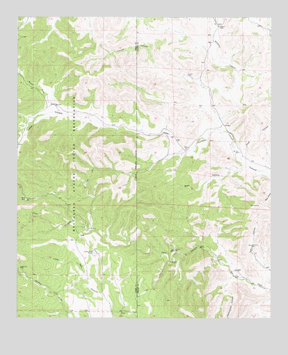
Clements Ranch, NM USGS Topographic Map
Click on map above to begin viewing in our Map Viewer.

This topographic map contains these locations and features:
Feature Name Type Latitude Longitude GNIS ID View Map
Buell CanyonValleyN33.0648°W105.2650°886848View Map
Calentine WellLocaleN33.0284°W105.2975°887079View Map
Clements RanchLocaleN33.1212°W105.2764°887674View Map
Felix CanyonValleyN33.0140°W105.2516°906247View Map
Indian CanyonValleyN33.0784°W105.2730°907195View Map
Indian WellLocaleN33.0709°W105.2914°890326View Map
Janes WellLocaleN33.0232°W105.2983°890411View Map
Little Felix TankReservoirN33.0271°W105.3375°891135View Map
Lower Indian WellLocaleN33.0884°W105.3572°891431View Map
McCarty WellLocaleN33.0693°W105.2666°891722View Map
North Fork Indian CanyonValleyN33.0862°W105.3553°933085View Map
Panther WellLocaleN33.0212°W105.3741°893067View Map
Pendergrass CanyonValleyN33.0173°W105.2694°909555View Map
Pendergrass WellLocaleN33.0170°W105.2666°893165View Map
Road CanyonValleyN33.0684°W105.2639°893993View Map
Tank Number 4ReservoirN33.0497°W105.3712°898144View Map
Taylor WellLocaleN33.0740°W105.2972°895543View Map
Teel CanyonValleyN33.0201°W105.2508°895562View Map
Teel Canyon WellLocaleN33.0304°W105.2600°895563View Map
Teel WellLocaleN33.0245°W105.2789°895565View Map
Whitetail CanyonValleyN33.0923°W105.2711°896556View Map
Willow WellLocaleN33.0293°W105.2853°896673View Map

Note: Coordinates in the location and feature list above are referenced to NAD83 datum.


Copyright (C) 2008-2025 Ryan Niemi / Sunset Dynamics ... All Rights Reserved