TopoQuest Logo
Do you find TopoQuest useful?
Help keep TopoQuest running and adding new maps/features by donating!
Bitcoin:  19c7KJd3qBynnjoSw5npx9KScwjBe4ifkT
Litecoin:  LXs6TkuXGGXo1vDsWCkWVdjQX94eUKd6ui
Home View Maps Find Maps Find Places Resources & Links


Elk, New Mexico Topographic Map

USGS Map Title: Elk, NM
USGS Map MRC: 32105H3
DRG (GeoTIFF) Download: o32105h3.tif


Neighboring USGS Topographic Map Quads:


  Turkey Peak, NM  
33105A4
 

  Clements Ranch, NM  
33105A3
 

  Loco Canyon, NM  
33105A2
 

  Mayhill, NM  
32105H4
 

  Elk, NM  
32105H3
 

  Thimble Canyon, NM  
32105H2
 

  Woodson Canyon, NM  
32105G4
 

  Robertson Canyon, NM  
32105G3
 

  Dunken, NM  
32105G2


Map MRC Location:

N33°
W106°
N33°
W105°
H8 H7 H6 H5 H4 H3 H2 H1
G8 G7 G6 G5 G4 G3 G2 G1
F8 F7 F6 F5 F4 F3 F2 F1
E8 E7 E6 E5 E4 E3 E2 E1
D8 D7 D6 D5 D4 D3 D2 D1
C8 C7 C6 C5 C4 C3 C2 C1
B8 B7 B6 B5 B4 B3 B2 B1
A8 A7 A6 A5 A4 A3 A2 A1
N32°
W106°
N32°
W105°

Elk, NM USGS 1:24K Topographic Map Preview:
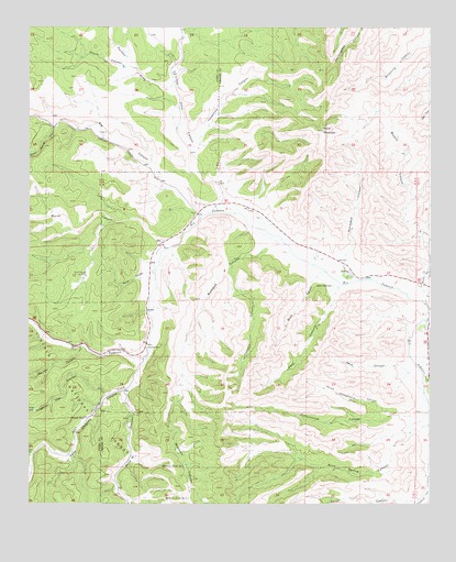
Elk, NM USGS Topographic Map
Click on map above to begin viewing in our Map Viewer.

This topographic map contains these locations and features:
Feature Name Type Latitude Longitude GNIS ID View Map
10356 Water WellWellN32.9495°W105.3019°923125View Map
10357 Water WellWellN32.9484°W105.3008°923124View Map
10358 Water WellWellN32.9498°W105.2980°923126View Map
10359 Water WellWellN32.9440°W105.3025°923123View Map
10360 Water WellWellN32.9501°W105.2980°923127View Map
10361 Water WellWellN32.9415°W105.3022°922081View Map
10362 Water WellWellN32.9418°W105.2894°922082View Map
10636 Water WellWellN32.9529°W105.3205°922076View Map
10637 Water WellWellN32.9518°W105.3072°922075View Map
10638 Water WellWellN32.9418°W105.3305°927220View Map
10639 Water WellWellN32.9312°W105.3322°923118View Map
10640 Water WellWellN32.9418°W105.2947°922083View Map
10641 Water WellWellN32.9373°W105.2905°923121View Map
10642 Water WellWellN32.9384°W105.2822°923122View Map
10643 Water WellWellN32.9345°W105.2780°923120View Map
10644 Water WellWellN32.9312°W105.2775°927225View Map
10645 Water WellWellN32.9145°W105.3344°927223View Map
12770 Water WellWellN32.9329°W105.2691°923119View Map
Agua Chiquita CanyonValleyN32.9134°W105.3386°903004View Map
Agua Chiquita CreekStreamN32.9107°W105.3403°1930544View Map
Bates CanyonValleyN32.9359°W105.3386°903606View Map
Bryant CanyonValleyN32.9234°W105.2519°904126View Map
Burnt CanyonValleyN32.9432°W105.3339°904217View Map
Crockett RanchLocaleN32.9159°W105.3380°905513View Map
Dam CanyonValleyN32.8887°W105.3739°905584View Map
ElkPopulated PlaceN32.9432°W105.3344°920594View Map
Elk CanyonValleyN32.9529°W105.3222°906119View Map
Elk CemeteryCemeteryN32.9356°W105.2752°906120View Map
Elk Post Office (historical)Post OfficeN32.9432°W105.3344°938279View Map
Elk Weather StationLocaleN32.9432°W105.3344°931833View Map
Garst CanyonValleyN32.8765°W105.2539°906490View Map
Gravel TankReservoirN32.8994°W105.3733°906717View Map
Graveyard CanyonValleyN32.9357°W105.2775°906721View Map
J B Runyan RanchLocaleN32.9079°W105.2503°890369View Map
Little Felix CanyonValleyN32.9557°W105.3150°908017View Map
Mathews CanyonValleyN32.9432°W105.2950°908460View Map
Mathews Tank Number 1ReservoirN32.8850°W105.3265°908461View Map
Mathews Tank Number 2ReservoirN32.8765°W105.3254°908462View Map
Mathews Tank Number ThreeReservoirN32.8944°W105.3229°913398View Map
Merrett CanyonValleyN32.9162°W105.3589°908574View Map
Mule CanyonValleyN32.9032°W105.3455°908969View Map
North Cottonwood CanyonValleyN32.8984°W105.2622°909132View Map
North Pasture WindmillLocaleN32.9348°W105.3572°892636View Map
Panther DrawValleyN32.9854°W105.3308°909474View Map
Paul CanyonValleyN32.9318°W105.2786°909513View Map
Paul SpringsSpringN32.9323°W105.2807°909514View Map
Peck CanyonValleyN32.9115°W105.2614°909530View Map
Penasco Volunteer Fire Department Station 2BuildingN32.9436°W105.3341°2658211View Map
Pine TankReservoirN32.8989°W105.3626°913279View Map
Short CanyonValleyN32.9351°W105.2858°911022View Map
Sixteen Springs CanyonValleyN32.9743°W105.3669°920708View Map
Skunk CanyonValleyN32.9901°W105.3458°911121View Map
Telephone CanyonValleyN32.9693°W105.3228°911591View Map
Tilotson CanyonValleyN32.9393°W105.3122°911715View Map
Turpin TankReservoirN32.8976°W105.3572°911917View Map
Turpin TankReservoirN32.8759°W105.3568°913278View Map
White Flat CanyonValleyN32.9040°W105.3511°912297View Map
Wind MountainSummitN32.9732°W105.2839°912449View Map

Note: Coordinates in the location and feature list above are referenced to NAD83 datum.


Copyright (C) 2008-2025 Ryan Niemi / Sunset Dynamics ... All Rights Reserved