TopoQuest Logo
Do you find TopoQuest useful?
Help keep TopoQuest running and adding new maps/features by donating!
Bitcoin:  19c7KJd3qBynnjoSw5npx9KScwjBe4ifkT
Litecoin:  LXs6TkuXGGXo1vDsWCkWVdjQX94eUKd6ui
Home View Maps Find Maps Find Places Resources & Links


Mayhill, New Mexico Topographic Map

USGS Map Title: Mayhill, NM
USGS Map MRC: 32105H4
DRG (GeoTIFF) Download: o32105h4.tif


Neighboring USGS Topographic Map Quads:


  Elk-Silver, NM  
33105A5
 

  Turkey Peak, NM  
33105A4
 

  Clements Ranch, NM  
33105A3
 

  Harvey Ranch, NM  
32105H5
 

  Mayhill, NM  
32105H4
 

  Elk, NM  
32105H3
 

  Sacramento, NM  
32105G5
 

  Woodson Canyon, NM  
32105G4
 

  Robertson Canyon, NM  
32105G3


Map MRC Location:

N33°
W106°
N33°
W105°
H8 H7 H6 H5 H4 H3 H2 H1
G8 G7 G6 G5 G4 G3 G2 G1
F8 F7 F6 F5 F4 F3 F2 F1
E8 E7 E6 E5 E4 E3 E2 E1
D8 D7 D6 D5 D4 D3 D2 D1
C8 C7 C6 C5 C4 C3 C2 C1
B8 B7 B6 B5 B4 B3 B2 B1
A8 A7 A6 A5 A4 A3 A2 A1
N32°
W106°
N32°
W105°

Mayhill, NM USGS 1:24K Topographic Map Preview:
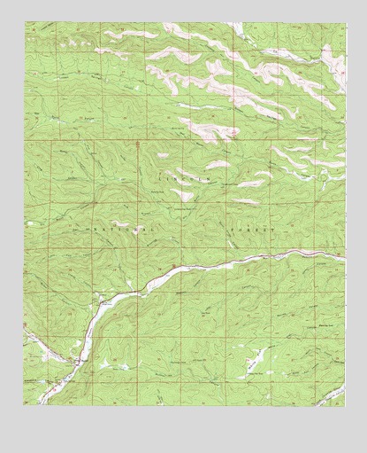
Mayhill, NM USGS Topographic Map
Click on map above to begin viewing in our Map Viewer.

This topographic map contains these locations and features:
Feature Name Type Latitude Longitude GNIS ID View Map
Big Canyon TankReservoirN32.8893°W105.4431°903786View Map
Black Dog TankReservoirN32.9014°W105.3798°903860View Map
Brantley TankReservoirN32.9448°W105.4511°904064View Map
Bridge CanyonValleyN32.9620°W105.3847°936754View Map
Bridge Canyon TankReservoirN32.9623°W105.4123°899097View Map
Browning CanyonValleyN32.9204°W105.4333°904101View Map
Burnt House CanyonValleyN32.9234°W105.4116°904223View Map
Burnt SpringSpringN32.9653°W105.4431°904229View Map
Burnt WellWellN32.9487°W105.4619°899098View Map
Carr CanyonValleyN32.9120°W105.4569°904786View Map
Carr Canyon TankReservoirN32.9319°W105.4712°899100View Map
CCC TankReservoirN32.8900°W105.4307°904273View Map
Cherry CanyonValleyN32.9087°W105.4664°905073View Map
Crooked CanyonValleyN32.9670°W105.3755°905516View Map
Crooked TankReservoirN32.9928°W105.4632°899015View Map
Crooked Well OneWellN32.9829°W105.4172°899017View Map
Crooked Well TwoWellN32.9954°W105.4430°899016View Map
Derrick TankReservoirN32.9353°W105.4898°899094View Map
Dry Burnt CanyonValleyN32.9557°W105.4150°905866View Map
Fire CanyonValleyN32.9484°W105.4667°906271View Map
First Baptist ChurchChurchN32.8895°W105.4780°920978View Map
Government TankReservoirN32.9473°W105.4234°906667View Map
Graveyard CanyonValleyN32.8807°W105.4850°906724View Map
Graveyard DamDamN32.8834°W105.4916°899096View Map
Hog BranchValleyN32.9393°W105.4439°907004View Map
Hog Branch TankReservoirN32.9378°W105.4578°899099View Map
Hog CanyonValleyN32.9376°W105.4697°1989368View Map
Horse CanyonValleyN32.9465°W105.4547°907088View Map
Hunter WellWellN32.8834°W105.4261°907169View Map
Jackson Trick TankReservoirN32.9014°W105.4033°899092View Map
James CanyonValleyN32.8879°W105.4780°920616View Map
Jones CanyonValleyN32.9226°W105.3780°907425View Map
Joy CanyonValleyN32.9248°W105.3978°907459View Map
Joy TankReservoirN32.9057°W105.4311°907460View Map
Latham Gap TankReservoirN32.9391°W105.4352°907889View Map
LE TankReservoirN32.9493°W105.4958°899090View Map
Lincoln National ForestForestN32.9538°W105.4437°1851857View Map
Little Carr CanyonValleyN32.9273°W105.4672°908001View Map
Long CanyonValleyN32.9470°W105.4692°908157View Map
Long Canyon TankReservoirN32.9491°W105.4892°899091View Map
Lower McGee TankReservoirN32.9048°W105.4728°899101View Map
Lower White Flat TankReservoirN32.8854°W105.3904°899093View Map
MayhillPopulated PlaceN32.8895°W105.4780°920644View Map
Mayhill Administration SiteLocaleN32.9090°W105.4691°928986View Map
Mayhill Administrative SiteLocaleN32.8895°W105.4780°935771View Map
Mayhill CemeteryCemeteryN32.8823°W105.4869°908484View Map
Mayhill Census Designated PlaceCensusN32.8962°W105.4960°2584153View Map
Mayhill Post OfficePost OfficeN32.8901°W105.4783°938213View Map
Mayhill Volunteer Fire Department HeadquartersBuildingN32.8892°W105.4794°2657829View Map
Mayhill Volunteer Fire Department Substation 3BuildingN32.8904°W105.4789°2658053View Map
Mayhill Weather StationLocaleN32.8895°W105.4780°931870View Map
McGee CanyonValleyN32.9045°W105.4711°908522View Map
McGee TankReservoirN32.9172°W105.4965°899095View Map
Mountain Acres CemeteryCemeteryN32.8909°W105.4911°908932View Map
Myers CanyonValleyN32.8962°W105.4936°908998View Map
North Dam CanyonValleyN32.8895°W105.3797°909133View Map
North Long TankReservoirN32.9569°W105.4817°899089View Map
Parker DamDamN32.9051°W105.4739°923927View Map
Parker ReservoirReservoirN32.9058°W105.4745°923928View Map
Paxton TankReservoirN32.8874°W105.4606°909518View Map
Posey SpringsSpringN32.8835°W105.4845°909800View Map
Sawmill CanyonValleyN32.9201°W105.4275°910831View Map
South Dam CanyonValleyN32.8895°W105.3794°911225View Map
Upper Rio Penasco Site 3a DamDamN32.8834°W105.4922°924001View Map
Walker CanyonValleyN32.9484°W105.4736°912134View Map
Wet Burnt CanyonValleyN32.9557°W105.4141°912276View Map
White FlatFlatN32.8907°W105.4094°912296View Map
White Flat TankReservoirN32.8976°W105.3969°1987533View Map
White Flat TankReservoirN32.8858°W105.4130°912298View Map

Note: Coordinates in the location and feature list above are referenced to NAD83 datum.


Copyright (C) 2008-2025 Ryan Niemi / Sunset Dynamics ... All Rights Reserved