TopoQuest Logo
Do you find TopoQuest useful?
Help keep TopoQuest running and adding new maps/features by donating!
Bitcoin:  19c7KJd3qBynnjoSw5npx9KScwjBe4ifkT
Litecoin:  LXs6TkuXGGXo1vDsWCkWVdjQX94eUKd6ui
Home View Maps Find Maps Find Places Resources & Links


Clover, South Carolina Topographic Map

USGS Map Title: Clover, SC
USGS Map MRC: 35081A2
DRG (GeoTIFF) Download: o35081a2.tif


Neighboring USGS Topographic Map Quads:


  Kings Mountain, NC  
35081B3
 

  Gastonia South, NC  
35081B2
 

  Belmont, NC  
35081B1
 

  Filbert, SC  
35081A3
 

  Clover, SC  
35081A2
 

  Lake Wylie, SC  
35081A1
 

  Sharon, SC  
34081H3
 

  Tirzah, SC  
34081H2
 

  Rock Hill West, SC  
34081H1


Map MRC Location:

N36°
W82°
N36°
W81°
H8 H7 H6 H5 H4 H3 H2 H1
G8 G7 G6 G5 G4 G3 G2 G1
F8 F7 F6 F5 F4 F3 F2 F1
E8 E7 E6 E5 E4 E3 E2 E1
D8 D7 D6 D5 D4 D3 D2 D1
C8 C7 C6 C5 C4 C3 C2 C1
B8 B7 B6 B5 B4 B3 B2 B1
A8 A7 A6 A5 A4 A3 A2 A1
N35°
W82°
N35°
W81°

Clover, SC USGS 1:24K Topographic Map Preview:
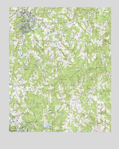
Clover, SC USGS Topographic Map
Click on map above to begin viewing in our Map Viewer.

This topographic map contains these locations and features:
Feature Name Type Latitude Longitude GNIS ID View Map
Abiding Presence Lutheran ChurchChurchN35.0032°W81.2373°1233585View Map
Allison Creek ChurchChurchN35.0635°W81.2304°1233586View Map
Belton Pond Dam D-3660DamN35.0368°W81.1481°1240365View Map
Beth Shiloh Presbyterian ChurchChurchN35.0265°W81.1798°1233600View Map
Beth-Shiloh SchoolSchoolN35.0287°W81.1834°1220521View Map
Bethel (historical)Populated PlaceN35.1013°W81.1501°1248876View Map
Bethel Fire Department Station 3BuildingN35.0517°W81.1565°2578888View Map
Bethel Presbyterian ChurchChurchN35.1115°W81.1531°1246801View Map
Bethel SchoolSchoolN35.0888°W81.1256°1246809View Map
Bethel-Lake Wylie AirportAirportN35.0488°W81.1373°1251991View Map
Bright Light Freewill Baptist ChurchChurchN35.0093°W81.2231°1233616View Map
Calabash BranchStreamN35.0671°W81.1909°1221193View Map
Camp RunStreamN35.1168°W81.1348°1221266View Map
Church of GodChurchN35.0015°W81.2320°1233658View Map
Church of the NazareneChurchN35.0015°W81.2373°1233664View Map
CloverPopulated PlaceN35.1112°W81.2265°1221646View Map
Clover Chapel CemeteryCemeteryN35.1149°W81.2348°1221647View Map
Clover DivisionCivilN35.1074°W81.2228°1938233View Map
Clover Fire DepartmentBuildingN35.1107°W81.2254°2578656View Map
Clover High SchoolSchoolN35.0965°W81.1831°1233667View Map
Clover Junior High SchoolSchoolN35.1049°W81.2206°1233668View Map
Clover Middle SchoolSchoolN35.1196°W81.2315°1233669View Map
Clover Plaza Shopping CenterLocaleN35.1112°W81.2259°1233670View Map
Clover Police DepartmentBuildingN35.1105°W81.2259°2734280View Map
Clover Post OfficePost OfficeN35.1096°W81.2251°1252126View Map
Clover Public LibraryBuildingN35.1090°W81.2276°1233671View Map
Clover Rescue SquadBuildingN35.1106°W81.2261°2739571View Map
Divine Savior Catholic ChurchChurchN35.0007°W81.2417°1233686View Map
English GardensPopulated PlaceN35.0071°W81.2181°1233699View Map
Episcopal Childrens HomeBuildingN35.0043°W81.2395°1233700View Map
Fairview Church (historical)ChurchN35.0565°W81.2484°1237454View Map
Fairview SchoolSchoolN35.0571°W81.2490°1222347View Map
Fishing Creek CemeteryCemeteryN35.0151°W81.2487°1222410View Map
Fishing Creek Watershed Dam Number OneReservoirN35.0018°W81.2048°1238544View Map
Gold Hill Baptist ChurchChurchN35.0212°W81.2012°1233741View Map
Gold Hill SchoolSchoolN35.0212°W81.2023°1222738View Map
Green Pond ChurchChurchN35.1060°W81.2059°1222878View Map
Grist BranchStreamN35.0599°W81.1804°1222918View Map
Jerusalem ChurchChurchN35.0904°W81.1967°1223571View Map
John B Harvey BridgeBridgeN35.0632°W81.1515°1233769View Map
Johnson BranchStreamN35.0682°W81.1670°1223602View Map
Kinard Elementary SchoolSchoolN35.1107°W81.2312°1251747View Map
Lincoln EstatesPopulated PlaceN35.0099°W81.2304°1233786View Map
Morris BranchStreamN35.0699°W81.2320°1224652View Map
Mount Harmony ChurchChurchN35.1224°W81.1284°1249576View Map
New Home ChurchChurchN35.0390°W81.1492°1224976View Map
New Home SchoolSchoolN35.0443°W81.1454°1224977View Map
Pine Bluff SchoolSchoolN35.0837°W81.1717°1225429View Map
Pine Bluff School (historical)SchoolN35.0979°W81.1965°1233847View Map
Poplar AcresPopulated PlaceN35.0029°W81.2179°1233856View Map
Rock BranchStreamN35.0632°W81.1520°1250409View Map
Saint Paul Baptist ChurchChurchN35.0851°W81.1920°1250648View Map
South Carolina Noname 46005 D-3678 DamDamN35.0501°W81.2248°1238539View Map
South Carolina Noname 46008 D-3659 DamDamN35.0018°W81.2048°1238543View Map
South Carolina Noname 46023 D-3658 DamDamN35.0835°W81.2415°1238564View Map
Town of CloverCivilN35.1123°W81.2201°2406283View Map
Union Baptist ChurchChurchN35.0404°W81.2284°1251262View Map
Walker BranchStreamN35.0760°W81.2076°1227374View Map
York DivisionCivilN35.0032°W81.2249°1938475View Map
Zion ChurchChurchN35.1199°W81.2362°1227760View Map

Note: Coordinates in the location and feature list above are referenced to NAD83 datum.


Copyright (C) 2008-2025 Ryan Niemi / Sunset Dynamics ... All Rights Reserved