TopoQuest Logo
Do you find TopoQuest useful?
Help keep TopoQuest running and adding new maps/features by donating!
Bitcoin:  19c7KJd3qBynnjoSw5npx9KScwjBe4ifkT
Litecoin:  LXs6TkuXGGXo1vDsWCkWVdjQX94eUKd6ui
Home View Maps Find Maps Find Places Resources & Links


Filbert, South Carolina Topographic Map

USGS Map Title: Filbert, SC
USGS Map MRC: 35081A3
DRG (GeoTIFF) Download: o35081a3.tif


Neighboring USGS Topographic Map Quads:


  Grover, NC  
35081B4
 

  Kings Mountain, NC  
35081B3
 

  Gastonia South, NC  
35081B2
 

  Kings Creek, SC  
35081A4
 

  Filbert, SC  
35081A3
 

  Clover, SC  
35081A2
 

  Hickory Grove, SC  
34081H4
 

  Sharon, SC  
34081H3
 

  Tirzah, SC  
34081H2


Map MRC Location:

N36°
W82°
N36°
W81°
H8 H7 H6 H5 H4 H3 H2 H1
G8 G7 G6 G5 G4 G3 G2 G1
F8 F7 F6 F5 F4 F3 F2 F1
E8 E7 E6 E5 E4 E3 E2 E1
D8 D7 D6 D5 D4 D3 D2 D1
C8 C7 C6 C5 C4 C3 C2 C1
B8 B7 B6 B5 B4 B3 B2 B1
A8 A7 A6 A5 A4 A3 A2 A1
N35°
W82°
N35°
W81°

Filbert, SC USGS 1:24K Topographic Map Preview:
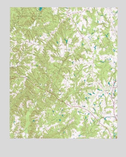
Filbert, SC USGS Topographic Map
Click on map above to begin viewing in our Map Viewer.

This topographic map contains these locations and features:
Feature Name Type Latitude Longitude GNIS ID View Map
Adams LakeReservoirN35.0930°W81.3091°1238536View Map
Battleground School (historical)SchoolN35.1224°W81.3498°1233593View Map
BeershebaPopulated PlaceN35.0379°W81.3192°1233596View Map
Beersheba Presbyterian ChurchChurchN35.0365°W81.3201°1233597View Map
BethanyPopulated PlaceN35.1171°W81.3062°1220522View Map
Bethany - Santiago Fire DepartmentBuildingN35.0950°W81.3288°2578538View Map
Bethany ChurchChurchN35.1226°W81.3059°1233602View Map
Bethany Elementary SchoolSchoolN35.1221°W81.3062°1233603View Map
Bush-N-Vine FarmLocaleN35.0361°W81.2536°2564094View Map
Cane Spring School (historical)SchoolN35.0301°W81.2998°1233625View Map
Cedar Grove School (historical)SchoolN35.0260°W81.3040°1233642View Map
Cedar Grove United Methodist ChurchChurchN35.0237°W81.3054°1247214View Map
Cedar Hill School (historical)SchoolN35.0818°W81.3112°1233643View Map
Center Hill School (historical)SchoolN35.0871°W81.3351°1233649View Map
Dixie School (historical)SchoolN35.0726°W81.2890°1233687View Map
FilbertPopulated PlaceN35.0487°W81.2542°1231282View Map
Filbert Presbyterian ChurchChurchN35.0482°W81.2540°1233708View Map
Filbert School (historical)SchoolN35.0482°W81.2542°1233709View Map
Fishing Creek Baptist ChurchChurchN35.0237°W81.2570°1247756View Map
Gin BranchStreamN35.0724°W81.3129°1222709View Map
Kings Mountain Chapel United Methodist ChurchChurchN35.0465°W81.2626°1233774View Map
Kings Mountain ChurchChurchN35.0468°W81.2626°1231451View Map
Lakeview Memory GardensCemeteryN35.0421°W81.2551°1223793View Map
Long BranchStreamN35.1087°W81.3673°1224157View Map
Midway ChurchChurchN35.1010°W81.3245°1224483View Map
Mount Enon ChurchChurchN35.0615°W81.3645°1249572View Map
New Zion Methodist ChurchChurchN35.0585°W81.3573°1249863View Map
New Zion School (historical)SchoolN35.0579°W81.3579°1233818View Map
Oakdale ChurchChurchN35.1110°W81.3131°1225136View Map
Ramah Presbyterian ChurchChurchN35.0851°W81.3462°1250290View Map
Rocky BranchStreamN35.0387°W81.3348°1225968View Map
Saint James School (historical)SchoolN35.0640°W81.2801°1233891View Map
Saint James United Methodist ChurchChurchN35.0637°W81.2804°1250528View Map
Santiago School (historical)SchoolN35.0899°W81.3451°1233899View Map
Smiths PondReservoirN35.0585°W81.2531°1238572View Map
Smiths School (historical)SchoolN35.0340°W81.3606°1233915View Map
South Carolina Noname 46002 D-3640 DamDamN35.1224°W81.3404°1238534View Map
South Carolina Noname 46003 D-1215 DamDamN35.0901°W81.3081°1238535View Map
South Carolina Noname 46006 D-1227 DamDamN35.0035°W81.2531°1238540View Map
South Carolina Noname 46030 D-3642 DamDamN35.0585°W81.2531°1238571View Map
Spring Lake Country ClubLocaleN35.0201°W81.2642°1242473View Map
Spring Lake Country Club Dam D-1226DamN35.0201°W81.2648°1240386View Map
Sutton Springs School (historical)SchoolN35.0015°W81.2931°1233936View Map
Upper York ReservoirReservoirN35.0043°W81.2525°1238541View Map
Warlick Pond Dam D-3641DamN35.0385°W81.2865°1240387View Map
York AirportAirportN35.0324°W81.2535°1251992View Map
Zadok (historical)Populated PlaceN35.0793°W81.2781°1248881View Map

Note: Coordinates in the location and feature list above are referenced to NAD83 datum.


Copyright (C) 2008-2024 Ryan Niemi / Sunset Dynamics ... All Rights Reserved