TopoQuest Logo
Do you find TopoQuest useful?
Help keep TopoQuest running and adding new maps/features by donating!
Bitcoin:  19c7KJd3qBynnjoSw5npx9KScwjBe4ifkT
Litecoin:  LXs6TkuXGGXo1vDsWCkWVdjQX94eUKd6ui
Home View Maps Find Maps Find Places Resources & Links


Cochetopa Park, Colorado Topographic Map

USGS Map Title: Cochetopa Park, CO
USGS Map MRC: 38106B6
DRG (GeoTIFF) Download: o38106b6.tif


Neighboring USGS Topographic Map Quads:


  Sawtooth Mountain, CO  
38106C7
 

  Razor Creek Dome, CO  
38106C6
 

  West Baldy, CO  
38106C5
 

  Cold Spring Park, CO  
38106B7
 

  Cochetopa Park, CO  
38106B6
 

  North Pass, CO  
38106B5
 

  Elk Park, CO  
38106A7
 

  Saguache Park, CO  
38106A6
 

  Grouse Creek, CO  
38106A5


Map MRC Location:

N39°
W107°
N39°
W106°
H8 H7 H6 H5 H4 H3 H2 H1
G8 G7 G6 G5 G4 G3 G2 G1
F8 F7 F6 F5 F4 F3 F2 F1
E8 E7 E6 E5 E4 E3 E2 E1
D8 D7 D6 D5 D4 D3 D2 D1
C8 C7 C6 C5 C4 C3 C2 C1
B8 B7 B6 B5 B4 B3 B2 B1
A8 A7 A6 A5 A4 A3 A2 A1
N38°
W107°
N38°
W106°

Cochetopa Park, CO USGS 1:24K Topographic Map Preview:
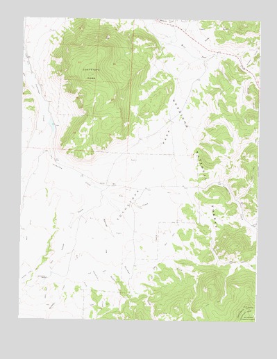
Cochetopa Park, CO USGS Topographic Map
Click on map above to begin viewing in our Map Viewer.

This topographic map contains these locations and features:
Feature Name Type Latitude Longitude GNIS ID View Map
Ant CreekStreamN38.1714°W106.7142°190042View Map
Archuleta CreekStreamN38.2144°W106.7375°190034View Map
Cochetopa DivisionCivilN38.2496°W106.7357°1935427View Map
Cochetopa DomeSummitN38.2267°W106.7148°190036View Map
Cochetopa ParkFlatN38.1883°W106.6817°190037View Map
Corduroy CreekStreamN38.1650°W106.6281°190030View Map
Dome Lakes State Wildlife AreaParkN38.1969°W106.7323°197352View Map
Los CreekStreamN38.1781°W106.7089°190031View Map
Lower Dome DamDamN38.2053°W106.7339°199620View Map
Lower Dome ReservoirReservoirN38.2053°W106.7342°197154View Map
Mesa DitchCanalN38.1500°W106.7495°203409View Map
Mexican Joe GulchValleyN38.1731°W106.7096°190040View Map
Monchego CreekStreamN38.1572°W106.7011°190039View Map
Perry DitchCanalN38.2233°W106.7475°203410View Map
Quarter Circle RanchLocaleN38.1422°W106.7364°190044View Map
Quemado CreekStreamN38.1444°W106.7331°190043View Map
Ricky Placers MineMineN38.1900°W106.6678°1745936View Map
Salaya CreekStreamN38.2261°W106.6281°190032View Map
Samora CreekStreamN38.2300°W106.6348°190033View Map
Stag GulchValleyN38.2347°W106.6598°190035View Map
Sunshine CreekStreamN38.1561°W106.7181°190041View Map
Texas CreekStreamN38.1719°W106.6884°190038View Map
Upper Dome DamDamN38.1978°W106.7345°199622View Map
Upper Dome ReservoirReservoirN38.1942°W106.7341°197155View Map
Van Tassel GulchValleyN38.1781°W106.7088°190023View Map

Note: Coordinates in the location and feature list above are referenced to NAD83 datum.


Copyright (C) 2008-2025 Ryan Niemi / Sunset Dynamics ... All Rights Reserved