TopoQuest Logo
Do you find TopoQuest useful?
Help keep TopoQuest running and adding new maps/features by donating!
Bitcoin:  19c7KJd3qBynnjoSw5npx9KScwjBe4ifkT
Litecoin:  LXs6TkuXGGXo1vDsWCkWVdjQX94eUKd6ui
Home View Maps Find Maps Find Places Resources & Links


Collison, Illinois Topographic Map

USGS Map Title: Collison, IL
USGS Map MRC: 40087B7
DRG (GeoTIFF) Download: o40087b7.tif


Neighboring USGS Topographic Map Quads:


  Penfield, IL  
40087C8
 

  Potomac, IL  
40087C7
 

  Henning, IL  
40087C6
 

  Royal, IL  
40087B8
 

  Collison, IL  
40087B7
 

  Danville NW, IL  
40087B6
 

  Homer, IL  
40087A8
 

  Oakwood, IL  
40087A7
 

  Danville SW, IL  
40087A6


Map MRC Location:

N41°
W88°
N41°
W87°
H8 H7 H6 H5 H4 H3 H2 H1
G8 G7 G6 G5 G4 G3 G2 G1
F8 F7 F6 F5 F4 F3 F2 F1
E8 E7 E6 E5 E4 E3 E2 E1
D8 D7 D6 D5 D4 D3 D2 D1
C8 C7 C6 C5 C4 C3 C2 C1
B8 B7 B6 B5 B4 B3 B2 B1
A8 A7 A6 A5 A4 A3 A2 A1
N40°
W88°
N40°
W87°

Collison, IL USGS 1:24K Topographic Map Preview:
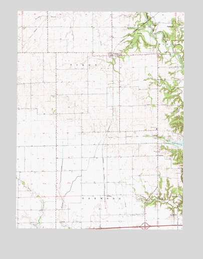
Collison, IL USGS Topographic Map
Click on map above to begin viewing in our Map Viewer.

This topographic map contains these locations and features:
Feature Name Type Latitude Longitude GNIS ID View Map
Belgium RowPopulated PlaceN40.1331°W87.7536°422451View Map
BrothersPopulated PlaceN40.1445°W87.8086°422504View Map
CollisonPopulated PlaceN40.2250°W87.8039°406387View Map
Collison Airport (historical)AirportN40.2348°W87.8100°427176View Map
Collison BranchStreamN40.2353°W87.7722°406388View Map
Collison CemeteryCemeteryN40.2247°W87.7988°1951156View Map
Collison Post OfficePost OfficeN40.2249°W87.8044°1823603View Map
Corner Chapel (historical)ChurchN40.1814°W87.7975°1719953View Map
Creig School (historical)SchoolN40.1670°W87.7984°1764449View Map
Dalbey School (historical)SchoolN40.1289°W87.8453°1764452View Map
Emberry Church (historical)ChurchN40.2017°W87.8461°1719952View Map
Embury CemeteryCemeteryN40.2011°W87.8464°407985View Map
Fowler School (historical)SchoolN40.1939°W87.8742°1764462View Map
GlenburnPopulated PlaceN40.1428°W87.7684°422741View Map
Gorman School (historical)SchoolN40.1573°W87.8636°1764469View Map
Hebron United Methodist ChurchChurchN40.1698°W87.7697°410016View Map
HigginsvillePopulated PlaceN40.2420°W87.7572°422805View Map
Higginsville CemeteryCemeteryN40.2429°W87.7716°410209View Map
Horseshoe Bottom Nature PreserveParkN40.2298°W87.7542°2013434View Map
Illinois Power Company LakeReservoirN40.1744°W87.7520°1691611View Map
Independent School (historical)SchoolN40.1328°W87.8075°1764478View Map
Interchange 206CrossingN40.1267°W87.7784°1823621View Map
Johnson Hill CemeteryCemeteryN40.1583°W87.7505°411167View Map
New Salem CemeteryCemeteryN40.2430°W87.7509°414458View Map
NewtownPopulated PlaceN40.1673°W87.7692°414502View Map
Newtown Middle SchoolSchoolN40.1831°W87.7700°414503View Map
Pilot School (historical)SchoolN40.2264°W87.8528°1764495View Map
Pleasant Grove CemeteryCemeteryN40.1418°W87.7787°415780View Map
Pleasant Grove School (historical)SchoolN40.1414°W87.7834°1719954View Map
Porter CemeteryCemeteryN40.2381°W87.7717°416045View Map
Red Oak School (historical)SchoolN40.2114°W87.7700°1719955View Map
Rice CemeteryCemeteryN40.1889°W87.8339°416583View Map
Sandbar School (historical)SchoolN40.1909°W87.8336°1764506View Map
Shellbark School (historical)SchoolN40.1803°W87.7547°1764508View Map
Snider School (historical)SchoolN40.1956°W87.7978°1764509View Map
Stearns CemeteryCemeteryN40.1264°W87.8603°419082View Map
Stump CemeteryCemeteryN40.1968°W87.7668°419237View Map
Township of OakwoodCivilN40.1296°W87.8390°429473View Map
Township of PilotCivilN40.2180°W87.8484°429565View Map
Trimmell CemeteryCemeteryN40.1779°W87.7701°419845View Map
Welcom School (historical)SchoolN40.1589°W87.8264°1764521View Map
WIAI-FM (Danville)TowerN40.1478°W87.7722°428177View Map

Note: Coordinates in the location and feature list above are referenced to NAD83 datum.


Copyright (C) 2008-2024 Ryan Niemi / Sunset Dynamics ... All Rights Reserved