TopoQuest Logo
Do you find TopoQuest useful?
Help keep TopoQuest running and adding new maps/features by donating!
Bitcoin:  19c7KJd3qBynnjoSw5npx9KScwjBe4ifkT
Litecoin:  LXs6TkuXGGXo1vDsWCkWVdjQX94eUKd6ui
Home View Maps Find Maps Find Places Resources & Links


Penfield, Illinois Topographic Map

USGS Map Title: Penfield, IL
USGS Map MRC: 40087C8
DRG (GeoTIFF) Download: o40087c8.tif


Neighboring USGS Topographic Map Quads:


  Paxton, IL  
40088D1
 

  Rankin, IL  
40087D8
 

  East Lynn, IL  
40087D7
 

  Gifford, IL  
40088C1
 

  Penfield, IL  
40087C8
 

  Potomac, IL  
40087C7
 

  Flatville, IL  
40088B1
 

  Royal, IL  
40087B8
 

  Collison, IL  
40087B7


Map MRC Location:

N41°
W88°
N41°
W87°
H8 H7 H6 H5 H4 H3 H2 H1
G8 G7 G6 G5 G4 G3 G2 G1
F8 F7 F6 F5 F4 F3 F2 F1
E8 E7 E6 E5 E4 E3 E2 E1
D8 D7 D6 D5 D4 D3 D2 D1
C8 C7 C6 C5 C4 C3 C2 C1
B8 B7 B6 B5 B4 B3 B2 B1
A8 A7 A6 A5 A4 A3 A2 A1
N40°
W88°
N40°
W87°

Penfield, IL USGS 1:24K Topographic Map Preview:
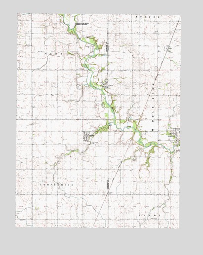
Penfield, IL USGS Topographic Map
Click on map above to begin viewing in our Map Viewer.

This topographic map contains these locations and features:
Feature Name Type Latitude Longitude GNIS ID View Map
ArmstrongPopulated PlaceN40.3064°W87.8778°403620View Map
Armstrong High SchoolSchoolN40.3056°W87.8800°1764433View Map
Armstrong Post OfficePost OfficeN40.3063°W87.8772°1823592View Map
Armstrong-Ellis Elementary SchoolSchoolN40.3070°W87.8753°1823593View Map
Buck CreekStreamN40.3114°W87.9253°405095View Map
Chenoweth CemeteryCemeteryN40.3614°W87.9475°406009View Map
Circle Post Office (historical)Post OfficeN40.3642°W87.9123°1823602View Map
EllisPopulated PlaceN40.3553°W87.8850°407897View Map
Foster School (historical)SchoolN40.2700°W87.8917°1764534View Map
GeraldPopulated PlaceN40.2706°W87.9300°422733View Map
Gordon School (historical)SchoolN40.3417°W87.9889°1802071View Map
Kuder School (historical)SchoolN40.3420°W87.9467°1802078View Map
Martin School (historical)SchoolN40.3706°W87.9898°1802085View Map
Obenchain School (historical)SchoolN40.2689°W87.9675°1802089View Map
Partlow CemeteryCemeteryN40.3002°W87.8766°1764494View Map
PenfieldPopulated PlaceN40.3034°W87.9467°415522View Map
Penfield Census Designated PlaceCensusN40.3047°W87.9443°2628559View Map
Penfield Post OfficePost OfficeN40.3052°W87.9480°1810855View Map
Penfield United Methodist ChurchChurchN40.3048°W87.9450°1962319View Map
Saint Lawrence Catholic ChurchChurchN40.3036°W87.9481°1962320View Map
Saint Lawrence CemeteryCemeteryN40.2995°W87.9428°417504View Map
Sugar CreekStreamN40.3656°W87.9570°419285View Map
Tomlinson CemeteryCemeteryN40.3562°W87.9443°419774View Map
Tomlinson Pioneer Cemetery Prairie Nature PreserveParkN40.3561°W87.9439°1992804View Map
Township of KerrCivilN40.3560°W87.9668°429204View Map
Walters School (historical)SchoolN40.3284°W87.9028°1764552View Map
WCCU-TV (Urbana)TowerN40.3117°W87.9134°428564View Map
Welles CemeteryCemeteryN40.2872°W87.9683°420737View Map

Note: Coordinates in the location and feature list above are referenced to NAD83 datum.


Copyright (C) 2008-2024 Ryan Niemi / Sunset Dynamics ... All Rights Reserved