TopoQuest Logo
Do you find TopoQuest useful?
Help keep TopoQuest running and adding new maps/features by donating!
Bitcoin:  19c7KJd3qBynnjoSw5npx9KScwjBe4ifkT
Litecoin:  LXs6TkuXGGXo1vDsWCkWVdjQX94eUKd6ui
Home View Maps Find Maps Find Places Resources & Links


Henning, Illinois Topographic Map

USGS Map Title: Henning, IL
USGS Map MRC: 40087C6
DRG (GeoTIFF) Download: o40087c6.tif


Neighboring USGS Topographic Map Quads:


  East Lynn, IL  
40087D7
 

  Hoopeston, IL  
40087D6
 

  Ambia, IN  
40087D5
 

  Potomac, IL  
40087C7
 

  Henning, IL  
40087C6
 

  Bismarck, IL  
40087C5
 

  Collison, IL  
40087B7
 

  Danville NW, IL  
40087B6
 

  Danville NE, IL  
40087B5


Map MRC Location:

N41°
W88°
N41°
W87°
H8 H7 H6 H5 H4 H3 H2 H1
G8 G7 G6 G5 G4 G3 G2 G1
F8 F7 F6 F5 F4 F3 F2 F1
E8 E7 E6 E5 E4 E3 E2 E1
D8 D7 D6 D5 D4 D3 D2 D1
C8 C7 C6 C5 C4 C3 C2 C1
B8 B7 B6 B5 B4 B3 B2 B1
A8 A7 A6 A5 A4 A3 A2 A1
N40°
W88°
N40°
W87°

Henning, IL USGS 1:24K Topographic Map Preview:
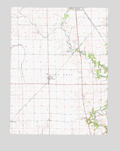
Henning, IL USGS Topographic Map
Click on map above to begin viewing in our Map Viewer.

This topographic map contains these locations and features:
Feature Name Type Latitude Longitude GNIS ID View Map
Albright School (historical)SchoolN40.3409°W87.7400°1764432View Map
Bean Creek DitchCanalN40.3131°W87.7356°404003View Map
Bismarck Community Fire Protection DistrictBuildingN40.3059°W87.7013°2681844View Map
Centennial School (historical)SchoolN40.2925°W87.6334°1764442View Map
Central School (historical)SchoolN40.2709°W87.6997°1764443View Map
Christman ParkParkN40.3745°W87.6722°406103View Map
College Hill School (historical)SchoolN40.3620°W87.6275°1764447View Map
Cuba School (historical)SchoolN40.2628°W87.6661°1764450View Map
Gundy CemeteryCemeteryN40.2710°W87.6427°409570View Map
HenningPopulated PlaceN40.3050°W87.7009°410062View Map
Henning High SchoolSchoolN40.3098°W87.7020°1764475View Map
JamesburgPopulated PlaceN40.2623°W87.7489°411031View Map
Lake DeReveyReservoirN40.3321°W87.6737°407023View Map
Lee School (historical)SchoolN40.2909°W87.6570°1764482View Map
Lincoln School (historical)SchoolN40.3289°W87.7022°1764486View Map
Manns ChapelChurchN40.3317°W87.6592°412902View Map
Middle BranchStreamN40.3098°W87.6378°439086View Map
Middle Branch North Fork Vermilion RiverStreamN40.3098°W87.6375°413480View Map
Moores CornerPopulated PlaceN40.2664°W87.6520°422997View Map
Myersville (historical)Populated PlaceN40.2659°W87.6406°1823633View Map
Painter CreekStreamN40.2764°W87.6270°415299View Map
RayvillePopulated PlaceN40.3067°W87.6584°423103View Map
Rickart School (historical)SchoolN40.2961°W87.7347°1764504View Map
Rossville JunctionPopulated PlaceN40.3578°W87.6436°423134View Map
Township of RossCivilN40.3603°W87.6327°429677View Map
Township of South RossCivilN40.3043°W87.6523°429778View Map
VernalPopulated PlaceN40.2636°W87.6995°423276View Map
Village of HenningCivilN40.3069°W87.7010°2398490View Map

Note: Coordinates in the location and feature list above are referenced to NAD83 datum.


Copyright (C) 2008-2024 Ryan Niemi / Sunset Dynamics ... All Rights Reserved