TopoQuest Logo
Do you find TopoQuest useful?
Help keep TopoQuest running and adding new maps/features by donating!
Bitcoin:  19c7KJd3qBynnjoSw5npx9KScwjBe4ifkT
Litecoin:  LXs6TkuXGGXo1vDsWCkWVdjQX94eUKd6ui
Home View Maps Find Maps Find Places Resources & Links


Columbia SE, California Topographic Map

USGS Map Title: Columbia SE, CA
USGS Map MRC: 38120A3
DRG (GeoTIFF) Download: o38120a3.tif


Neighboring USGS Topographic Map Quads:


  Murphys, CA  
38120B4
 

  Stanislaus, CA  
38120B3
 

  Crandall Peak, CA  
38120B2
 

  Columbia, CA  
38120A4
 

  Columbia SE, CA  
38120A3
 

  Twain Harte, CA  
38120A2
 

  Sonora, CA  
37120H4
 

  Standard, CA  
37120H3
 

  Tuolumne, CA  
37120H2


Map MRC Location:

N39°
W121°
N39°
W120°
H8 H7 H6 H5 H4 H3 H2 H1
G8 G7 G6 G5 G4 G3 G2 G1
F8 F7 F6 F5 F4 F3 F2 F1
E8 E7 E6 E5 E4 E3 E2 E1
D8 D7 D6 D5 D4 D3 D2 D1
C8 C7 C6 C5 C4 C3 C2 C1
B8 B7 B6 B5 B4 B3 B2 B1
A8 A7 A6 A5 A4 A3 A2 A1
N38°
W121°
N38°
W120°

Columbia SE, CA USGS 1:24K Topographic Map Preview:
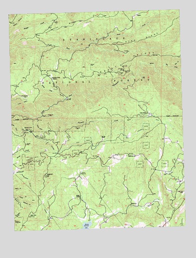
Columbia SE, CA USGS Topographic Map
Click on map above to begin viewing in our Map Viewer.

This topographic map contains these locations and features:
Feature Name Type Latitude Longitude GNIS ID View Map
American Camp StationLocaleN38.0871°W120.3455°256216View Map
Apple Valley EstatesPopulated PlaceN38.0110°W120.3288°1809388View Map
Bald MountainSummitN38.0083°W120.3630°256459View Map
BelleviewPopulated PlaceN38.0130°W120.2907°1655825View Map
Belleview AcresPopulated PlaceN38.0158°W120.2791°1809389View Map
Belleview Elementary SchoolSchoolN38.0416°W120.2910°219004View Map
Bellwood EstatesPopulated PlaceN38.0205°W120.3007°1809390View Map
Blewetts PointSummitN38.0585°W120.3660°1655836View Map
Canady GulchValleyN38.0185°W120.3735°257928View Map
Cedar RidgePopulated PlaceN38.0658°W120.2769°1655879View Map
Cedar Ridge Census Designated PlaceCensusN38.0661°W120.2737°2582970View Map
Cedar Rock LodgeLocaleN38.0199°W120.2516°258145View Map
Chaparral HeightsPopulated PlaceN38.0024°W120.2519°1809393View Map
Clarks GulchValleyN38.0638°W120.3571°258413View Map
Columbia DitchCanalN38.0469°W120.3357°221411View Map
Comstock RanchPopulated PlaceN38.0499°W120.2627°1809395View Map
Contention MineMineN38.1202°W120.3410°258655View Map
Contention RidgeRidgeN38.1169°W120.3371°266594View Map
Crystal FallsPopulated PlaceN38.0202°W120.2719°1809396View Map
Deer CreekStreamN38.0916°W120.2705°259216View Map
Dry CreekStreamN38.0919°W120.2569°259551View Map
Eagle CreekStreamN38.1055°W120.3307°259653View Map
Five Mile Regional CenterLocaleN38.0499°W120.3021°1652915View Map
Fivemile CreekStreamN38.0660°W120.3535°260184View Map
French CampLocaleN38.0777°W120.3683°260370View Map
French CreekStreamN38.0788°W120.3405°260375View Map
Gold Ridge MineMineN38.0916°W120.2932°260661View Map
Goldmont ForestPopulated PlaceN38.0233°W120.2524°1809397View Map
Grant MineMineN38.0891°W120.3099°260770View Map
Hardscrabble GulchValleyN38.0335°W120.3707°261092View Map
Hatler MillLocaleN38.0399°W120.3399°1652916View Map
Indian Girl MineMineN38.1058°W120.2971°261746View Map
Italian BarLocaleN38.0758°W120.3349°261836View Map
Italian RanchLocaleN38.0188°W120.3269°261839View Map
JupiterPopulated PlaceN38.1224°W120.2827°1656105View Map
Keltz MineMineN38.0860°W120.2796°262123View Map
Long GulchValleyN38.0696°W120.3744°262832View Map
Lucky Strike MineMineN38.0896°W120.2916°263065View Map
Meentzen GulchValleyN38.0160°W120.3716°263443View Map
Mono Vista Census Designated PlaceCensusN38.0123°W120.2698°2408856View Map
Mountain Lily MineMineN38.0655°W120.3485°263902View Map
Noonday MineMineN38.0944°W120.3174°264116View Map
Old Oak RanchLocaleN38.0524°W120.3105°264334View Map
Phoenix LakePopulated PlaceN38.0059°W120.3070°2413660View Map
Phoenix Lake Census Designated PlaceCensusN38.0074°W120.3090°2633170View Map
Phoenix Lake County Club EstatesPopulated PlaceN38.0113°W120.3035°1809407View Map
Phoenix Lake Golf CourseLocaleN38.0083°W120.3069°1809408View Map
Phoenix Lake-Cedar Ridge Census Designated Place (historical)CensusN38.0380°W120.3012°2409060View Map
Phoenix PowerhouseLocaleN38.0324°W120.3266°1654376View Map
Phoenix ReservoirReservoirN38.0005°W120.3223°230612View Map
Ridgeway MineMineN38.0580°W120.3619°265419View Map
Rifle MineMineN38.0538°W120.3535°231577View Map
Ripperton MineMineN38.0435°W120.2502°231628View Map
Scenic HeightsPopulated PlaceN38.0166°W120.2566°1809409View Map
Shanghai MineMineN38.0496°W120.3660°266040View Map
Silver GulchValleyN38.0755°W120.3363°266189View Map
Sonnet MineMineN38.0896°W120.2960°267393View Map
Sonora MeadowsPopulated PlaceN38.0110°W120.2866°1809411View Map
Star MineMineN38.1013°W120.2902°267683View Map
Telegraph HillSummitN38.0313°W120.3513°268121View Map
Tuolumne County Fire Department Station 57 Crystal FallsBuildingN38.0170°W120.2820°2624386View Map
Tuolumne County Fire Department Station 58 Cedar RidgeBuildingN38.0608°W120.2669°2624404View Map
Volunteer MineMineN38.0585°W120.3291°268720View Map
White Oak EstatesPopulated PlaceN38.0096°W120.2738°1809418View Map
Yankee HillRidgeN38.0421°W120.3602°269333View Map

Note: Coordinates in the location and feature list above are referenced to NAD83 datum.


Copyright (C) 2008-2025 Ryan Niemi / Sunset Dynamics ... All Rights Reserved