TopoQuest Logo
Do you find TopoQuest useful?
Help keep TopoQuest running and adding new maps/features by donating!
Bitcoin:  19c7KJd3qBynnjoSw5npx9KScwjBe4ifkT
Litecoin:  LXs6TkuXGGXo1vDsWCkWVdjQX94eUKd6ui
Home View Maps Find Maps Find Places Resources & Links


Twain Harte, California Topographic Map

USGS Map Title: Twain Harte, CA
USGS Map MRC: 38120A2
DRG (GeoTIFF) Download: o38120a2.tif


Neighboring USGS Topographic Map Quads:


  Stanislaus, CA  
38120B3
 

  Crandall Peak, CA  
38120B2
 

  Strawberry, CA  
38120B1
 

  Columbia SE, CA  
38120A3
 

  Twain Harte, CA  
38120A2
 

  Hull Creek, CA  
38120A1
 

  Standard, CA  
37120H3
 

  Tuolumne, CA  
37120H2
 

  Duckwall Mountain, CA  
37120H1


Map MRC Location:

N39°
W121°
N39°
W120°
H8 H7 H6 H5 H4 H3 H2 H1
G8 G7 G6 G5 G4 G3 G2 G1
F8 F7 F6 F5 F4 F3 F2 F1
E8 E7 E6 E5 E4 E3 E2 E1
D8 D7 D6 D5 D4 D3 D2 D1
C8 C7 C6 C5 C4 C3 C2 C1
B8 B7 B6 B5 B4 B3 B2 B1
A8 A7 A6 A5 A4 A3 A2 A1
N38°
W121°
N38°
W120°

Twain Harte, CA USGS 1:24K Topographic Map Preview:
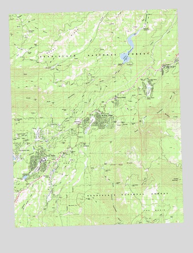
Twain Harte, CA USGS Topographic Map
Click on map above to begin viewing in our Map Viewer.

This topographic map contains these locations and features:
Feature Name Type Latitude Longitude GNIS ID View Map
All Saints Catholic ChurchChurchN38.0438°W120.2335°1809387View Map
Black Oak EstatesPopulated PlaceN38.0366°W120.2280°1809391View Map
Brentwood ParkPopulated PlaceN38.0449°W120.2469°1682538View Map
Brentwood Park 555 DamDamN38.0416°W120.2494°1663947View Map
CampLocaleN38.0021°W120.1371°220438View Map
Camp EarnestPopulated PlaceN38.0130°W120.2260°1658199View Map
Casa Madera MineMineN38.0227°W120.1657°220658View Map
Cedar Pines VistaPopulated PlaceN38.0338°W120.2266°1809392View Map
Cedar Rock LodgePopulated PlaceN38.0216°W120.2469°1658244View Map
Chapel in the PinesChurchN38.0438°W120.2305°1809394View Map
ConfidencePopulated PlaceN38.0474°W120.2013°1658309View Map
Confidence MineMineN38.0435°W120.2082°1682542View Map
Corona MineMineN38.0352°W120.1844°221576View Map
Department of Forestry and Fire Protection Twaine Harte Forest FireBuildingN38.0388°W120.2314°2624647View Map
Elizabeth PeakSummitN38.0633°W120.2480°223101View Map
Excelsior MineMineN38.0594°W120.1627°1682543View Map
Fair Oaks MineMineN38.0141°W120.1930°223317View Map
Gem MineMineN38.0602°W120.1546°1682545View Map
Geraldine MineMineN38.0402°W120.2138°224125View Map
Grant RidgeRidgeN38.1010°W120.2277°224425View Map
Green MineMineN38.0596°W120.1677°1682546View Map
Grub GulchValleyN38.1194°W120.2385°224686View Map
Hess MillPopulated PlaceN38.1024°W120.2377°1658744View Map
High Sierra ParkPopulated PlaceN38.0819°W120.1474°276164View Map
Johnnie GulchValleyN38.0335°W120.1841°226284View Map
KKBN-FM (Twain Harte)TowerN38.0635°W120.2474°1663122View Map
Lakewood HighlandsPopulated PlaceN38.0546°W120.2188°1809398View Map
Lakewood ParkPopulated PlaceN38.0516°W120.2135°1809399View Map
Lakewood Park LakeReservoirN38.0494°W120.2254°1809400View Map
Lilac TerracePopulated PlaceN38.0299°W120.2346°1809401View Map
Long BarnPopulated PlaceN38.0930°W120.1344°227537View Map
Long Barn Census Designated PlaceCensusN38.0957°W120.1285°2583061View Map
Long Barn FD Fire StationLocaleN38.0921°W120.1319°1652948View Map
Long Barn High SchoolSchoolN38.0916°W120.1382°1809402View Map
Long Barn Post OfficePost OfficeN38.0918°W120.1362°2769446View Map
Lucky Strike MineMineN38.0296°W120.1830°227826View Map
Lynnwood EstatesPopulated PlaceN38.0449°W120.2321°1809403View Map
Lyons 97-073 DamDamN38.0940°W120.1676°1663643View Map
Lyons CreekStreamN38.0963°W120.1619°227868View Map
Lyons ReservoirReservoirN38.0973°W120.1652°227869View Map
Main Tuolumne DitchCanalN38.0735°W120.1938°227971View Map
Marble MountainSummitN38.0255°W120.1282°228072View Map
Mi Wok District Ranger OfficeLocaleN38.0652°W120.1835°276166View Map
Mi Wuk Village Post OfficePost OfficeN38.0650°W120.1819°2789142View Map
Mi-Wok Fire StationLocaleN38.0655°W120.1735°1652950View Map
Mi-Wuk VillagePopulated PlaceN38.0658°W120.1849°277556View Map
Mi-Wuk Village Census Designated PlaceCensusN38.0570°W120.1790°2408846View Map
Mi-Wuk Village Golf and Country ClubLocaleN38.0605°W120.1921°1809404View Map
Mount Calvary Lutheran ChurchChurchN38.0599°W120.1988°1809405View Map
Mount LewisSummitN38.0355°W120.1624°227050View Map
Mount ProvoSummitN38.0119°W120.2063°1659438View Map
Odd Fellows Fire DepartmentLocaleN38.0816°W120.1452°1652949View Map
Odd Fellows High Sierra ParkParkN38.0835°W120.1494°229931View Map
Odd Fellows Rebekah Youth CampLocaleN38.0794°W120.1560°1809406View Map
Poseidon MineMineN38.0241°W120.1755°1682548View Map
Red Cloud MineMineN38.0705°W120.2127°231320View Map
Robert Nichols SpringSpringN38.0745°W120.1501°1682549View Map
Ruby Hill SpringSpringN38.1143°W120.2364°232004View Map
Rushing MeadowFlatN38.1146°W120.1485°232032View Map
Ryan MineMineN38.0583°W120.1691°1682550View Map
Sherwood ForestPopulated PlaceN38.0291°W120.2244°1682552View Map
Sierra Pines Golf CourseLocaleN38.0538°W120.2316°1809410View Map
Sierra VillagePopulated PlaceN38.0719°W120.1730°1682553View Map
Sierra Village Census Designated PlaceCensusN38.0768°W120.1623°2583140View Map
Soulsbyville DitchCanalN38.0158°W120.2419°234910View Map
SSFD Fire StationLocaleN38.0571°W120.1985°1652946View Map
Star RidgeRidgeN38.1208°W120.2480°235393View Map
SugarpinePopulated PlaceN38.0583°W120.2016°1659910View Map
Sugarpine CreekStreamN38.0613°W120.1521°235679View Map
Summit RidgeRidgeN38.0258°W120.1532°235758View Map
Sylvan LodgePopulated PlaceN38.0841°W120.1571°1659939View Map
Tall Timber CampPopulated PlaceN38.0735°W120.1724°1652972View Map
The BasinBasinN38.0030°W120.1496°236143View Map
Thunderbolt MineMineN38.0505°W120.2424°236331View Map
Tramway CampLocaleN38.0783°W120.1888°1652947View Map
Tuolumne County Fire Department Station 54 Long Barn StationBuildingN38.0915°W120.1381°2623787View Map
Tuolumne County Fire Department Station 77 Mi - WukBuildingN38.0612°W120.1991°2623693View Map
Twain HartePopulated PlaceN38.0396°W120.2327°1660049View Map
Twain Harte Census Designated PlaceCensusN38.0384°W120.2339°2409370View Map
Twain Harte Community CenterBuildingN38.0388°W120.2271°1809412View Map
Twain Harte Community Services District Fire and Rescue DivisionBuildingN38.0388°W120.2288°2624623View Map
Twain Harte Elementary SchoolSchoolN38.0399°W120.2280°1809413View Map
Twain Harte Evangelical Free ChurchChurchN38.0408°W120.2352°1809414View Map
Twain Harte F D Fires StationLocaleN38.0435°W120.2266°1652945View Map
Twain Harte Golf CourseLocaleN38.0341°W120.2330°1809415View Map
Twain Harte Horseman TrailTrailN38.0733°W120.2035°276163View Map
Twain Harte Post OfficePost OfficeN38.0394°W120.2317°1809416View Map
Twain Harte ValleyPopulated PlaceN38.0535°W120.2294°1809417View Map
Twain Harte ValleyBasinN38.0541°W120.2327°1682555View Map
Twaine Harte 551 DamDamN38.0283°W120.2444°1663946View Map
Wrights CreekStreamN38.0655°W120.1377°238203View Map

Note: Coordinates in the location and feature list above are referenced to NAD83 datum.


Copyright (C) 2008-2024 Ryan Niemi / Sunset Dynamics ... All Rights Reserved