TopoQuest Logo
Do you find TopoQuest useful?
Help keep TopoQuest running and adding new maps/features by donating!
Bitcoin:  19c7KJd3qBynnjoSw5npx9KScwjBe4ifkT
Litecoin:  LXs6TkuXGGXo1vDsWCkWVdjQX94eUKd6ui
Home View Maps Find Maps Find Places Resources & Links


Stanislaus, California Topographic Map

USGS Map Title: Stanislaus, CA
USGS Map MRC: 38120B3
DRG (GeoTIFF) Download: o38120b3.tif


Neighboring USGS Topographic Map Quads:


  Fort Mountain, CA  
38120C4
 

  Dorrington, CA  
38120C3
 

  Boards Crossing, CA  
38120C2
 

  Murphys, CA  
38120B4
 

  Stanislaus, CA  
38120B3
 

  Crandall Peak, CA  
38120B2
 

  Columbia, CA  
38120A4
 

  Columbia SE, CA  
38120A3
 

  Twain Harte, CA  
38120A2


Map MRC Location:

N39°
W121°
N39°
W120°
H8 H7 H6 H5 H4 H3 H2 H1
G8 G7 G6 G5 G4 G3 G2 G1
F8 F7 F6 F5 F4 F3 F2 F1
E8 E7 E6 E5 E4 E3 E2 E1
D8 D7 D6 D5 D4 D3 D2 D1
C8 C7 C6 C5 C4 C3 C2 C1
B8 B7 B6 B5 B4 B3 B2 B1
A8 A7 A6 A5 A4 A3 A2 A1
N38°
W121°
N38°
W120°

Stanislaus, CA USGS 1:24K Topographic Map Preview:
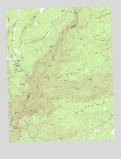
Stanislaus, CA USGS Topographic Map
Click on map above to begin viewing in our Map Viewer.

This topographic map contains these locations and features:
Feature Name Type Latitude Longitude GNIS ID View Map
Arnold California Division of Forestry Fire StationLocaleN38.2349°W120.3605°1652904View Map
Arnold Census Designated PlaceCensusN38.2423°W120.3546°2407763View Map
AveryPopulated PlaceN38.2044°W120.3699°218477View Map
Avery Post OfficePost OfficeN38.2042°W120.3693°1804862View Map
Avery RanchLocaleN38.1299°W120.3599°218478View Map
Beaver CreekStreamN38.2071°W120.3180°233480View Map
Big Trees CreekStreamN38.2413°W120.2730°219272View Map
Calaveras District Ranger OfficeLocaleN38.1883°W120.3674°274818View Map
Calaveras Ranger StationLocaleN38.1969°W120.3666°220378View Map
Camp Forty-NinerLocaleN38.2174°W120.3724°1804917View Map
Candy RockLocaleN38.1894°W120.3513°1652908View Map
Canyon ViewPopulated PlaceN38.1924°W120.3566°1804869View Map
Clark FlatFlatN38.1427°W120.3735°266336View Map
Cone HillSummitN38.1844°W120.3308°221442View Map
Crescent Cove CampgroundLocaleN38.1833°W120.3741°274819View Map
Crescent Cove Picnic AreaLocaleN38.1827°W120.3738°1652907View Map
Department of Forestry and Fire Protection Arnold Fire StationBuildingN38.1876°W120.3676°2624649View Map
Department of Forestry and Fire Protection Arnold StationBuildingN38.2351°W120.3649°2624579View Map
Doud HillSummitN38.2124°W120.3371°222553View Map
Douds LandingPopulated PlaceN38.2127°W120.3255°1658431View Map
Ebbetts Pass Fire Protection District Station 3BuildingN38.1928°W120.3635°2624479View Map
Ebbetts Pass Fire Protection District Station 4BuildingN38.2362°W120.3432°2624488View Map
Ebbetts Pass HighlandsPopulated PlaceN38.2085°W120.3696°1804926View Map
Fly in Acres 503 DamDamN38.2452°W120.3360°1663918View Map
Fly in Acres ReservoirReservoirN38.2459°W120.3349°1652902View Map
Fly-In AcresPopulated PlaceN38.2319°W120.3371°1804959View Map
Forebay LookoutLocaleN38.1469°W120.3624°223669View Map
Griswold CreekStreamN38.1780°W120.3374°224624View Map
Hathaway PinesPopulated PlaceN38.1919°W120.3655°1658721View Map
Hathaway Pines Post OfficePost OfficeN38.1924°W120.3653°2789167View Map
Hathaways Mountain PinesPopulated PlaceN38.1946°W120.3683°1804878View Map
Hungry FlatFlatN38.1816°W120.3041°225770View Map
Hunter ReservoirReservoirN38.2000°W120.3595°225788View Map
Hunter Reservoir HeliportAirportN38.1913°W120.3538°1653242View Map
Hunters 99-002 DamDamN38.1985°W120.3599°1663688View Map
Lakemont PinesPopulated PlaceN38.2352°W120.3713°1804929View Map
Leach FieldParkN38.2052°W120.3658°1804930View Map
Long CanyonValleyN38.2063°W120.2769°227549View Map
Love CreekStreamN38.2166°W120.3588°234202View Map
McCormick CreekStreamN38.1827°W120.3269°228322View Map
McCormick LookoutLocaleN38.1819°W120.2805°228323View Map
McCormick MeadowsFlatN38.1913°W120.2910°228324View Map
McKayPopulated PlaceN38.2469°W120.3083°1659088View Map
McKays PointCliffN38.2444°W120.2955°228385View Map
MeadowmontPopulated PlaceN38.2463°W120.3691°1804933View Map
Middle Fork Stanislaus RiverStreamN38.1541°W120.3574°234292View Map
Mill CreekStreamN38.1816°W120.3391°228665View Map
Moran CreekStreamN38.2166°W120.3585°234327View Map
North Fork Stanislaus RiverStreamN38.1541°W120.3574°234375View Map
PinebrookPopulated PlaceN38.2419°W120.3308°1804941View Map
Pinebrook ReservoirReservoirN38.2361°W120.3424°1652903View Map
Ponderosa ParkPopulated PlaceN38.1860°W120.3688°1804892View Map
Rattlesnake HillSummitN38.1780°W120.3599°231266View Map
Saint Claires Episcopal ChurchChurchN38.2074°W120.3683°1804944View Map
Soap CreekStreamN38.2069°W120.2649°234801View Map
StanislausPopulated PlaceN38.1383°W120.3702°1659858View Map
Stanislaus Forebay 97-083 DamDamN38.1466°W120.3544°1663648View Map
Stanislaus Grove Big TreesWoodsN38.2427°W120.2549°233370View Map
Stanislaus TunnelTunnelN38.1713°W120.2571°235372View Map
Sugar Pine GapGapN38.2480°W120.2502°235637View Map
Sunset PointPopulated PlaceN38.1888°W120.3633°1804897View Map
Utica DitchCanalN38.1755°W120.3602°236941View Map
Wisehart PitMineN38.1477°W120.2641°274816View Map

Note: Coordinates in the location and feature list above are referenced to NAD83 datum.


Copyright (C) 2008-2025 Ryan Niemi / Sunset Dynamics ... All Rights Reserved