TopoQuest Logo
Do you find TopoQuest useful?
Help keep TopoQuest running and adding new maps/features by donating!
Bitcoin:  19c7KJd3qBynnjoSw5npx9KScwjBe4ifkT
Litecoin:  LXs6TkuXGGXo1vDsWCkWVdjQX94eUKd6ui
Home View Maps Find Maps Find Places Resources & Links


Commerce North, Texas Topographic Map

USGS Map Title: Commerce North, TX
USGS Map MRC: 33095C8
DRG (GeoTIFF) Download: o33095c8.tif


Neighboring USGS Topographic Map Quads:


  Gober, TX  
33096D1
 

  Ladonia, TX  
33095D8
 

  Pecan Gap, TX  
33095D7
 

  Wolfe City, TX  
33096C1
 

  Commerce North, TX  
33095C8
 

  Klondike, TX  
33095C7
 

  Greenville NE, TX  
33096B1
 

  Commerce South, TX  
33095B8
 

  Cumby, TX  
33095B7


Map MRC Location:

N34°
W96°
N34°
W95°
H8 H7 H6 H5 H4 H3 H2 H1
G8 G7 G6 G5 G4 G3 G2 G1
F8 F7 F6 F5 F4 F3 F2 F1
E8 E7 E6 E5 E4 E3 E2 E1
D8 D7 D6 D5 D4 D3 D2 D1
C8 C7 C6 C5 C4 C3 C2 C1
B8 B7 B6 B5 B4 B3 B2 B1
A8 A7 A6 A5 A4 A3 A2 A1
N33°
W96°
N33°
W95°

Commerce North, TX USGS 1:24K Topographic Map Preview:
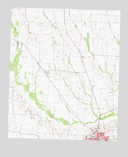
Commerce North, TX USGS Topographic Map
Click on map above to begin viewing in our Map Viewer.

This topographic map contains these locations and features:
Feature Name Type Latitude Longitude GNIS ID View Map
Bethel Church of God in ChristChurchN33.2526°W95.8927°2020825View Map
Commerce DivisionCivilN33.3009°W95.9343°1938642View Map
Commerce Municipal AirportAirportN33.2929°W95.8964°1386410View Map
DurhamPopulated PlaceN33.3507°W95.9789°1379690View Map
East Fork Pecan CreekStreamN33.3426°W95.9122°1381815View Map
England Grove ChurchChurchN33.3018°W95.9041°1357025View Map
FairliePopulated PlaceN33.3134°W95.9583°1357168View Map
Hope CemeteryCemeteryN33.3607°W95.9511°1359535View Map
Hunt County Emergency Medical Services Station 3BuildingN33.2585°W95.8981°2720945View Map
JardinPopulated PlaceN33.3296°W95.9183°1379997View Map
Long BranchStreamN33.2890°W95.9691°1361700View Map
Lyndon Baines Johnson ParkParkN33.2529°W95.8794°2029850View Map
Norris ParkParkN33.2504°W95.8930°1363976View Map
Norris SchoolSchoolN33.2504°W95.8869°1363978View Map
Presbyterian ChurchChurchN33.2509°W95.9030°2020842View Map
Ridgecrest Baptist ChurchChurchN33.2576°W95.8961°2020815View Map
Sonora CemeteryCemeteryN33.3087°W95.9369°1368607View Map
Willow Oak CreekStreamN33.2709°W95.8955°1382978View Map

Note: Coordinates in the location and feature list above are referenced to NAD83 datum.


Copyright (C) 2008-2024 Ryan Niemi / Sunset Dynamics ... All Rights Reserved