TopoQuest Logo
Do you find TopoQuest useful?
Help keep TopoQuest running and adding new maps/features by donating!
Bitcoin:  19c7KJd3qBynnjoSw5npx9KScwjBe4ifkT
Litecoin:  LXs6TkuXGGXo1vDsWCkWVdjQX94eUKd6ui
Home View Maps Find Maps Find Places Resources & Links


Commissary Ridge, Idaho Topographic Map

USGS Map Title: Commissary Ridge, ID
USGS Map MRC: 43111C4
DRG (GeoTIFF) Download: o43111c4.tif


Neighboring USGS Topographic Map Quads:


  Point Lookout, ID  
43111D5
 

  Conant Valley, ID  
43111D4
 

  Swan Valley, ID  
43111D3
 

  Castle Rock, ID  
43111C5
 

  Commissary Ridge, ID  
43111C4
 

  Red Ridge, ID  
43111C3
 

  Homer Valley, ID  
43111B5
 

  Herman, ID  
43111B4
 

  Big Elk Mountain, ID  
43111B3


Map MRC Location:

N44°
W112°
N44°
W111°
H8 H7 H6 H5 H4 H3 H2 H1
G8 G7 G6 G5 G4 G3 G2 G1
F8 F7 F6 F5 F4 F3 F2 F1
E8 E7 E6 E5 E4 E3 E2 E1
D8 D7 D6 D5 D4 D3 D2 D1
C8 C7 C6 C5 C4 C3 C2 C1
B8 B7 B6 B5 B4 B3 B2 B1
A8 A7 A6 A5 A4 A3 A2 A1
N43°
W112°
N43°
W111°

Commissary Ridge, ID USGS 1:24K Topographic Map Preview:
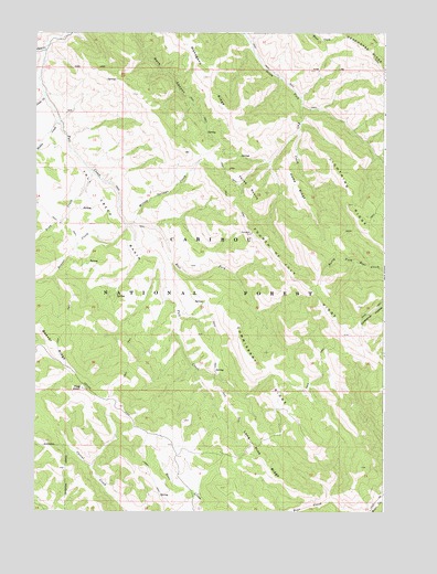
Commissary Ridge, ID USGS Topographic Map
Click on map above to begin viewing in our Map Viewer.

This topographic map contains these locations and features:
Feature Name Type Latitude Longitude GNIS ID View Map
Beaver CreekStreamN43.3244°W111.4675°397421View Map
Beaver RidgeRidgeN43.2924°W111.4933°377286View Map
Camp CreekStreamN43.3585°W111.4975°378778View Map
Commissary RidgeRidgeN43.2871°W111.4211°379602View Map
East Fork Fall CreekStreamN43.3246°W111.4669°381095View Map
Fall Creek BasinBasinN43.3421°W111.4791°381560View Map
Flag KnollSummitN43.2821°W111.4830°381813View Map
Fourth of July RidgeRidgeN43.3105°W111.4083°381984View Map
Gibson CreekStreamN43.3705°W111.4969°382265View Map
Haskin CreekStreamN43.3519°W111.4930°382952View Map
Home RidgeRidgeN43.3327°W111.4052°383270View Map
Lightning RidgeRidgeN43.3302°W111.3886°384647View Map
Lone Pine RidgeRidgeN43.2621°W111.4172°386011View Map
Mahogany RidgeRidgeN43.3494°W111.4666°399119View Map
Mahogany RidgeRidgeN43.3633°W111.4402°400286View Map
Swan Valley DivisionCivilN43.3365°W111.4037°1936814View Map
Three KnollsSummitN43.3344°W111.4238°397254View Map
Trap CreekStreamN43.3385°W111.4800°392332View Map
Willow Springs CreekStreamN43.3258°W111.4650°393534View Map

Note: Coordinates in the location and feature list above are referenced to NAD83 datum.


Copyright (C) 2008-2025 Ryan Niemi / Sunset Dynamics ... All Rights Reserved