TopoQuest Logo
Do you find TopoQuest useful?
Help keep TopoQuest running and adding new maps/features by donating!
Bitcoin:  19c7KJd3qBynnjoSw5npx9KScwjBe4ifkT
Litecoin:  LXs6TkuXGGXo1vDsWCkWVdjQX94eUKd6ui
Home View Maps Find Maps Find Places Resources & Links


Coochie Brake, Louisiana Topographic Map

USGS Map Title: Coochie Brake, LA
USGS Map MRC: 31092G7
DRG (GeoTIFF) Download: o31092g7.tif


Neighboring USGS Topographic Map Quads:


  Coup Point, LA  
31092H8
 

  Calvin, LA  
31092H7
 

  Winnfield West, LA  
31092H6
 

  Saint Maurice, LA  
31092G8
 

  Coochie Brake, LA  
31092G7
 

  Atlanta, LA  
31092G6
 

  Montgomery, LA  
31092F8
 

  Verda, LA  
31092F7
 

  Savage Creek, LA  
31092F6


Map MRC Location:

N32°
W93°
N32°
W92°
H8 H7 H6 H5 H4 H3 H2 H1
G8 G7 G6 G5 G4 G3 G2 G1
F8 F7 F6 F5 F4 F3 F2 F1
E8 E7 E6 E5 E4 E3 E2 E1
D8 D7 D6 D5 D4 D3 D2 D1
C8 C7 C6 C5 C4 C3 C2 C1
B8 B7 B6 B5 B4 B3 B2 B1
A8 A7 A6 A5 A4 A3 A2 A1
N31°
W93°
N31°
W92°

Coochie Brake, LA USGS 1:24K Topographic Map Preview:
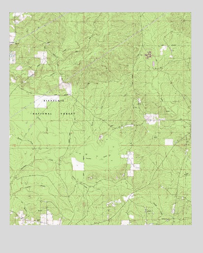
Coochie Brake, LA USGS Topographic Map
Click on map above to begin viewing in our Map Viewer.

This topographic map contains these locations and features:
Feature Name Type Latitude Longitude GNIS ID View Map
Bethlehem ChurchChurchN31.7532°W92.7674°548267View Map
Bethlehem ChurchChurchN31.7535°W92.7668°541800View Map
Coochie BrakeSwampN31.7917°W92.8127°547243View Map
CouleyPopulated PlaceN31.8574°W92.8724°549128View Map
Couley ChurchChurchN31.8563°W92.8718°547251View Map
Couley School (historical)SchoolN31.8627°W92.8640°551103View Map
Cypress BranchStreamN31.7693°W92.8735°547277View Map
Double ChurchChurchN31.8563°W92.8490°547305View Map
Emden SchoolSchoolN31.7529°W92.7679°547344View Map
Frame CreekStreamN31.7929°W92.8571°541798View Map
Gravel CreekStreamN31.8729°W92.8265°547414View Map
Joe Mitchell BranchStreamN31.7696°W92.8710°556519View Map
Kensie CreekStreamN31.7977°W92.8093°547541View Map
Kimbrell CemeteryCemeteryN31.7535°W92.8571°547547View Map
Mayhaw CreekStreamN31.7882°W92.8582°548180View Map
Parish Governing Authority District 1CivilN31.7811°W92.8389°1929771View Map
Parish Governing Authority District 8 (historical)CivilN31.7727°W92.8038°1930257View Map
Robins CreekStreamN31.7891°W92.8390°541799View Map
Winn Correctional CenterBuildingN31.8502°W92.7812°551109View Map
Winn Correctional Center Special Services District FacilitySchoolN31.8502°W92.7812°2462816View Map

Note: Coordinates in the location and feature list above are referenced to NAD83 datum.


Copyright (C) 2008-2025 Ryan Niemi / Sunset Dynamics ... All Rights Reserved