TopoQuest Logo
Do you find TopoQuest useful?
Help keep TopoQuest running and adding new maps/features by donating!
Bitcoin:  19c7KJd3qBynnjoSw5npx9KScwjBe4ifkT
Litecoin:  LXs6TkuXGGXo1vDsWCkWVdjQX94eUKd6ui
Home View Maps Find Maps Find Places Resources & Links


Hookerton, North Carolina Topographic Map

USGS Map Title: Hookerton, NC
USGS Map MRC: 35077D5
DRG (GeoTIFF) Download: o35077d5.tif


Neighboring USGS Topographic Map Quads:


  Walstonburg, NC  
35077E6
 

  Farmville, NC  
35077E5
 

  Greenville SW, NC  
35077E4
 

  Snow Hill, NC  
35077D6
 

  Hookerton, NC  
35077D5
 

  Ayden, NC  
35077D4
 

  Falling Creek, NC  
35077C6
 

  Kinston, NC  
35077C5
 

  Grifton, NC  
35077C4


Map MRC Location:

N36°
W78°
N36°
W77°
H8 H7 H6 H5 H4 H3 H2 H1
G8 G7 G6 G5 G4 G3 G2 G1
F8 F7 F6 F5 F4 F3 F2 F1
E8 E7 E6 E5 E4 E3 E2 E1
D8 D7 D6 D5 D4 D3 D2 D1
C8 C7 C6 C5 C4 C3 C2 C1
B8 B7 B6 B5 B4 B3 B2 B1
A8 A7 A6 A5 A4 A3 A2 A1
N35°
W78°
N35°
W77°

Hookerton, NC USGS 1:24K Topographic Map Preview:
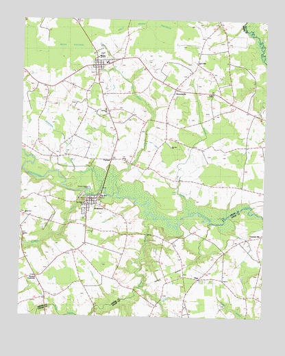
Hookerton, NC USGS Topographic Map
Click on map above to begin viewing in our Map Viewer.

This topographic map contains these locations and features:
Feature Name Type Latitude Longitude GNIS ID View Map
Antioch ChurchChurchN35.4407°W77.5711°1004599View Map
Beaverdam RunStreamN35.4285°W77.5833°1023817View Map
Calvert SchoolSchoolN35.4318°W77.5119°982468View Map
Chase FieldAirportN35.4269°W77.5971°2717295View Map
Darewood Estates - Mobile Home ParkPopulated PlaceN35.4859°W77.5857°2505452View Map
East Green SchoolSchoolN35.4621°W77.5819°1004600View Map
Eastern Correctional InstitutionBuildingN35.4802°W77.5973°2769846View Map
Fountain HillPopulated PlaceN35.4099°W77.5008°985333View Map
FourwayPopulated PlaceN35.4410°W77.5786°1008116View Map
Glenfield CrossroadsPopulated PlaceN35.3932°W77.6161°1006217View Map
Greene Correctional InstitutionBuildingN35.4782°W77.5991°2769847View Map
Half Moon PocosinSwampN35.4979°W77.5602°1024513View Map
HookertonPopulated PlaceN35.4252°W77.5883°1020820View Map
Hookerton Post OfficePost OfficeN35.4240°W77.5884°2774066View Map
Hookerton Volunteer Fire Department and Emergency Medical ServicesBuildingN35.4242°W77.5864°2638689View Map
HugoPopulated PlaceN35.3916°W77.5327°1020862View Map
Hugo ChurchChurchN35.3907°W77.5200°1024616View Map
Hugo Volunteer Fire Department and RescueBuildingN35.3905°W77.5330°2639342View Map
MauryPopulated PlaceN35.4821°W77.5861°989483View Map
Maury Census Designated PlaceCensusN35.4792°W77.5902°2628644View Map
Maury Correctional InstitutionBuildingN35.4484°W77.6075°2505312View Map
Maury Post OfficePost OfficeN35.4811°W77.5858°2774015View Map
Maury Volunteer Fire and RescueBuildingN35.4815°W77.5815°2639792View Map
Mount Calvary ChurchChurchN35.4257°W77.5836°1004597View Map
Mussel RunStreamN35.4268°W77.5747°1024181View Map
New Zion ChurchChurchN35.4466°W77.5477°1004598View Map
OrmondsvillePopulated PlaceN35.4721°W77.5458°991690View Map
Patsy Bran Mobile Home ParkPopulated PlaceN35.4084°W77.5029°2505541View Map
Polecat BranchStreamN35.4893°W77.5455°1024229View Map
Rainbow CemeteryCemeteryN35.4102°W77.6244°1003838View Map
Rainbow CreekStreamN35.4282°W77.5908°1024241View Map
Rainbow Methodist ChurchChurchN35.4093°W77.6233°1024512View Map
Rices PocosinSwampN35.4893°W77.6064°993286View Map
Rouses ChapelChurchN35.4691°W77.5269°1024615View Map
Saints Delight ChurchChurchN35.4821°W77.5355°1004613View Map
Scuffleton Rural Fire AssociationBuildingN35.4586°W77.5064°2638248View Map
Shady Grove ChurchChurchN35.4179°W77.6227°1004595View Map
Star of ZionChurchN35.4227°W77.5927°1004596View Map
Town of HookertonCivilN35.4230°W77.5894°2405860View Map
Township of HookertonCivilN35.4007°W77.6240°1026723View Map
Township of OrmondsCivilN35.4646°W77.5386°1026726View Map
Union ChapelChurchN35.4521°W77.6164°996430View Map
Water Branch SchoolSchoolN35.4477°W77.5141°996840View Map
Wheat SwampStreamN35.4191°W77.5586°1027479View Map

Note: Coordinates in the location and feature list above are referenced to NAD83 datum.


Copyright (C) 2008-2024 Ryan Niemi / Sunset Dynamics ... All Rights Reserved