TopoQuest Logo
Do you find TopoQuest useful?
Help keep TopoQuest running and adding new maps/features by donating!
Bitcoin:  19c7KJd3qBynnjoSw5npx9KScwjBe4ifkT
Litecoin:  LXs6TkuXGGXo1vDsWCkWVdjQX94eUKd6ui
Home View Maps Find Maps Find Places Resources & Links


Lawrenceville, Kentucky Topographic Map

USGS Map Title: Lawrenceville, KY
USGS Map MRC: 38084E6
DRG (GeoTIFF) Download: o38084e6.tif


Neighboring USGS Topographic Map Quads:


  Glencoe, KY  
38084F7
 

  Elliston, KY  
38084F6
 

  Williamstown, KY  
38084F5
 

  Owenton, KY  
38084E7
 

  Lawrenceville, KY  
38084E6
 

  Mason, KY  
38084E5
 

  Monterey, KY  
38084D7
 

  New Columbus, KY  
38084D6
 

  Sadieville, KY  
38084D5


Map MRC Location:

N39°
W85°
N39°
W84°
H8 H7 H6 H5 H4 H3 H2 H1
G8 G7 G6 G5 G4 G3 G2 G1
F8 F7 F6 F5 F4 F3 F2 F1
E8 E7 E6 E5 E4 E3 E2 E1
D8 D7 D6 D5 D4 D3 D2 D1
C8 C7 C6 C5 C4 C3 C2 C1
B8 B7 B6 B5 B4 B3 B2 B1
A8 A7 A6 A5 A4 A3 A2 A1
N38°
W85°
N38°
W84°

Lawrenceville, KY USGS 1:24K Topographic Map Preview:
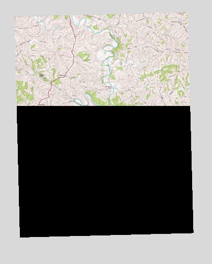
Lawrenceville, KY USGS Topographic Map
Click on map above to begin viewing in our Map Viewer.

This topographic map contains these locations and features:
Feature Name Type Latitude Longitude GNIS ID View Map
Bethany ChurchChurchN38.5890°W84.7099°486940View Map
Buck Elk CreekStreamN38.5373°W84.7374°488220View Map
CanbyPopulated PlaceN38.5173°W84.6611°507643View Map
Canby Post Office (historical)Post OfficeN38.5174°W84.6609°2567481View Map
Chipman RidgeRidgeN38.6023°W84.6297°489482View Map
Coxs BranchStreamN38.5015°W84.6927°490233View Map
Cub BranchStreamN38.5392°W84.7136°490440View Map
Dark Hollow BranchStreamN38.5726°W84.6780°490595View Map
Elk CreekStreamN38.5440°W84.7244°491658View Map
Elk RiffleRapidsN38.5462°W84.7236°491675View Map
Gaugh CemeteryCemeteryN38.6206°W84.6299°492753View Map
Grassy RunStreamN38.6000°W84.6840°493170View Map
Gross CemeteryCemeteryN38.5662°W84.7297°1900895View Map
Hammond CreekStreamN38.5073°W84.6908°493641View Map
Hensley FordPopulated PlaceN38.5765°W84.7077°508224View Map
HolbrookPopulated PlaceN38.5906°W84.7141°508262View Map
Holiday FordPopulated PlaceN38.5640°W84.7261°508263View Map
Horse Shoe BendBendN38.5504°W84.7284°2567387View Map
KeeferPopulated PlaceN38.5351°W84.6338°508372View Map
LawrencevillePopulated PlaceN38.5681°W84.6499°496082View Map
Lingenfelter CemeteryCemeteryN38.5384°W84.6838°496587View Map
Long BranchStreamN38.5778°W84.6397°497082View Map
Lusby Mill (historical)LocaleN38.5301°W84.7194°2567400View Map
Lusby Post Office (historical)Post OfficeN38.5306°W84.7144°2567401View Map
Lusbys Mill SchoolSchoolN38.5256°W84.7186°497350View Map
Margaret Post Office (historical)Post OfficeN38.5253°W84.6822°2567404View Map
Mason CemeteryCemeteryN38.5173°W84.6424°497656View Map
Morgan CreekStreamN38.5092°W84.6366°498591View Map
Mount Hebron Baptist ChurchChurchN38.5670°W84.7305°498745View Map
Mount Hebron CemeteryCemeteryN38.5667°W84.7305°1900949View Map
Musselman CreekStreamN38.5687°W84.6766°499138View Map
Musselshoals ChurchChurchN38.5217°W84.7013°499139View Map
NeedmorePopulated PlaceN38.5745°W84.7341°508684View Map
Nix CemeteryCemeteryN38.6028°W84.6455°499490View Map
Ram BranchStreamN38.5331°W84.7488°501544View Map
Richland CreekStreamN38.5070°W84.6961°501823View Map
Salem United Methodist ChurchChurchN38.6195°W84.6330°502798View Map
Sand Lick BranchStreamN38.6109°W84.7372°502928View Map
Singer RunStreamN38.5267°W84.7316°503552View Map
Starnes BridgeBridgeN38.5831°W84.6797°517290View Map
Three Forks CreekStreamN38.5681°W84.6774°505232View Map
Waldrop School (historical)SchoolN38.5869°W84.7250°2567461View Map
White ChapelChurchN38.5990°W84.7008°506574View Map
Work CemeteryCemeteryN38.5012°W84.6474°507146View Map

Note: Coordinates in the location and feature list above are referenced to NAD83 datum.


Copyright (C) 2008-2024 Ryan Niemi / Sunset Dynamics ... All Rights Reserved