TopoQuest Logo
Do you find TopoQuest useful?
Help keep TopoQuest running and adding new maps/features by donating!
Bitcoin:  19c7KJd3qBynnjoSw5npx9KScwjBe4ifkT
Litecoin:  LXs6TkuXGGXo1vDsWCkWVdjQX94eUKd6ui
Home View Maps Find Maps Find Places Resources & Links


Elliston, Kentucky Topographic Map

USGS Map Title: Elliston, KY
USGS Map MRC: 38084F6
DRG (GeoTIFF) Download: o38084f6.tif


Neighboring USGS Topographic Map Quads:


  Patriot, IN  
38084G7
 

  Verona, KY  
38084G6
 

  Walton, KY  
38084G5
 

  Glencoe, KY  
38084F7
 

  Elliston, KY  
38084F6
 

  Williamstown, KY  
38084F5
 

  Owenton, KY  
38084E7
 

  Lawrenceville, KY  
38084E6
 

  Mason, KY  
38084E5


Map MRC Location:

N39°
W85°
N39°
W84°
H8 H7 H6 H5 H4 H3 H2 H1
G8 G7 G6 G5 G4 G3 G2 G1
F8 F7 F6 F5 F4 F3 F2 F1
E8 E7 E6 E5 E4 E3 E2 E1
D8 D7 D6 D5 D4 D3 D2 D1
C8 C7 C6 C5 C4 C3 C2 C1
B8 B7 B6 B5 B4 B3 B2 B1
A8 A7 A6 A5 A4 A3 A2 A1
N38°
W85°
N38°
W84°

Elliston, KY USGS 1:24K Topographic Map Preview:
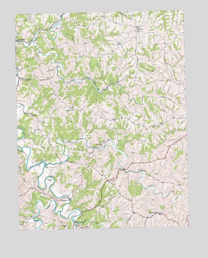
Elliston, KY USGS Topographic Map
Click on map above to begin viewing in our Map Viewer.

This topographic map contains these locations and features:
Feature Name Type Latitude Longitude GNIS ID View Map
Arnolds CreekStreamN38.7337°W84.7361°486059View Map
Childers School (historical)SchoolN38.6605°W84.6984°2554091View Map
Clarks CreekStreamN38.6626°W84.7283°489550View Map
Clarks Creek ChurchChurchN38.6731°W84.6877°489551View Map
Clay LickStreamN38.6575°W84.6592°489579View Map
Delf CemeteryCemeteryN38.7167°W84.7247°490795View Map
DeliaPopulated PlaceN38.6590°W84.6719°507839View Map
DowningsvillePopulated PlaceN38.6417°W84.7133°507872View Map
Dry Ridge Fire Department Station 2BuildingN38.7368°W84.6595°2637344View Map
Eagle Mill FordLocaleN38.6617°W84.7299°491409View Map
EllistonPopulated PlaceN38.7345°W84.7466°491724View Map
FolsomPopulated PlaceN38.7120°W84.7474°492293View Map
Four CornersPopulated PlaceN38.6526°W84.6844°508028View Map
Horseshoe BendBendN38.6542°W84.7263°494606View Map
Jacks LickStreamN38.6734°W84.6791°495096View Map
JerichoPopulated PlaceN38.7309°W84.6736°508338View Map
Little Ten Mile CreekStreamN38.7381°W84.7191°496878View Map
Mount Pisgah ChurchChurchN38.6270°W84.7149°498820View Map
Mount ZionPopulated PlaceN38.7409°W84.6597°498912View Map
Napoleon BranchStreamN38.7342°W84.7499°499170View Map
New Vine Run CemeteryCemeteryN38.6942°W84.7088°499408View Map
Pettit CemeteryCemeteryN38.6837°W84.7361°500486View Map
Rattlesnake CreekStreamN38.6306°W84.7102°501593View Map
Redman CemeteryCemeteryN38.6834°W84.6486°501682View Map
Sipple CemeteryCemeteryN38.7126°W84.7255°503577View Map
Stevens CreekStreamN38.6353°W84.7197°504362View Map
StewartsvillePopulated PlaceN38.6331°W84.6483°504388View Map
Straight Fork CreekStreamN38.6326°W84.7394°504562View Map
Sycamore CreekStreamN38.6662°W84.7430°504879View Map
Twin BridgesLocaleN38.6290°W84.7086°505705View Map
Vine Run Baptist ChurchChurchN38.7126°W84.7419°506056View Map
Webster CemeteryCemeteryN38.7309°W84.6741°506347View Map
Wesley ChurchChurchN38.6826°W84.7336°506401View Map
Williams BranchStreamN38.6420°W84.6302°506794View Map
Williamstown-Dry Ridge DivisionCivilN38.6492°W84.6335°1937321View Map

Note: Coordinates in the location and feature list above are referenced to NAD83 datum.


Copyright (C) 2008-2024 Ryan Niemi / Sunset Dynamics ... All Rights Reserved