TopoQuest Logo
Do you find TopoQuest useful?
Help keep TopoQuest running and adding new maps/features by donating!
Bitcoin:  19c7KJd3qBynnjoSw5npx9KScwjBe4ifkT
Litecoin:  LXs6TkuXGGXo1vDsWCkWVdjQX94eUKd6ui
Home View Maps Find Maps Find Places Resources & Links


Copeland, Alabama Topographic Map

USGS Map Title: Copeland, AL
USGS Map MRC: 31088E4
DRG (GeoTIFF) Download: o31088e4.tif


Neighboring USGS Topographic Map Quads:


  Denham, MS  
31088F5
 

  Aquilla, AL  
31088F4
 

  Millry North, AL  
31088F3
 

  Buckatunna, MS  
31088E5
 

  Copeland, AL  
31088E4
 

  Millry South, AL  
31088E3
 

  Knobtown, MS  
31088D5
 

  State Line, MS  
31088D4
 

  Chatom, AL  
31088D3


Map MRC Location:

N32°
W89°
N32°
W88°
H8 H7 H6 H5 H4 H3 H2 H1
G8 G7 G6 G5 G4 G3 G2 G1
F8 F7 F6 F5 F4 F3 F2 F1
E8 E7 E6 E5 E4 E3 E2 E1
D8 D7 D6 D5 D4 D3 D2 D1
C8 C7 C6 C5 C4 C3 C2 C1
B8 B7 B6 B5 B4 B3 B2 B1
A8 A7 A6 A5 A4 A3 A2 A1
N31°
W89°
N31°
W88°

Copeland, AL USGS 1:24K Topographic Map Preview:
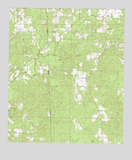
Copeland, AL USGS Topographic Map
Click on map above to begin viewing in our Map Viewer.

This topographic map contains these locations and features:
Feature Name Type Latitude Longitude GNIS ID View Map
Antioch Baptist ChurchChurchN31.5810°W88.4506°113125View Map
Antioch CemeteryCemeteryN31.5815°W88.4503°157543View Map
Bee BranchStreamN31.5604°W88.4750°666746View Map
BelmontPopulated PlaceN31.5688°W88.4839°691695View Map
Carter CemeteryCemeteryN31.5643°W88.4120°115660View Map
Chase School (historical)SchoolN31.5321°W88.4945°684067View Map
Chason CemeteryCemeteryN31.5313°W88.4947°668351View Map
CopelandPopulated PlaceN31.5602°W88.4192°116603View Map
Copeland Assembly of God ChurchChurchN31.5604°W88.4239°138881View Map
Copeland CemeteryCemeteryN31.5599°W88.4289°157555View Map
Copeland Church of GodChurchN31.5602°W88.4297°138882View Map
Copeland Gas FieldOilfieldN31.5210°W88.4222°151212View Map
Copeland Methodist Church (historical)ChurchN31.5646°W88.4128°157556View Map
Copeland Volunteer Fire DepartmentBuildingN31.5623°W88.4245°2691542View Map
Flat Branch Assembly of God ChurchChurchN31.6032°W88.4503°118370View Map
Flat Branch CemeteryCemeteryN31.6035°W88.4503°157565View Map
Independent Community ChurchChurchN31.5943°W88.3914°151850View Map
Lewis ChapelChurchN31.6043°W88.4886°672424View Map
Lewis Chapel CemeteryCemeteryN31.6046°W88.4886°706432View Map
Little Red CreekStreamN31.5824°W88.4675°121853View Map
MehaffeyPopulated PlaceN31.6177°W88.3986°152296View Map
Minerva CemeteryCemeteryN31.6160°W88.3981°157586View Map
Minerva Memorial Methodist ChurchChurchN31.6166°W88.3981°138780View Map
New Haven Baptist ChurchChurchN31.5199°W88.3981°123757View Map
New Haven CemeteryCemeteryN31.5196°W88.3981°157592View Map
Omega (historical)LocaleN31.6113°W88.4300°138791View Map
Pine Tree CemeteryCemeteryN31.5874°W88.3945°157599View Map
Pine Tree ChurchChurchN31.5877°W88.3947°124845View Map
Progress ChurchChurchN31.6177°W88.4881°676346View Map
Red CreekStreamN31.5824°W88.4681°125475View Map
Red Creek ChurchChurchN31.5841°W88.4809°676527View Map
Red Creek Gas FieldOilfieldN31.5835°W88.4297°151215View Map
Savannah BranchStreamN31.5635°W88.4703°126436View Map
Tabernacle Holiness ChurchChurchN31.6073°W88.4321°2580496View Map
Wayne County Volunteer Fire Department Progress StationBuildingN31.6193°W88.4892°2667977View Map
Zion Rest CemeteryCemeteryN31.6221°W88.4911°706468View Map
Zion Rest ChurchChurchN31.6216°W88.4917°680037View Map

Note: Coordinates in the location and feature list above are referenced to NAD83 datum.


Copyright (C) 2008-2025 Ryan Niemi / Sunset Dynamics ... All Rights Reserved