TopoQuest Logo
Do you find TopoQuest useful?
Help keep TopoQuest running and adding new maps/features by donating!
Bitcoin:  19c7KJd3qBynnjoSw5npx9KScwjBe4ifkT
Litecoin:  LXs6TkuXGGXo1vDsWCkWVdjQX94eUKd6ui
Home View Maps Find Maps Find Places Resources & Links


State Line, Mississippi Topographic Map

USGS Map Title: State Line, MS
USGS Map MRC: 31088D4
DRG (GeoTIFF) Download: o31088d4.tif


Neighboring USGS Topographic Map Quads:


  Buckatunna, MS  
31088E5
 

  Copeland, AL  
31088E4
 

  Millry South, AL  
31088E3
 

  Knobtown, MS  
31088D5
 

  State Line, MS  
31088D4
 

  Chatom, AL  
31088D3
 

  Clark, MS  
31088C5
 

  Fruitdale, AL  
31088C4
 

  Vinegar Bend, AL  
31088C3


Map MRC Location:

N32°
W89°
N32°
W88°
H8 H7 H6 H5 H4 H3 H2 H1
G8 G7 G6 G5 G4 G3 G2 G1
F8 F7 F6 F5 F4 F3 F2 F1
E8 E7 E6 E5 E4 E3 E2 E1
D8 D7 D6 D5 D4 D3 D2 D1
C8 C7 C6 C5 C4 C3 C2 C1
B8 B7 B6 B5 B4 B3 B2 B1
A8 A7 A6 A5 A4 A3 A2 A1
N31°
W89°
N31°
W88°

State Line, MS USGS 1:24K Topographic Map Preview:
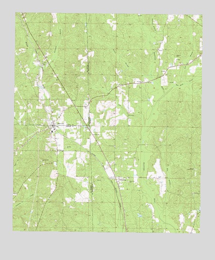
State Line, MS USGS Topographic Map
Click on map above to begin viewing in our Map Viewer.

This topographic map contains these locations and features:
Feature Name Type Latitude Longitude GNIS ID View Map
Big BranchStreamN31.3852°W88.4022°114227View Map
Chatom Gas FieldOilfieldN31.4718°W88.3984°151213View Map
Coaker DamDamN31.3885°W88.3750°129802View Map
Coaker PondReservoirN31.3890°W88.3754°129803View Map
EretPopulated PlaceN31.4702°W88.4822°691847View Map
First Baptist ChurchChurchN31.4348°W88.4751°2596199View Map
Flat BranchStreamN31.4604°W88.3867°118358View Map
Gilley CemeteryCemeteryN31.4066°W88.4036°118956View Map
Givens BranchStreamN31.4641°W88.4084°119008View Map
Milstead Lookout TowerTowerN31.4118°W88.3786°164378View Map
Mount Moriah ChurchChurchN31.4235°W88.4650°674060View Map
Pine Log BranchStreamN31.4324°W88.4131°124830View Map
Red Bank Baptist Church (historical)ChurchN31.4763°W88.3931°157602View Map
Red Bank CemeteryCemeteryN31.4765°W88.3922°125467View Map
Red Bank CreekStreamN31.4546°W88.3995°125468View Map
Savannah BranchStreamN31.4691°W88.4839°677437View Map
Sawmill BranchStreamN31.4860°W88.4100°126442View Map
Scott Paper Company DamDamN31.3852°W88.4150°129801View Map
Scott Paper Company PondReservoirN31.3850°W88.4156°129800View Map
Seven Oak Baptist ChurchChurchN31.4607°W88.4153°150017View Map
South Oak Grove Baptist ChurchChurchN31.3977°W88.3800°127133View Map
State LinePopulated PlaceN31.4363°W88.4745°678229View Map
State Line Baptist ChurchChurchN31.4335°W88.4728°690211View Map
State Line CemeteryCemeteryN31.4316°W88.4764°711091View Map
State Line Police DepartmentBuildingN31.4372°W88.4746°2754273View Map
State Line Post OfficePost OfficeN31.4376°W88.4756°2768612View Map
State Line Volunteer Fire DepartmentBuildingN31.4375°W88.4749°2667857View Map
Town of State LineCivilN31.4360°W88.4739°2406662View Map
Union Baptist ChurchChurchN31.4052°W88.4414°128286View Map
Union CemeteryCemeteryN31.4246°W88.4331°128265View Map
Yellow PinePopulated PlaceN31.4057°W88.4297°155314View Map
Yellow Pine Baptist ChurchChurchN31.4068°W88.4331°157637View Map
Yellow Pine CemeteryCemeteryN31.4043°W88.4233°129294View Map
Yellow Pine Church of GodChurchN31.4121°W88.4359°157638View Map

Note: Coordinates in the location and feature list above are referenced to NAD83 datum.


Copyright (C) 2008-2025 Ryan Niemi / Sunset Dynamics ... All Rights Reserved