TopoQuest Logo
Do you find TopoQuest useful?
Help keep TopoQuest running and adding new maps/features by donating!
Bitcoin:  19c7KJd3qBynnjoSw5npx9KScwjBe4ifkT
Litecoin:  LXs6TkuXGGXo1vDsWCkWVdjQX94eUKd6ui
Home View Maps Find Maps Find Places Resources & Links


Denham, Mississippi Topographic Map

USGS Map Title: Denham, MS
USGS Map MRC: 31088F5
DRG (GeoTIFF) Download: o31088f5.tif


Neighboring USGS Topographic Map Quads:


  Shubuta, MS  
31088G6
 

  Matherville, MS  
31088G5
 

  Isney, AL  
31088G4
 

  Waynesboro, MS  
31088F6
 

  Denham, MS  
31088F5
 

  Aquilla, AL  
31088F4
 

  Clara, MS  
31088E6
 

  Buckatunna, MS  
31088E5
 

  Copeland, AL  
31088E4


Map MRC Location:

N32°
W89°
N32°
W88°
H8 H7 H6 H5 H4 H3 H2 H1
G8 G7 G6 G5 G4 G3 G2 G1
F8 F7 F6 F5 F4 F3 F2 F1
E8 E7 E6 E5 E4 E3 E2 E1
D8 D7 D6 D5 D4 D3 D2 D1
C8 C7 C6 C5 C4 C3 C2 C1
B8 B7 B6 B5 B4 B3 B2 B1
A8 A7 A6 A5 A4 A3 A2 A1
N31°
W89°
N31°
W88°

Denham, MS USGS 1:24K Topographic Map Preview:
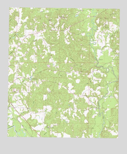
Denham, MS USGS Topographic Map
Click on map above to begin viewing in our Map Viewer.

This topographic map contains these locations and features:
Feature Name Type Latitude Longitude GNIS ID View Map
Alexanders BranchStreamN31.6957°W88.5253°666189View Map
Antioch ChurchChurchN31.7321°W88.5159°666304View Map
Big BranchStreamN31.6765°W88.5309°667087View Map
Big Rock CemeteryCemeteryN31.7452°W88.5084°706412View Map
Big Rock ChurchChurchN31.7452°W88.5081°667138View Map
Cedar BridgeBridgeN31.7168°W88.5270°684065View Map
Chapel Hill ChurchChurchN31.6532°W88.6034°668321View Map
Clark Pond DamDamN31.6935°W88.5484°680833View Map
Coldwater CreekStreamN31.7485°W88.5306°668668View Map
DenhamPopulated PlaceN31.6538°W88.5256°691808View Map
Denham School (historical)SchoolN31.6560°W88.5275°706424View Map
Dyess BridgeBridgeN31.6940°W88.5192°684076View Map
East Shady Grove ChurchChurchN31.7410°W88.5634°669606View Map
Ellis Lake DamDamN31.7435°W88.5450°680872View Map
Eudora CemeteryCemeteryN31.7279°W88.5661°669822View Map
Fedora (historical)LocaleN31.7279°W88.5661°706428View Map
Fedora Methodist Church (historical)ChurchN31.7279°W88.5667°706429View Map
Holly Bush ChurchChurchN31.7188°W88.5931°671308View Map
Langs CreekStreamN31.6374°W88.6245°672301View Map
Macks School (historical)SchoolN31.6829°W88.5573°684084View Map
Maynor Creek Water Park DamDamN31.6935°W88.5334°680832View Map
Mill CreekStreamN31.6777°W88.5125°673601View Map
New Saint Paul ChurchChurchN31.7377°W88.5798°674826View Map
Palmer Ponds DamDamN31.6618°W88.5050°680812View Map
Patton CreekStreamN31.6349°W88.6189°675504View Map
Philadelphus CemeteryCemeteryN31.7002°W88.5234°706440View Map
Philadelphus ChurchChurchN31.7007°W88.5234°675680View Map
Pine Grove ChurchChurchN31.6354°W88.5767°675827View Map
Pleasant Grove CemeteryCemeteryN31.7085°W88.5042°706442View Map
Pleasant Grove ChurchChurchN31.7090°W88.5036°675998View Map
Pond BranchStreamN31.6946°W88.5453°676193View Map
Robinsons Store (historical)LocaleN31.7113°W88.6148°684100View Map
Supervisor District 2CivilN31.6851°W88.5423°712130View Map
TokioPopulated PlaceN31.7449°W88.5481°684108View Map
Turkey CreekStreamN31.7090°W88.5284°678948View Map
Wayne County Farm (historical)LocaleN31.6474°W88.5834°684117View Map
Wayne County Volunteer Fire Department Denham StationBuildingN31.6709°W88.5558°2667995View Map
Waynesboro LakeReservoirN31.6823°W88.5993°679400View Map
Waynesboro Lake DamDamN31.6802°W88.5967°680824View Map
Winchester Oil FieldOilfieldN31.6668°W88.6014°706463View Map

Note: Coordinates in the location and feature list above are referenced to NAD83 datum.


Copyright (C) 2008-2025 Ryan Niemi / Sunset Dynamics ... All Rights Reserved