TopoQuest Logo
Do you find TopoQuest useful?
Help keep TopoQuest running and adding new maps/features by donating!
Bitcoin:  19c7KJd3qBynnjoSw5npx9KScwjBe4ifkT
Litecoin:  LXs6TkuXGGXo1vDsWCkWVdjQX94eUKd6ui
Home View Maps Find Maps Find Places Resources & Links


Buckatunna, Mississippi Topographic Map

USGS Map Title: Buckatunna, MS
USGS Map MRC: 31088E5
DRG (GeoTIFF) Download: o31088e5.tif


Neighboring USGS Topographic Map Quads:


  Waynesboro, MS  
31088F6
 

  Denham, MS  
31088F5
 

  Aquilla, AL  
31088F4
 

  Clara, MS  
31088E6
 

  Buckatunna, MS  
31088E5
 

  Copeland, AL  
31088E4
 

  Piave, MS  
31088D6
 

  Knobtown, MS  
31088D5
 

  State Line, MS  
31088D4


Map MRC Location:

N32°
W89°
N32°
W88°
H8 H7 H6 H5 H4 H3 H2 H1
G8 G7 G6 G5 G4 G3 G2 G1
F8 F7 F6 F5 F4 F3 F2 F1
E8 E7 E6 E5 E4 E3 E2 E1
D8 D7 D6 D5 D4 D3 D2 D1
C8 C7 C6 C5 C4 C3 C2 C1
B8 B7 B6 B5 B4 B3 B2 B1
A8 A7 A6 A5 A4 A3 A2 A1
N31°
W89°
N31°
W88°

Buckatunna, MS USGS 1:24K Topographic Map Preview:
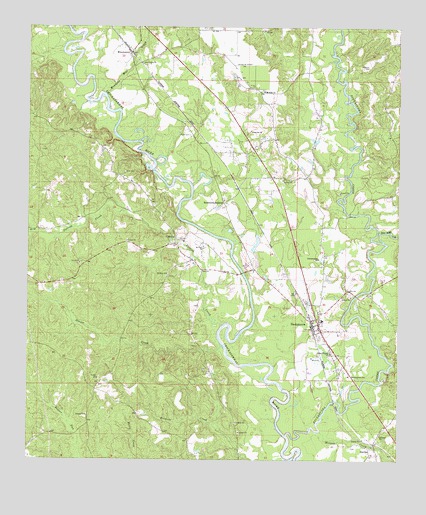
Buckatunna, MS USGS Topographic Map
Click on map above to begin viewing in our Map Viewer.

This topographic map contains these locations and features:
Feature Name Type Latitude Longitude GNIS ID View Map
African ChurchChurchN31.5074°W88.5064°666162View Map
BattlesPopulated PlaceN31.5018°W88.5095°691687View Map
Beaver CreekStreamN31.5335°W88.5598°692506View Map
Big Red CreekStreamN31.5632°W88.5056°667135View Map
BuckatunnaPopulated PlaceN31.5391°W88.5289°667736View Map
Buckatunna Attendance CenterSchoolN31.5404°W88.5259°706415View Map
Buckatunna Baptist ChurchChurchN31.5379°W88.5270°684062View Map
Buckatunna Census Designated PlaceCensusN31.5423°W88.5293°2586585View Map
Buckatunna CreekStreamN31.5074°W88.5378°667737View Map
Buckatunna Methodist ChurchChurchN31.5424°W88.5270°706416View Map
Buckatunna Post OfficePost OfficeN31.5407°W88.5289°2768833View Map
Buckatunna SchoolSchoolN31.5246°W88.5170°667739View Map
ChicoraPopulated PlaceN31.5638°W88.5753°691765View Map
Chicora First Baptist ChurchChurchN31.5568°W88.5695°684068View Map
Meadows Mill CreekStreamN31.6057°W88.5995°673454View Map
Meadows Mill Pond (historical)LakeN31.6199°W88.5861°684086View Map
Mills CemeteryCemeteryN31.5832°W88.5928°673655View Map
Mongus CreekStreamN31.5085°W88.5267°694017View Map
Mount Zion CemeteryCemeteryN31.6071°W88.5461°706436View Map
Mount Zion ChurchChurchN31.5538°W88.5781°674335View Map
Mount Zion ChurchChurchN31.6066°W88.5459°674336View Map
New Light ChurchChurchN31.6146°W88.5870°674775View Map
Nobles Store (historical)LocaleN31.6235°W88.5295°684091View Map
Patrick CreekStreamN31.5388°W88.5600°694326View Map
Pattons Ferry (historical)CrossingN31.6182°W88.6125°684096View Map
Philadelphia ChurchChurchN31.5579°W88.5270°675677View Map
Pineville ChurchChurchN31.5952°W88.5500°675888View Map
Poes Ferry (historical)CrossingN31.5643°W88.5603°684097View Map
Powe CemeteryCemeteryN31.5940°W88.5706°676284View Map
Robinsons JunctionPopulated PlaceN31.5746°W88.5592°692182View Map
Saint Paul ChurchChurchN31.5618°W88.5661°677183View Map
Supervisor District 1CivilN31.5067°W88.5644°712129View Map
Sweet Pilgrim ChurchChurchN31.5310°W88.5231°678484View Map
Uriel (historical)LocaleN31.5507°W88.6189°684110View Map
Washam CemeteryCemeteryN31.6138°W88.5103°679357View Map
Wayne County Volunteer Fire Department Buckatunna StationBuildingN31.5390°W88.5273°2667981View Map
WinchesterPopulated PlaceN31.6177°W88.5906°679779View Map
Winchester CemeteryCemeteryN31.6168°W88.5914°706462View Map
Winchester United Methodist ChurchChurchN31.6174°W88.5911°706464View Map

Note: Coordinates in the location and feature list above are referenced to NAD83 datum.


Copyright (C) 2008-2025 Ryan Niemi / Sunset Dynamics ... All Rights Reserved