TopoQuest Logo
Do you find TopoQuest useful?
Help keep TopoQuest running and adding new maps/features by donating!
Bitcoin:  19c7KJd3qBynnjoSw5npx9KScwjBe4ifkT
Litecoin:  LXs6TkuXGGXo1vDsWCkWVdjQX94eUKd6ui
Home View Maps Find Maps Find Places Resources & Links


Russell, Iowa Topographic Map

USGS Map Title: Russell, IA
USGS Map MRC: 40093H2
DRG (GeoTIFF) Download: o40093h2.tif


Neighboring USGS Topographic Map Quads:


  Chariton, IA  
41093A3
 

  Olmitz, IA  
41093A2
 

  Weller, IA  
41093A1
 

  Corydon NE, IA  
40093H3
 

  Russell, IA  
40093H2
 

  Melrose, IA  
40093H1
 

  Corydon, IA  
40093G3
 

  Confidence, IA  
40093G2
 

  Plano, IA  
40093G1


Map MRC Location:

N41°
W94°
N41°
W93°
H8 H7 H6 H5 H4 H3 H2 H1
G8 G7 G6 G5 G4 G3 G2 G1
F8 F7 F6 F5 F4 F3 F2 F1
E8 E7 E6 E5 E4 E3 E2 E1
D8 D7 D6 D5 D4 D3 D2 D1
C8 C7 C6 C5 C4 C3 C2 C1
B8 B7 B6 B5 B4 B3 B2 B1
A8 A7 A6 A5 A4 A3 A2 A1
N40°
W94°
N40°
W93°

Russell, IA USGS 1:24K Topographic Map Preview:
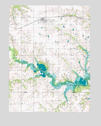
Russell, IA USGS Topographic Map
Click on map above to begin viewing in our Map Viewer.

This topographic map contains these locations and features:
Feature Name Type Latitude Longitude GNIS ID View Map
Center Community ChurchChurchN40.9492°W93.1549°455282View Map
City of RussellCivilN40.9801°W93.2005°2396456View Map
Colyn State Wildlife AreaParkN40.9175°W93.2135°455996View Map
Faith United Methodist ChurchChurchN40.9819°W93.1985°1970665View Map
First Baptist ChurchChurchN40.9819°W93.1985°1970664View Map
Goodwater CreekStreamN40.9053°W93.1491°456965View Map
Jones CemeteryCemeteryN40.8804°W93.1443°1970558View Map
Lost BranchStreamN40.9183°W93.2005°458620View Map
Ragtown BranchStreamN40.9319°W93.2052°460501View Map
Ragtown CemeteryCemeteryN40.9593°W93.2405°460502View Map
RussellLocaleN40.9847°W93.1988°1970683View Map
RussellPopulated PlaceN40.9819°W93.1985°460861View Map
Russell CemeteryCemeteryN40.9807°W93.1851°460862View Map
Russell Community SchoolSchoolN40.9814°W93.1938°1970684View Map
Russell MallLocaleN40.9819°W93.1985°1970680View Map
Russell Post OfficePost OfficeN40.9819°W93.1985°1970681View Map
Russell Town HallBuildingN40.9819°W93.1985°1970682View Map
Russell Volunteer Fire DepartmentBuildingN40.9839°W93.1996°2577196View Map
Township of WashingtonCivilN40.9423°W93.1551°468928View Map
White SchoolSchoolN40.9997°W93.1927°462999View Map
ZeroPopulated PlaceN40.9833°W93.1271°464296View Map
Zero (historical)LocaleN40.9833°W93.1271°1970581View Map
Zero Post Office (historical)Post OfficeN40.9833°W93.1271°1970582View Map

Note: Coordinates in the location and feature list above are referenced to NAD83 datum.


Copyright (C) 2008-2025 Ryan Niemi / Sunset Dynamics ... All Rights Reserved