TopoQuest Logo
Do you find TopoQuest useful?
Help keep TopoQuest running and adding new maps/features by donating!
Bitcoin:  19c7KJd3qBynnjoSw5npx9KScwjBe4ifkT
Litecoin:  LXs6TkuXGGXo1vDsWCkWVdjQX94eUKd6ui
Home View Maps Find Maps Find Places Resources & Links


Mina, California Topographic Map

USGS Map Title: Mina, CA
USGS Map MRC: 39123H3
DRG (GeoTIFF) Download: o39123h3.tif


Neighboring USGS Topographic Map Quads:


  Lake Mountain, CA  
40123A4
 

  Long Ridge, CA  
40123A3
 

  Four Corners Rock, CA  
40123A1
 

  Updegraff Ridge, CA  
39123H4
 

  Mina, CA  
39123H3
 

  Bluenose Ridge, CA  
39123H2
 

  Iron Peak, CA  
39123G4
 

  Covelo West, CA  
39123G3
 

  Covelo East, CA  
39123G2


Map MRC Location:

N40°
W124°
N40°
W123°
H8 H7 H6 H5 H4 H3 H2 H1
G8 G7 G6 G5 G4 G3 G2 G1
F8 F7 F6 F5 F4 F3 F2 F1
E8 E7 E6 E5 E4 E3 E2 E1
D8 D7 D6 D5 D4 D3 D2 D1
C8 C7 C6 C5 C4 C3 C2 C1
B8 B7 B6 B5 B4 B3 B2 B1
A8 A7 A6 A5 A4 A3 A2 A1
N39°
W124°
N39°
W123°

Mina, CA USGS 1:24K Topographic Map Preview:
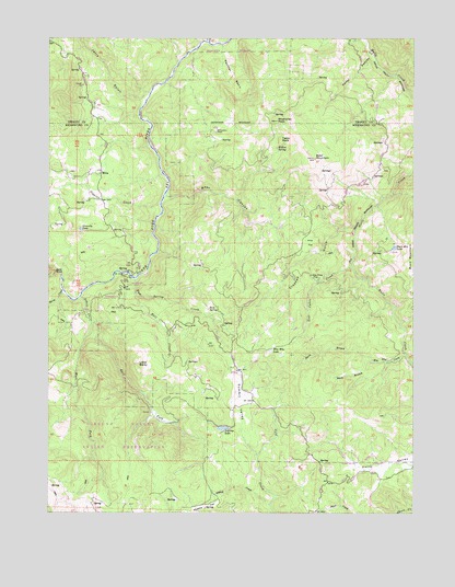
Mina, CA USGS Topographic Map
Click on map above to begin viewing in our Map Viewer.

This topographic map contains these locations and features:
Feature Name Type Latitude Longitude GNIS ID View Map
Asbill CreekStreamN39.9318°W123.3650°218423View Map
Bald MountainSummitN39.9682°W123.2845°218595View Map
Bear CanyonValleyN39.9582°W123.3350°218790View Map
Buck Mountain LakeLakeN39.9448°W123.2576°220000View Map
Cedar CanyonValleyN39.9949°W123.2656°220758View Map
Crooked GulchValleyN39.9502°W123.2711°221845View Map
Delmonico PlacePopulated PlaceN39.9754°W123.3184°1658406View Map
Diggins CreekStreamN39.9560°W123.3372°222385View Map
East Fork Asbill CreekStreamN39.9252°W123.3614°222879View Map
Gibson CreekStreamN39.8768°W123.2997°224151View Map
Gravelly LakeLakeN39.9496°W123.3650°224495View Map
Hall CreekStreamN39.9332°W123.3459°224805View Map
Horse CreekStreamN39.9338°W123.3709°225604View Map
Jerry GulchValleyN39.9835°W123.3445°261931View Map
Lake Mountain Community HallLocaleN39.9954°W123.3670°226800View Map
Lake Mountain School (historical)SchoolN39.9954°W123.3672°1666638View Map
Little BaldySummitN39.9143°W123.3450°227187View Map
Little Pine FlatFlatN39.9371°W123.2834°227330View Map
Lost Cabin CreekStreamN39.9399°W123.2720°227691View Map
Lousy CreekStreamN39.9990°W123.3211°262975View Map
Lowrey LakeLakeN39.8972°W123.3163°227804View Map
MinaPopulated PlaceN39.9649°W123.3584°252796View Map
North Branch Who Who CreekStreamN39.9146°W123.2645°229612View Map
Panther BasinBasinN39.9902°W123.3128°230293View Map
Pine FlatFlatN39.9460°W123.2864°230690View Map
Ram SpringSpringN39.9286°W123.3212°231198View Map
Ram Spring CreekStreamN39.9368°W123.3464°231199View Map
Round Valley ReservationCivilN39.8926°W123.3289°267196View Map
Sheubeck Ranch (historical)LocaleN39.9554°W123.3725°1724134View Map
South Branch Who Who CreekStreamN39.9146°W123.2645°234943View Map
Split RockCliffN39.9388°W123.3734°235208View Map
Summit ValleyValleyN39.8935°W123.3081°235769View Map
Table RockSummitN39.9735°W123.2961°1659944View Map
West Fork Asbill CreekStreamN39.9252°W123.3614°237460View Map
Who Who CreekStreamN39.9174°W123.2545°237722View Map
Who Who LakeLakeN39.9176°W123.3001°237723View Map
Wildhorse PeakSummitN39.9779°W123.2975°237816View Map
Willow SpringSpringN39.9709°W123.2979°237940View Map
Wylettie FlatFlatN39.8763°W123.3225°238213View Map

Note: Coordinates in the location and feature list above are referenced to NAD83 datum.


Copyright (C) 2008-2025 Ryan Niemi / Sunset Dynamics ... All Rights Reserved