TopoQuest Logo
Do you find TopoQuest useful?
Help keep TopoQuest running and adding new maps/features by donating!
Bitcoin:  19c7KJd3qBynnjoSw5npx9KScwjBe4ifkT
Litecoin:  LXs6TkuXGGXo1vDsWCkWVdjQX94eUKd6ui
Home View Maps Find Maps Find Places Resources & Links


Leech Lake Mountain, California Topographic Map

USGS Map Title: Leech Lake Mountain, CA
USGS Map MRC: 39123H1
DRG (GeoTIFF) Download: o39123h1.tif


Neighboring USGS Topographic Map Quads:


  Four Corners Rock, CA  
40123A1
 

  South Yolla Bolly, CA  
40122A7
 

  Bluenose Ridge, CA  
39123H2
 

  Leech Lake Mountain, CA  
39123H1
 

  Buck Rock, CA  
39122H8
 

  Covelo East, CA  
39123G2
 

  Newhouse Ridge, CA  
39123G1
 

  Mendocino Pass, CA  
39122G8


Map MRC Location:

N40°
W124°
N40°
W123°
H8 H7 H6 H5 H4 H3 H2 H1
G8 G7 G6 G5 G4 G3 G2 G1
F8 F7 F6 F5 F4 F3 F2 F1
E8 E7 E6 E5 E4 E3 E2 E1
D8 D7 D6 D5 D4 D3 D2 D1
C8 C7 C6 C5 C4 C3 C2 C1
B8 B7 B6 B5 B4 B3 B2 B1
A8 A7 A6 A5 A4 A3 A2 A1
N39°
W124°
N39°
W123°

Leech Lake Mountain, CA USGS 1:24K Topographic Map Preview:
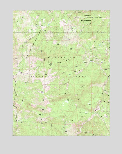
Leech Lake Mountain, CA USGS Topographic Map
Click on map above to begin viewing in our Map Viewer.

This topographic map contains these locations and features:
Feature Name Type Latitude Longitude GNIS ID View Map
Airplane MeadowFlatN39.9485°W123.0342°218031View Map
Alder CreekStreamN39.9588°W123.0317°256162View Map
Asa Bean FlatFlatN39.9804°W123.1036°218420View Map
Asa Bear CrossingLocaleN39.9840°W123.0906°218421View Map
Barney MeadowFlatN39.9488°W123.0111°1666465View Map
Bear CreekStreamN39.9099°W123.0100°256645View Map
Bear Trap SpringSpringN39.9024°W123.0850°218887View Map
Bear WallowBasinN39.9268°W123.1100°218898View Map
Beaver CreekStreamN39.9332°W123.0028°256763View Map
Bell SpringSpringN39.9671°W123.0661°218990View Map
Blands CoveSpringN39.9099°W123.0545°219439View Map
Buttermilk CreekStreamN39.8999°W123.1206°220305View Map
Castle PeakSummitN39.9515°W123.1233°258064View Map
Cedar SpringsSpringN39.9471°W123.0756°220799View Map
Cedar Springs RidgeRidgeN39.9421°W123.0789°220800View Map
Deer Lick CreekStreamN39.9710°W123.0458°222194View Map
Devils DenFlatN39.8985°W123.0311°222296View Map
Dewell GardenFlatN39.9399°W123.0442°222334View Map
Dewell LakeLakeN39.9618°W123.0490°222335View Map
Fishtown CreekStreamN39.9199°W123.0089°260167View Map
Fly CreekStreamN39.8968°W123.0192°260223View Map
Fossil CreekStreamN39.9529°W123.0303°223721View Map
Foster GladesFlatN39.9904°W123.0858°223727View Map
Foster RanchLocaleN39.9485°W123.0128°223730View Map
Grass LakeLakeN39.9360°W123.0537°224463View Map
Ham PassGapN39.8871°W123.0895°224825View Map
Hammerhorn CreekStreamN39.9399°W123.0086°261051View Map
Hotel CampLocaleN39.9677°W123.1089°225681View Map
Howard CreekStreamN39.9068°W123.0145°261571View Map
Leech LakeLakeN39.9178°W123.0869°226997View Map
Leech Lake MountainSummitN39.9235°W123.0842°226998View Map
Lily LakeLakeN39.9822°W123.0510°227097View Map
Line GulchValleyN39.9804°W123.0872°227165View Map
Maple CreekStreamN39.9615°W123.0328°228057View Map
Osborn StationLocaleN39.8996°W123.0083°230133View Map
Pine RidgeRidgeN39.9099°W123.0850°267128View Map
Pothole CreekStreamN39.9485°W123.0261°230987View Map
Pothole CrossingLocaleN39.9504°W123.0267°230988View Map
Rattlesnake CreekStreamN39.9732°W123.0564°265205View Map
Red Chert CreekStreamN39.9963°W123.1078°265259View Map
Red RockSummitN39.9374°W123.1164°231376View Map
Reeves PlacePopulated PlaceN39.8890°W123.1136°1659496View Map
Steel BenchBenchN39.9057°W123.0286°235422View Map
Stick LakeLakeN39.9357°W123.0849°235475View Map
Stick Lake CanyonValleyN39.9779°W123.0836°235476View Map
Taliaferro RidgeRidgeN39.9171°W123.0472°253960View Map
Thistle SpringSpringN39.8963°W123.0895°236248View Map
Travelers HomeLocaleN39.8799°W123.0586°1654483View Map

Note: Coordinates in the location and feature list above are referenced to NAD83 datum.


Copyright (C) 2008-2025 Ryan Niemi / Sunset Dynamics ... All Rights Reserved