TopoQuest Logo
Do you find TopoQuest useful?
Help keep TopoQuest running and adding new maps/features by donating!
Bitcoin:  19c7KJd3qBynnjoSw5npx9KScwjBe4ifkT
Litecoin:  LXs6TkuXGGXo1vDsWCkWVdjQX94eUKd6ui
Home View Maps Find Maps Find Places Resources & Links


Boyd, Wisconsin Topographic Map

USGS Map Title: Boyd, WI
USGS Map MRC: 44091H1
DRG (GeoTIFF) Download: o44091h1.tif


Neighboring USGS Topographic Map Quads:


  Crescent, WI  
45091A2
 

  Colburn, WI  
45091A1
 

  Huron, WI  
45090A8
 

  Cadott, WI  
44091H2
 

  Boyd, WI  
44091H1
 

  Stanley, WI  
44090H8
 

  Lake Eau Claire West, WI  
44091G2
 

  Lake Eau Claire East, WI  
44091G1
 

  Simes Creek, WI  
44090G8


Map MRC Location:

N45°
W92°
N45°
W91°
H8 H7 H6 H5 H4 H3 H2 H1
G8 G7 G6 G5 G4 G3 G2 G1
F8 F7 F6 F5 F4 F3 F2 F1
E8 E7 E6 E5 E4 E3 E2 E1
D8 D7 D6 D5 D4 D3 D2 D1
C8 C7 C6 C5 C4 C3 C2 C1
B8 B7 B6 B5 B4 B3 B2 B1
A8 A7 A6 A5 A4 A3 A2 A1
N44°
W92°
N44°
W91°

Boyd, WI USGS 1:24K Topographic Map Preview:
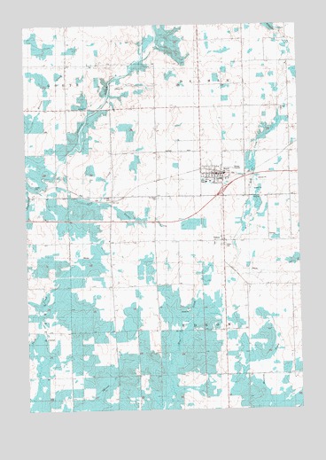
Boyd, WI USGS Topographic Map
Click on map above to begin viewing in our Map Viewer.

This topographic map contains these locations and features:
Feature Name Type Latitude Longitude GNIS ID View Map
BoydPopulated PlaceN44.9519°W91.0349°1562108View Map
Boyd Edson Delmar Volunteer Fire Department Ambulance and RescueBuildingN44.9477°W91.0440°2696757View Map
Boyd Elementary SchoolSchoolN44.9489°W91.0423°1842797View Map
Boyd Police DepartmentBuildingN44.9513°W91.0369°2759802View Map
Boyd Wastewater Treatment FacilityLocaleN44.9530°W91.0303°2729061View Map
Danielson School (historical)SchoolN44.9947°W91.1060°1842823View Map
Delmar Center School (historical)SchoolN44.9808°W91.0251°1842824View Map
EdsonPopulated PlaceN44.9300°W91.0349°1564456View Map
Liberty Hill School (historical)SchoolN44.8794°W91.0349°1842864View Map
Lotz CreekStreamN44.9530°W91.1101°1568693View Map
Lotz ParkParkN44.9489°W91.0440°1568694View Map
McKinley School (historical)SchoolN44.9447°W91.0851°1842885View Map
Popple Grove School (historical)SchoolN44.9150°W91.0035°1842871View Map
Saint Joseph CemeteryCemeteryN44.9438°W91.0643°1573156View Map
Saint Peter CemeteryCemeteryN44.9441°W91.0860°1573506View Map
Saint Peters Lutheran ChurchChurchN44.9516°W91.0432°1842905View Map
Sherman School (historical)SchoolN44.9147°W91.0865°1842909View Map
Slaughterhouse CreekStreamN44.9489°W91.1240°1574265View Map
Town of DelmarCivilN44.9899°W91.0096°1583072View Map
Town of EdsonCivilN44.9008°W91.0141°1583135View Map
Turner CreekStreamN44.9425°W91.0913°1575723View Map
Union CemeteryCemeteryN44.9280°W91.0343°1575892View Map
Victory School (historical)SchoolN44.9727°W91.0649°1842920View Map
Village of BoydCivilN44.9533°W91.0398°1582849View Map

Note: Coordinates in the location and feature list above are referenced to NAD83 datum.


Copyright (C) 2008-2024 Ryan Niemi / Sunset Dynamics ... All Rights Reserved