TopoQuest Logo
Do you find TopoQuest useful?
Help keep TopoQuest running and adding new maps/features by donating!
Bitcoin:  19c7KJd3qBynnjoSw5npx9KScwjBe4ifkT
Litecoin:  LXs6TkuXGGXo1vDsWCkWVdjQX94eUKd6ui
Home View Maps Find Maps Find Places Resources & Links


Crosby, Pennsylvania Topographic Map

USGS Map Title: Crosby, PA
USGS Map MRC: 41078F4
DRG (GeoTIFF) Download: o41078f4.tif


Neighboring USGS Topographic Map Quads:


  Cyclone, PA  
41078G5
 

  Smethport, PA  
41078G4
 

  Port Allegany, PA  
41078G3
 

  Hazel Hurst, PA  
41078F5
 

  Crosby, PA  
41078F4
 

  Norwich, PA  
41078F3
 

  Glen Hazel, PA  
41078E5
 

  Wildwood Fire Tower, PA  
41078E4
 

  Rich Valley, PA  
41078E3


Map MRC Location:

N42°
W79°
N42°
W78°
H8 H7 H6 H5 H4 H3 H2 H1
G8 G7 G6 G5 G4 G3 G2 G1
F8 F7 F6 F5 F4 F3 F2 F1
E8 E7 E6 E5 E4 E3 E2 E1
D8 D7 D6 D5 D4 D3 D2 D1
C8 C7 C6 C5 C4 C3 C2 C1
B8 B7 B6 B5 B4 B3 B2 B1
A8 A7 A6 A5 A4 A3 A2 A1
N41°
W79°
N41°
W78°

Crosby, PA USGS 1:24K Topographic Map Preview:
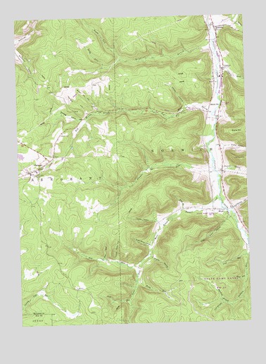
Crosby, PA USGS Topographic Map
Click on map above to begin viewing in our Map Viewer.

This topographic map contains these locations and features:
Feature Name Type Latitude Longitude GNIS ID View Map
BetulaPopulated PlaceN41.6709°W78.3936°1203080View Map
Brewer RunStreamN41.6881°W78.3933°1170214View Map
Browns Mill HollowValleyN41.7122°W78.4555°1170393View Map
Bunker HillSummitN41.7234°W78.4664°1202141View Map
ClermontPopulated PlaceN41.6895°W78.4884°1171991View Map
Clermont CemeteryCemeteryN41.7031°W78.4750°1171992View Map
Clermont Volunteer Fire Department Station 14BuildingN41.6886°W78.4892°2644815View Map
Cogsdell BrookStreamN41.6692°W78.3831°1202143View Map
ColegrovePopulated PlaceN41.7287°W78.3858°1203308View Map
Colegrove BrookStreamN41.7301°W78.3889°1172182View Map
Combs HollowValleyN41.7137°W78.4073°1192287View Map
CrosbyPopulated PlaceN41.7451°W78.3903°1172734View Map
Crosby Post OfficePost OfficeN41.7454°W78.3894°2772654View Map
Donley ForkStreamN41.7326°W78.4414°1173378View Map
Evans HollowValleyN41.6967°W78.3878°1174349View Map
Frog Camp HollowValleyN41.6664°W78.3867°1175283View Map
Green BrookStreamN41.6712°W78.4097°1176056View Map
Hamlin StationPopulated PlaceN41.7109°W78.3945°1176434View Map
Hickory Point HollowValleyN41.6511°W78.4480°1176966View Map
Indian RunStreamN41.6523°W78.3756°1177784View Map
Jay Cox HillSummitN41.6909°W78.3778°1198939View Map
Kimball HollowValleyN41.6718°W78.3823°1178457View Map
Lick RunStreamN41.6345°W78.4403°1179302View Map
Long RunStreamN41.6523°W78.3756°1179889View Map
Lost HollowValleyN41.6327°W78.3886°1179970View Map
Lost RunStreamN41.6701°W78.3839°1202144View Map
Mosier HollowValleyN41.6524°W78.4280°1181613View Map
Murdock BranchStreamN41.6317°W78.3842°1182102View Map
Norwich CemeteryCemeteryN41.7242°W78.3910°1182690View Map
Norwich Township Volunteer Fire DepartmentBuildingN41.7447°W78.3898°2645807View Map
Oviatt HollowValleyN41.6666°W78.4252°1183145View Map
Pine RunStreamN41.6509°W78.4542°1183884View Map
Red Mill BrookStreamN41.7109°W78.3914°1184769View Map
Robbins BrookStreamN41.7365°W78.3917°1185198View Map
Rocky ForkStreamN41.7303°W78.4509°1185350View Map
Rocky RunStreamN41.6434°W78.4364°1185371View Map
Sackett HollowValleyN41.6878°W78.3879°1185676View Map
Short RunStreamN41.6453°W78.3767°1187602View Map
South Fork West Branch Potato CreekStreamN41.6503°W78.4336°1193410View Map
Spangler HollowValleyN41.7113°W78.4607°1188148View Map
Sugar Bush HollowValleyN41.6567°W78.4284°1188920View Map
Walcott BrookStreamN41.7462°W78.3922°1193600View Map
Wernwag HollowValleyN41.7079°W78.4642°1190841View Map
West Branch Potato CreekStreamN41.6762°W78.3900°1190924View Map
West Fork West Branch Potato CreekStreamN41.6503°W78.4339°1191029View Map
White HollowValleyN41.7480°W78.3794°1191282View Map

Note: Coordinates in the location and feature list above are referenced to NAD83 datum.


Copyright (C) 2008-2025 Ryan Niemi / Sunset Dynamics ... All Rights Reserved