TopoQuest Logo
Do you find TopoQuest useful?
Help keep TopoQuest running and adding new maps/features by donating!
Bitcoin:  19c7KJd3qBynnjoSw5npx9KScwjBe4ifkT
Litecoin:  LXs6TkuXGGXo1vDsWCkWVdjQX94eUKd6ui
Home View Maps Find Maps Find Places Resources & Links


Smethport, Pennsylvania Topographic Map

USGS Map Title: Smethport, PA
USGS Map MRC: 41078G4
DRG (GeoTIFF) Download: o41078g4.tif


Neighboring USGS Topographic Map Quads:


  Derrick City, PA  
41078H5
 

  Eldred, PA  
41078H4
 

  Bullis Mills, PA  
41078H3
 

  Cyclone, PA  
41078G5
 

  Smethport, PA  
41078G4
 

  Port Allegany, PA  
41078G3
 

  Hazel Hurst, PA  
41078F5
 

  Crosby, PA  
41078F4
 

  Norwich, PA  
41078F3


Map MRC Location:

N42°
W79°
N42°
W78°
H8 H7 H6 H5 H4 H3 H2 H1
G8 G7 G6 G5 G4 G3 G2 G1
F8 F7 F6 F5 F4 F3 F2 F1
E8 E7 E6 E5 E4 E3 E2 E1
D8 D7 D6 D5 D4 D3 D2 D1
C8 C7 C6 C5 C4 C3 C2 C1
B8 B7 B6 B5 B4 B3 B2 B1
A8 A7 A6 A5 A4 A3 A2 A1
N41°
W79°
N41°
W78°

Smethport, PA USGS 1:24K Topographic Map Preview:
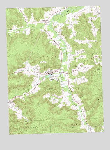
Smethport, PA USGS Topographic Map
Click on map above to begin viewing in our Map Viewer.

This topographic map contains these locations and features:
Feature Name Type Latitude Longitude GNIS ID View Map
Beechwood CampLocaleN41.7778°W78.4606°1200725View Map
Blacksmith RunStreamN41.8067°W78.4534°1169776View Map
Borough of SmethportCivilN41.8071°W78.4435°1215435View Map
Boyer BrookStreamN41.7590°W78.3986°1198041View Map
Brooder HollowValleyN41.8729°W78.4788°1170317View Map
Burbank HollowValleyN41.7816°W78.4095°1170697View Map
Bush HillSummitN41.8284°W78.3886°1170762View Map
Bush Hill School (historical)SchoolN41.8292°W78.3822°1200726View Map
Camp ComfortLocaleN41.7759°W78.4639°1200724View Map
Champlin HollowValleyN41.8739°W78.3834°1171550View Map
Cloverlot HollowValleyN41.8498°W78.4118°1172034View Map
Cole CreekStreamN41.8573°W78.4414°1172172View Map
Daly BrookStreamN41.7681°W78.4045°1172903View Map
Devils DenSummitN41.7948°W78.4420°1173198View Map
Diegel HollowValleyN41.8716°W78.4318°1173260View Map
East SmethportPopulated PlaceN41.8087°W78.4195°1173874View Map
East Smethport Post OfficePost OfficeN41.8100°W78.4272°2772683View Map
Farmers ValleyPopulated PlaceN41.8609°W78.4486°1174623View Map
Gifford HollowValleyN41.8067°W78.4189°1175598View Map
Hacket HollowValleyN41.8234°W78.4149°1176344View Map
Hamlin LakeReservoirN41.8084°W78.4331°1195802View Map
Hamlin Lake Park DamDamN41.8084°W78.4331°1195801View Map
Ice Pond BrookStreamN41.8112°W78.4661°1177675View Map
Irish HollowValleyN41.7841°W78.4269°1177828View Map
Irons HollowValleyN41.7814°W78.4992°1177853View Map
Kent HollowValleyN41.8720°W78.3904°1178380View Map
Marvin CreekStreamN41.8092°W78.4303°1210192View Map
Marvin Creek Oil FieldOilfieldN41.7945°W78.4811°1180511View Map
McKean County Sheriff's OfficeBuildingN41.7965°W78.4639°2766714View Map
North Branch Cole CreekStreamN41.8562°W78.4700°1182532View Map
Olds ClubLocaleN41.7523°W78.4722°1200723View Map
Pierce BrookStreamN41.8703°W78.4111°1183703View Map
Pospect Hill Lookout TowerTowerN41.8128°W78.3811°1212815View Map
Prospect HillSummitN41.8131°W78.3811°1184448View Map
Reilly HollowValleyN41.8019°W78.4191°1184880View Map
Rose Hill CemeteryCemeteryN41.8035°W78.4347°1185447View Map
Saint Elizabeths CemeteryCemeteryN41.8020°W78.4332°1185926View Map
Sartwell Oil FieldOilfieldN41.8631°W78.3981°1186988View Map
SmethportPopulated PlaceN41.8112°W78.4447°1187848View Map
Smethport Area Junior Senior High SchoolSchoolN41.8034°W78.4425°1207208View Map
Smethport Elementary SchoolSchoolN41.8026°W78.4431°1207209View Map
Smethport Fire DepartmentBuildingN41.8101°W78.4356°2644878View Map
Smethport Police DepartmentBuildingN41.8093°W78.4432°2766710View Map
Smethport Post OfficePost OfficeN41.8086°W78.4412°2772983View Map
Smith CemeteryCemeteryN41.8543°W78.4348°1187862View Map
South Branch Cole CreekStreamN41.8562°W78.4697°1188022View Map
State Game Lands Number 301ParkN41.8667°W78.4331°1208056View Map
Stickles HollowValleyN41.8277°W78.4137°1188660View Map
The NippleSummitN41.8162°W78.4106°1189435View Map
Township of KeatingCivilN41.8250°W78.4889°1216787View Map
Tyler BrookStreamN41.8570°W78.4664°1190036View Map

Note: Coordinates in the location and feature list above are referenced to NAD83 datum.


Copyright (C) 2008-2025 Ryan Niemi / Sunset Dynamics ... All Rights Reserved