TopoQuest Logo
Do you find TopoQuest useful?
Help keep TopoQuest running and adding new maps/features by donating!
Bitcoin:  19c7KJd3qBynnjoSw5npx9KScwjBe4ifkT
Litecoin:  LXs6TkuXGGXo1vDsWCkWVdjQX94eUKd6ui
Home View Maps Find Maps Find Places Resources & Links


Wildwood Fire Tower, Pennsylvania Topographic Map

USGS Map Title: Wildwood Fire Tower, PA
USGS Map MRC: 41078E4
DRG (GeoTIFF) Download: o41078e4.tif


Neighboring USGS Topographic Map Quads:


  Hazel Hurst, PA  
41078F5
 

  Crosby, PA  
41078F4
 

  Norwich, PA  
41078F3
 

  Glen Hazel, PA  
41078E5
 

  Wildwood Fire Tower, PA  
41078E4
 

  Rich Valley, PA  
41078E3
 

  Saint Marys, PA  
41078D5
 

  Rathbun, PA  
41078D4
 

  West Creek, PA  
41078D3


Map MRC Location:

N42°
W79°
N42°
W78°
H8 H7 H6 H5 H4 H3 H2 H1
G8 G7 G6 G5 G4 G3 G2 G1
F8 F7 F6 F5 F4 F3 F2 F1
E8 E7 E6 E5 E4 E3 E2 E1
D8 D7 D6 D5 D4 D3 D2 D1
C8 C7 C6 C5 C4 C3 C2 C1
B8 B7 B6 B5 B4 B3 B2 B1
A8 A7 A6 A5 A4 A3 A2 A1
N41°
W79°
N41°
W78°

Wildwood Fire Tower, PA USGS 1:24K Topographic Map Preview:
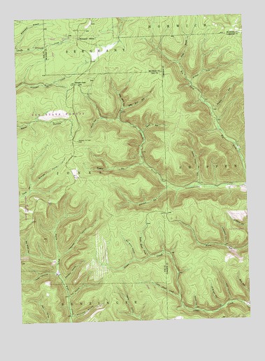
Wildwood Fire Tower, PA USGS Topographic Map
Click on map above to begin viewing in our Map Viewer.

This topographic map contains these locations and features:
Feature Name Type Latitude Longitude GNIS ID View Map
Al Wright HollowValleyN41.5056°W78.3898°1168108View Map
Billy Buck RunStreamN41.5837°W78.4434°1169627View Map
Boy Scout HollowValleyN41.5258°W78.4370°1170080View Map
Brewer ForkStreamN41.5970°W78.4033°1170211View Map
Bull Wheel HollowValleyN41.5289°W78.4958°1170654View Map
Cherry RunStreamN41.5776°W78.4311°1171663View Map
Company HollowValleyN41.5175°W78.4763°1172271View Map
Dead Mans LickStreamN41.5878°W78.4411°1192334View Map
Elk RiverLocaleN41.5559°W78.3756°1212779View Map
H C HollowValleyN41.5109°W78.4736°1176338View Map
Indian Camp RunStreamN41.5553°W78.3997°1177735View Map
Jarrets SummitSummitN41.5495°W78.4689°1202255View Map
Little Clear CreekStreamN41.5098°W78.4125°1179504View Map
Lockwood HollowValleyN41.5303°W78.3875°1179767View Map
Mason HollowValleyN41.5047°W78.4043°1180527View Map
Nichols RunStreamN41.5862°W78.3925°1182440View Map
Oviatt BranchStreamN41.6062°W78.4103°1183144View Map
Post HollowValleyN41.5075°W78.3850°1184314View Map
Right Hand ForkStreamN41.5265°W78.4289°1185078View Map
Robinson RunStreamN41.5551°W78.4181°1185233View Map
Straight CreekPopulated PlaceN41.5976°W78.4678°1204755View Map
Toner HollowValleyN41.5205°W78.4801°1193540View Map
Transfer HollowValleyN41.5277°W78.4782°1189718View Map
Wellendorf BranchStreamN41.6126°W78.4989°1190805View Map
Wellendorf StationLocaleN41.6167°W78.4645°1190806View Map
Whitman HollowValleyN41.5025°W78.4716°1191354View Map
Wildwood Fire TowerTowerN41.5745°W78.4664°1213409View Map
Windfall RunStreamN41.5653°W78.4306°1191574View Map

Note: Coordinates in the location and feature list above are referenced to NAD83 datum.


Copyright (C) 2008-2025 Ryan Niemi / Sunset Dynamics ... All Rights Reserved