TopoQuest Logo
Do you find TopoQuest useful?
Help keep TopoQuest running and adding new maps/features by donating!
Bitcoin:  19c7KJd3qBynnjoSw5npx9KScwjBe4ifkT
Litecoin:  LXs6TkuXGGXo1vDsWCkWVdjQX94eUKd6ui
Home View Maps Find Maps Find Places Resources & Links


Norwich, Pennsylvania Topographic Map

USGS Map Title: Norwich, PA
USGS Map MRC: 41078F3
DRG (GeoTIFF) Download: o41078f3.tif


Neighboring USGS Topographic Map Quads:


  Smethport, PA  
41078G4
 

  Port Allegany, PA  
41078G3
 

  Roulette, PA  
41078G2
 

  Crosby, PA  
41078F4
 

  Norwich, PA  
41078F3
 

  Keating Summit, PA  
41078F2
 

  Wildwood Fire Tower, PA  
41078E4
 

  Rich Valley, PA  
41078E3
 

  Emporium, PA  
41078E2


Map MRC Location:

N42°
W79°
N42°
W78°
H8 H7 H6 H5 H4 H3 H2 H1
G8 G7 G6 G5 G4 G3 G2 G1
F8 F7 F6 F5 F4 F3 F2 F1
E8 E7 E6 E5 E4 E3 E2 E1
D8 D7 D6 D5 D4 D3 D2 D1
C8 C7 C6 C5 C4 C3 C2 C1
B8 B7 B6 B5 B4 B3 B2 B1
A8 A7 A6 A5 A4 A3 A2 A1
N41°
W79°
N41°
W78°

Norwich, PA USGS 1:24K Topographic Map Preview:
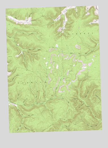
Norwich, PA USGS Topographic Map
Click on map above to begin viewing in our Map Viewer.

This topographic map contains these locations and features:
Feature Name Type Latitude Longitude GNIS ID View Map
Doubler HollowValleyN41.6580°W78.2794°1173413View Map
East Branch Potato CreekStreamN41.6540°W78.3628°1173760View Map
Evans HillSummitN41.7026°W78.3672°1174347View Map
Hamlin RunStreamN41.6562°W78.3236°1176433View Map
Hand BrookStreamN41.6551°W78.3620°1176452View Map
Havens RunStreamN41.6540°W78.3628°1176656View Map
Jay Cox HillSummitN41.6906°W78.3686°1200767View Map
Keesler HollowValleyN41.7073°W78.3490°1178296View Map
Larson HollowValleyN41.7374°W78.3429°1178901View Map
Little Parker RunStreamN41.6340°W78.2511°1179629View Map
Lyman RunStreamN41.6592°W78.3114°1180108View Map
North Branch Colegrove BrookStreamN41.7203°W78.3664°1182533View Map
NorwichPopulated PlaceN41.6595°W78.3733°1204309View Map
O'Brien HollowValleyN41.6550°W78.2728°1182723View Map
Panther RunStreamN41.6545°W78.3378°1183263View Map
Pigeon HollowValleyN41.6326°W78.3570°1183718View Map
Porcupine HollowValleyN41.6539°W78.3550°1184271View Map
Railroad RunStreamN41.6598°W78.3117°1184603View Map
Saltlog HollowValleyN41.7063°W78.3544°1186886View Map
Squab HollowValleyN41.6407°W78.3545°1188364View Map
State Game Lands Number 30ParkN41.6334°W78.3164°1208051View Map
Stone Chimney HollowValleyN41.6524°W78.2723°1188709View Map
Strang HollowValleyN41.7413°W78.2966°1188852View Map
Susquehanna State ForestForestN41.7320°W78.3056°1212158View Map
Taylor Field BranchStreamN41.7090°W78.3542°1189304View Map
Township of NorwichCivilN41.6812°W78.3479°1216790View Map

Note: Coordinates in the location and feature list above are referenced to NAD83 datum.


Copyright (C) 2008-2025 Ryan Niemi / Sunset Dynamics ... All Rights Reserved