TopoQuest Logo
Do you find TopoQuest useful?
Help keep TopoQuest running and adding new maps/features by donating!
Bitcoin:  19c7KJd3qBynnjoSw5npx9KScwjBe4ifkT
Litecoin:  LXs6TkuXGGXo1vDsWCkWVdjQX94eUKd6ui
Home View Maps Find Maps Find Places Resources & Links


Edwards, Missouri Topographic Map

USGS Map Title: Edwards, MO
USGS Map MRC: 38093B2
DRG (GeoTIFF) Download: o38093b2.tif


Neighboring USGS Topographic Map Quads:


  Lincoln SE, MO  
38093C3
 

  Lakeview Heights, MO  
38093C2
 

  Boylers Mill, MO  
38093C1
 

  Warsaw East, MO  
38093B3
 

  Edwards, MO  
38093B2
 

  Knobby, MO  
38093B1
 

  Fristoe, MO  
38093A3
 

  Cross Timbers, MO  
38093A2
 

  Climax Springs, MO  
38093A1


Map MRC Location:

N39°
W94°
N39°
W93°
H8 H7 H6 H5 H4 H3 H2 H1
G8 G7 G6 G5 G4 G3 G2 G1
F8 F7 F6 F5 F4 F3 F2 F1
E8 E7 E6 E5 E4 E3 E2 E1
D8 D7 D6 D5 D4 D3 D2 D1
C8 C7 C6 C5 C4 C3 C2 C1
B8 B7 B6 B5 B4 B3 B2 B1
A8 A7 A6 A5 A4 A3 A2 A1
N38°
W94°
N38°
W93°

Edwards, MO USGS 1:24K Topographic Map Preview:
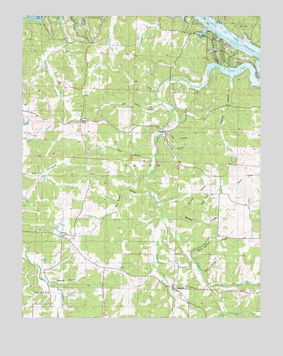
Edwards, MO USGS Topographic Map
Click on map above to begin viewing in our Map Viewer.

This topographic map contains these locations and features:
Feature Name Type Latitude Longitude GNIS ID View Map
Belleview CemeteryCemeteryN38.1595°W93.2260°713927View Map
Buck BranchStreamN38.1378°W93.1510°714950View Map
Buckley HollowValleyN38.1659°W93.1727°714984View Map
Cantrell HollowValleyN38.1673°W93.1683°715373View Map
Deer CreekStreamN38.2231°W93.1535°716795View Map
Deer Creek ArmBayN38.2267°W93.1413°716801View Map
Deer Creek Fire Protection District Station 2BuildingN38.2476°W93.1633°2621609View Map
Deer Creek Fire Protection District Station 3 HeadquartersBuildingN38.2454°W93.2099°2621716View Map
Deer Creek Fire Protection District Station 4BuildingN38.1375°W93.1690°2621068View Map
Duroc (historical)LocaleN38.2353°W93.1563°744884View Map
Duroc BayBayN38.2436°W93.1552°717210View Map
EdwardsPopulated PlaceN38.1367°W93.1696°717410View Map
Edwards Post OfficePost OfficeN38.1375°W93.1682°2783002View Map
Edwards School (historical)SchoolN38.1373°W93.1694°745393View Map
Globe School (historical)SchoolN38.1686°W93.1477°745392View Map
Haistain School (historical)SchoolN38.2064°W93.1658°745391View Map
HastainPopulated PlaceN38.2020°W93.1763°740911View Map
Hastain CemeteryCemeteryN38.2200°W93.1694°719199View Map
Hay HollowValleyN38.2189°W93.1810°719252View Map
Jockey City CornersLocaleN38.2067°W93.2199°742825View Map
Lakewood LakeReservoirN38.2474°W93.2200°764890View Map
Little Deer CreekStreamN38.1664°W93.1771°721220View Map
Mattock HollowValleyN38.1398°W93.2374°729775View Map
Miller RidgeRidgeN38.1753°W93.1524°722384View Map
Oak Hunter HollowValleyN38.2131°W93.1777°723627View Map
Picnic HollowValleyN38.2011°W93.1777°724315View Map
Pleasant Green School (historical)SchoolN38.2153°W93.2183°745389View Map
Rob HollowValleyN38.2467°W93.2405°725386View Map
Rock Spring School (historical)SchoolN38.1834°W93.2077°745390View Map
Sarvis BranchStreamN38.1259°W93.1435°726067View Map
Sawmill HollowValleyN38.1431°W93.1552°726076View Map
Short School HollowValleyN38.1517°W93.1633°726418View Map
Spry HollowValleyN38.1911°W93.1833°726969View Map
Thatcher HollowValleyN38.2250°W93.1405°727546View Map
Township of UnionCivilN38.1594°W93.1600°766318View Map
Turkey HollowValleyN38.2017°W93.1749°727871View Map
William Hayes Lake DamDamN38.2484°W93.2202°764889View Map
Wolf Branch HollowValleyN38.1773°W93.1855°729033View Map

Note: Coordinates in the location and feature list above are referenced to NAD83 datum.


Copyright (C) 2008-2025 Ryan Niemi / Sunset Dynamics ... All Rights Reserved