TopoQuest Logo
Do you find TopoQuest useful?
Help keep TopoQuest running and adding new maps/features by donating!
Bitcoin:  19c7KJd3qBynnjoSw5npx9KScwjBe4ifkT
Litecoin:  LXs6TkuXGGXo1vDsWCkWVdjQX94eUKd6ui
Home View Maps Find Maps Find Places Resources & Links


Crosstown, Missouri Topographic Map

USGS Map Title: Crosstown, MO
USGS Map MRC: 37089F6
DRG (GeoTIFF) Download: o37089f6.tif


Neighboring USGS Topographic Map Quads:


  Belgique, MO  
37089G7
 

  Rockwood, IL  
37089G6
 

  Raddle, IL  
37089G5
 

  Perryville East, MO  
37089F7
 

  Crosstown, MO  
37089F6
 

  Altenburg, MO  
37089F5
 

  Friedheim, MO  
37089E7
 

  Oak Ridge, MO  
37089E6
 

  Neelys Landing, MO  
37089E5


Map MRC Location:

N38°
W90°
N38°
W89°
H8 H7 H6 H5 H4 H3 H2 H1
G8 G7 G6 G5 G4 G3 G2 G1
F8 F7 F6 F5 F4 F3 F2 F1
E8 E7 E6 E5 E4 E3 E2 E1
D8 D7 D6 D5 D4 D3 D2 D1
C8 C7 C6 C5 C4 C3 C2 C1
B8 B7 B6 B5 B4 B3 B2 B1
A8 A7 A6 A5 A4 A3 A2 A1
N37°
W90°
N37°
W89°

Crosstown, MO USGS 1:24K Topographic Map Preview:
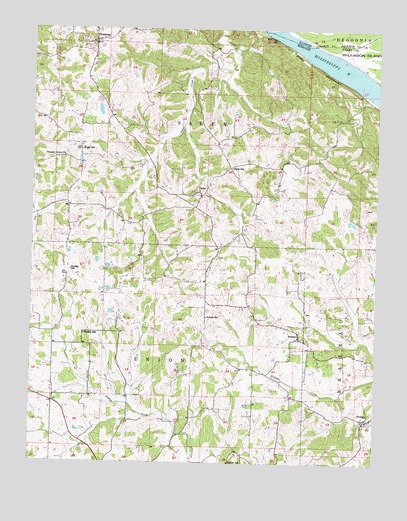
Crosstown, MO USGS Topographic Map
Click on map above to begin viewing in our Map Viewer.

This topographic map contains these locations and features:
Feature Name Type Latitude Longitude GNIS ID View Map
BrazeauPopulated PlaceN37.6612°W89.6529°714661View Map
Brazeau Presbyterian ChurchChurchN37.6610°W89.6507°736906View Map
Brazeau Presbyterian Church CemeteryCemeteryN37.6613°W89.6502°2702631View Map
CrosstownPopulated PlaceN37.7464°W89.7279°716539View Map
East Perry County Rural Fire Protection Association Station 2BuildingN37.7021°W89.6977°2620869View Map
EurekaPopulated PlaceN37.6789°W89.7370°736426View Map
Eureka SchoolSchoolN37.6803°W89.7359°717655View Map
FarrarPopulated PlaceN37.7023°W89.6887°717857View Map
Fiehler SchoolSchoolN37.6253°W89.6776°717899View Map
Hager SchoolSchoolN37.7151°W89.7323°718970View Map
Pleasant Grove ChurchChurchN37.7131°W89.7384°736335View Map
Red RockLocaleN37.7492°W89.6704°735982View Map
Salem Lutheran CemeteryCemeteryN37.7023°W89.6916°2702635View Map
Schalls SchoolSchoolN37.6670°W89.6865°726093View Map
Swan SchoolSchoolN37.7101°W89.6779°727363View Map
Township of SalemCivilN37.7276°W89.7020°767156View Map
Township of UnionCivilN37.6405°W89.7150°767158View Map
Trickey SchoolSchoolN37.6620°W89.7309°727771View Map
Upper Wilkinson Landing (historical)LocaleN37.7481°W89.6337°1772243View Map

Note: Coordinates in the location and feature list above are referenced to NAD83 datum.


Copyright (C) 2008-2025 Ryan Niemi / Sunset Dynamics ... All Rights Reserved