TopoQuest Logo
Do you find TopoQuest useful?
Help keep TopoQuest running and adding new maps/features by donating!
Bitcoin:  19c7KJd3qBynnjoSw5npx9KScwjBe4ifkT
Litecoin:  LXs6TkuXGGXo1vDsWCkWVdjQX94eUKd6ui
Home View Maps Find Maps Find Places Resources & Links


Friedheim, Missouri Topographic Map

USGS Map Title: Friedheim, MO
USGS Map MRC: 37089E7
DRG (GeoTIFF) Download: o37089e7.tif


Neighboring USGS Topographic Map Quads:


  Perryville West, MO  
37089F8
 

  Perryville East, MO  
37089F7
 

  Crosstown, MO  
37089F6
 

  Sedgewickville, MO  
37089E8
 

  Friedheim, MO  
37089E7
 

  Oak Ridge, MO  
37089E6
 

  Scopus, MO  
37089D8
 

  Millersville, MO  
37089D7
 

  Jackson, MO  
37089D6


Map MRC Location:

N38°
W90°
N38°
W89°
H8 H7 H6 H5 H4 H3 H2 H1
G8 G7 G6 G5 G4 G3 G2 G1
F8 F7 F6 F5 F4 F3 F2 F1
E8 E7 E6 E5 E4 E3 E2 E1
D8 D7 D6 D5 D4 D3 D2 D1
C8 C7 C6 C5 C4 C3 C2 C1
B8 B7 B6 B5 B4 B3 B2 B1
A8 A7 A6 A5 A4 A3 A2 A1
N37°
W90°
N37°
W89°

Friedheim, MO USGS 1:24K Topographic Map Preview:
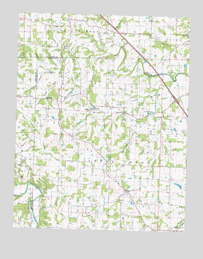
Friedheim, MO USGS Topographic Map
Click on map above to begin viewing in our Map Viewer.

This topographic map contains these locations and features:
Feature Name Type Latitude Longitude GNIS ID View Map
Allie CreekStreamN37.5926°W89.8526°713236View Map
Apple CreekPopulated PlaceN37.6128°W89.7509°736347View Map
ArnsbergPopulated PlaceN37.5698°W89.7776°740636View Map
Arnsberg Community ParkParkN37.5684°W89.7959°743242View Map
Arnsberg School (historical)SchoolN37.5681°W89.7959°730540View Map
BiehlePopulated PlaceN37.6053°W89.8412°748813View Map
Biehle Census Designated PlaceCensusN37.6065°W89.8377°2587053View Map
Biehle Community Fire Protection AssociationBuildingN37.6195°W89.8363°2620862View Map
Black Haw BranchStreamN37.6159°W89.8073°738544View Map
Brick SchoolSchoolN37.5695°W89.8437°714687View Map
Conrads MillPopulated PlaceN37.5064°W89.8607°740762View Map
CritesvillePopulated PlaceN37.5153°W89.8348°730539View Map
Critesville School (historical)SchoolN37.5176°W89.8382°730541View Map
DaisyPopulated PlaceN37.5237°W89.7932°716638View Map
Daisy Post OfficePost OfficeN37.5233°W89.7938°2782998View Map
Dickman CemeteryCemeteryN37.5787°W89.7782°743239View Map
DissenPopulated PlaceN37.5842°W89.8420°730538View Map
FriedheimPopulated PlaceN37.5701°W89.8201°718222View Map
Friedheim StationLocaleN37.5542°W89.8340°718223View Map
Froggy BranchStreamN37.5931°W89.8434°738550View Map
Fulbright CemeteryCemeteryN37.5028°W89.7551°743244View Map
HilderbrandPopulated PlaceN37.5756°W89.8540°731583View Map
Hoffman School (historical)SchoolN37.6209°W89.7882°719667View Map
Kimmelton (historical)Populated PlaceN37.5784°W89.7568°730537View Map
Little Apple CreekStreamN37.5878°W89.7618°721147View Map
New Frame SchoolSchoolN37.6223°W89.8379°723196View Map
New Salem CemeteryCemeteryN37.5173°W89.7995°2681394View Map
New Salem ChurchChurchN37.5176°W89.7995°743245View Map
North Cape Girardeau County Fire District North StationBuildingN37.5804°W89.7569°2620887View Map
Number 750 DamDamN37.5667°W89.7634°764500View Map
Number 821 DamDamN37.5667°W89.8468°764795View Map
Rocky BranchStreamN37.6020°W89.8070°738543View Map
Saint Joseph CemeteryCemeteryN37.6098°W89.7538°743238View Map
Saint Maurus CemeteryCemeteryN37.6034°W89.8440°743240View Map
Sandy BranchStreamN37.5590°W89.7764°738549View Map
Sandy CreekStreamN37.5756°W89.7720°726037View Map
Sargents ChapelChurchN37.5364°W89.8695°726066View Map
Schnurbusch ChurchChurchN37.6137°W89.7515°736429View Map
Schnurbusch SchoolSchoolN37.6128°W89.7518°736430View Map
Sides CemeteryCemeteryN37.5589°W89.7512°743243View Map
South Fork Apple CreekStreamN37.5967°W89.8434°726725View Map
Stallings Brothers DamDamN37.5267°W89.7534°763890View Map
Stallings Brothers LakeReservoirN37.5271°W89.7554°763891View Map
Township of Apple CreekCivilN37.5357°W89.7624°766395View Map
Trinity CemeteryCemeteryN37.5706°W89.8193°743241View Map

Note: Coordinates in the location and feature list above are referenced to NAD83 datum.


Copyright (C) 2008-2025 Ryan Niemi / Sunset Dynamics ... All Rights Reserved